New tropical depression forms south-southwest of Sasebo; not forecast to last for long nor become too strong. (Joint Typhoon Warning Center)
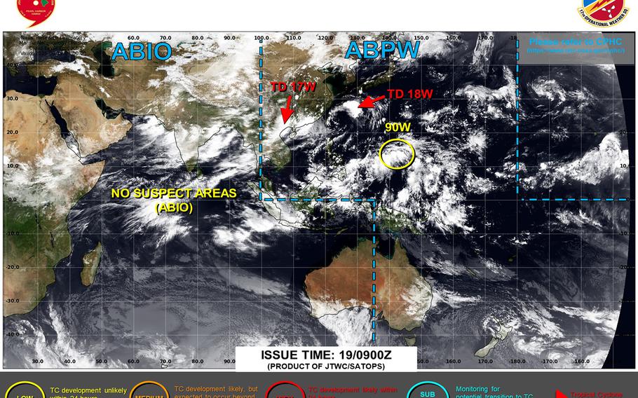
11:15 p.m. Tuesday, Aug. 19, Japan time: A tropical depression, the 18th numbered system in the northwest Pacific’s typhoon season, spawned Tuesday morning just north of Okinawa.
But Joint Typhoon Warning Center’s forecast track indicates 18W might not be around for long, nor become all that strong.
At 9 p.m., 18W was 395 miles south-southwest of Sasebo Naval Base, grinding north-northwest at 10 mph with 35-mph sustained winds and 45-mph gusts.
Commander Fleet Activities Sasebo remained in seasonal Tropical Cyclone Condition of Readiness 5 through Tuesday evening.
JTWC projects 18W to reach minimal tropical-storm intensity in the next day or so, making a slow, gentle curve northeast, weakening to a tropical depression and passing about 35 miles north-northwest of Sasebo at mid-afternoon Friday.
Destructive winds are not expected at Sasebo, though the base can expect rain Thursday, according to CFAS’ extended forecast.
