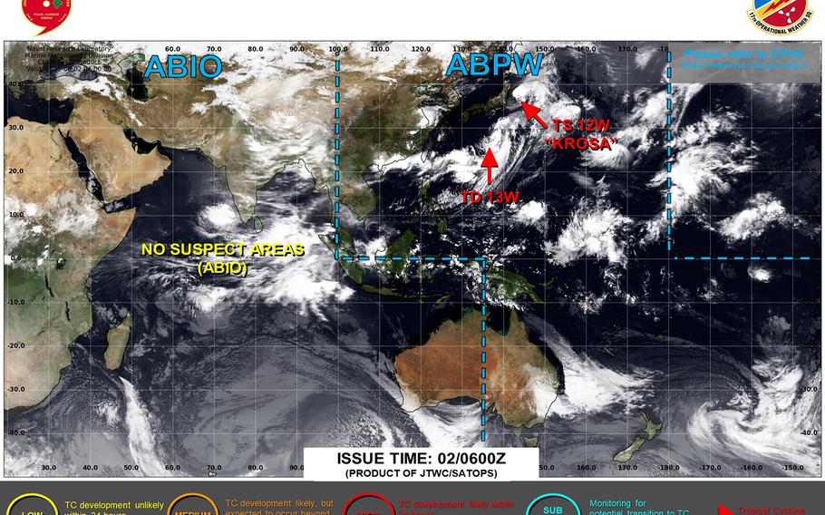
Tropical Depression 13W pops up on the map as Tropical Storm Krosa turns northeast away from the Kanto Plain. Yokosuka resumes seasonal TCCOR 5. (Joint Typhoon Warning Center)
11:50 a.m. Saturday, Aug. 2, Japan time: Just as Tropical Storm Krosa hits the accelerator and heads northeast away from the Tokyo area, another tropical depression has popped up onto the map and is headed in the general direction of the Kanto Plain.
But Tropical Depression 13W’s initial Joint Typhoon Warning Center’s forecast track takes it well southeast of Yokosuka Naval Base around mid-day Sunday.
At 9 a.m., 13W was nearly 600 miles south-southwest of Yokosuka, headed northeast at 7 mph with 30-mph sustained winds and 40-mph gusts.
Commander Fleet Activities Yokosuka has resumed seasonal Tropical Cyclone Condition of Readiness 5 with Tropical Storm Krosa headed away from the area. More on that in a bit.
If 13W stays on its current forecast track, JTWC projects it to peak as a tropical storm and pass some 210 miles southeast of Yokosuka at around 11 a.m. Sunday, then hurtle over open water in the northwest Pacific.
As for Krosa, it was about 130 miles east-northeast of Narita International Airport at 9 a.m., grinding north-northeast at 16 mph and holding steady at 65-mph sustained winds and 80-mph gusts.
