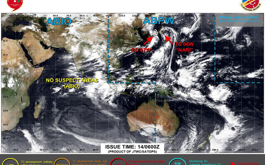
Nari hurtles past Yokosuka, remains forecast to pass more than 120 miles east-southeast of Misawa late Monday evening. (Joint Typhoon Warning Center)
6 p.m. Monday, July 14, Japan time: Closest point of approach to Yokosuka Naval Base by Tropical Storm Nari has come and gone. Nari continues rocketing north and remains forecast to pass about 120 miles east-southeast of Misawa Air Base late Monday evening.
At 3 p.m., Nari was about 190 miles east-northeast of Yokosuka, hurtling north at 30 mph and holding steady at 52-mph sustained winds and 63-mph gusts at center. Fleet Activities Yokosuka remains in Tropical Cyclone Condition of Readiness Storm Watch through late Tuesday afternoon.
