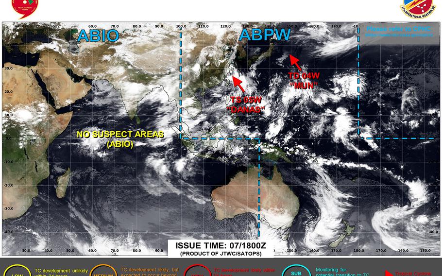
Danas getting set to curve into China’s east coast, still remains well out of range of Okinawa. ()
4:45 a.m. Tuesday, July 8, Taiwan time: Tropical Storm Danas continues to weaken as it heads northwest, on course for a sharp left turn into the China coast later Tuesday, according to Joint Typhoon Warning Center’s latest forecast track.
At 2 a.m., Danas was about 190 miles north-northeast of Taipei and 355 miles west-northwest of Kadena Air Base, Okinawa, moving north at 9 mph with 46-mph sustained winds and 58-mph gusts at center. U.S. bases on Okinawa remain in seasonal Tropical Cyclone Condition of Readiness 4.
Danas is forecast by JTWC to hook left and burrow into China’s east coast, passing about 200 miles south of Shanghai at mid-afternoon Tuesday. Expect plenty of rain as Danas moves inland. This is Storm Tracker’s final report on Danas.
Danas made landfall at midnight Sunday over Tainan in southwestern Taiwan as a Category 2-equivalent typhoon. It was one of the strongest tropical cyclones to make landfall on Taiwan’s west coast since records began being kept in 1958, tied with Typhoon Thelma in 1977.