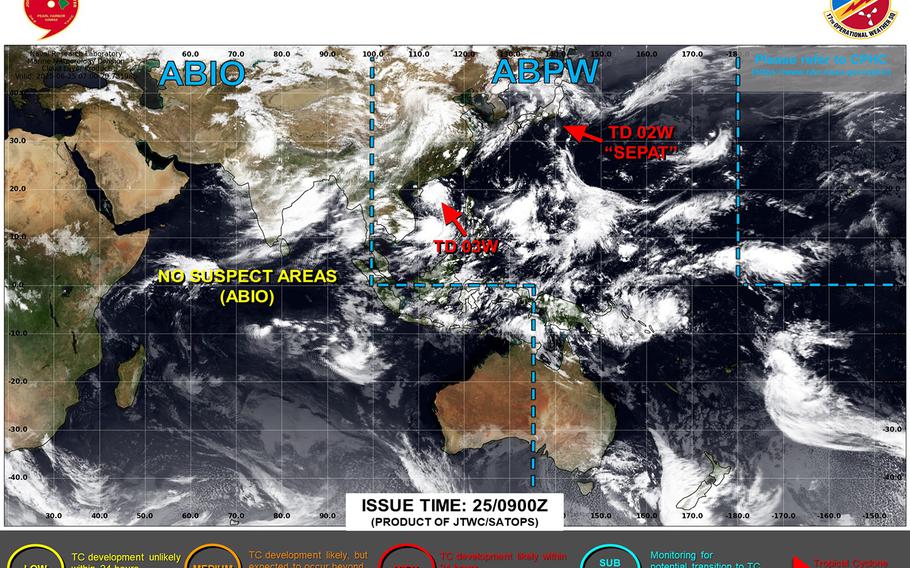
Sepat degrading into a remnant low, continues heading toward passage about 60 miles southeast of Yokosuka early Thursday. ()
11:30 p.m. Wednesday, June 25, Japan time: Tropical Depression Sepat is slowly degrading down to a remnant low. It remains on track to skirt Honshu’s coast, southeast of the Tokyo-Kanto Plain area early Thursday.
At 9 p.m., Sepat was about 110 miles south of Yokosuka Naval Base, moving north at 12 mph with 30-mph sustained winds and 40-mph gusts at center. U.S. bases in the Kanto Plain remain in seasonal Tropical Cyclone Condition of Readiness 5.
If Sepat remains on present course, Joint Typhoon Warning Center projects it to keep moving north-northwest through Wednesday, then curve north-northeast, passing 60 miles southeast of Yokosuka at about 3 a.m. Thursday as a post-tropical low, with 30-mph sustained winds and 40-mph gusts at center.
Yokosuka’s five-day weather forecast continues to show peak 40-mph gusts as Sepat passes east of the base at mid-day Thursday, with showers and possible thunderstorms.
