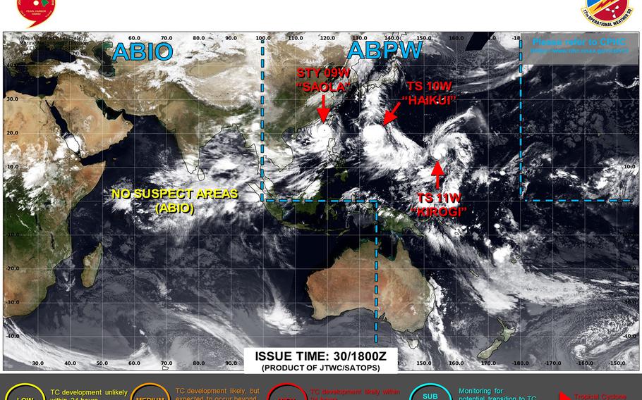
U.S. bases on Okinawa remained in TCCOR 2 through Thursday morning. Haikui remains on course to pass some 200 miles southwest of Okinawa early Friday evening as a Category 1-equivalent typhoon. (Joint Typhoon Warning Center)
2 p.m. Thursday, Aug. 31, Japan time: It looks like Okinawa might catch something of a break, as Tropical Storm Kaihui’s Joint Typhoon Warning Center’s latest forecast track has edged it further south of the island than previously reported.
At 12:30 p.m., Haikui was about 490 miles southeast of Kadena Air Base, headed west-northwest at 14 mph, packing 58-mph sustained winds and 75-mph gusts at center. U.S. bases on Okinawa remained in Tropical Cyclone Condition of Readiness 2 through Thursday morning into early afternoon.
If Haikui remains on present heading, JTWC projects it to head northwest and strengthen to 92-mph sustained winds and 115-mph gusts at center, Category 1-equivalent intensity, as it passes 204 miles south-southwest of Kadena at about 7 p.m. Friday.
Kadena’s 18th Wing Weather Flight’s latest wind-forecast timeline calls for peak winds of 35-mph sustained and 52-mph gusts for south Okinawa and 29-mph sustained winds and 46-mph gusts for Kadena at about 4 p.m. Friday.
From there, Haikui is forecast to peak as a Category 2-equivalent typhoon as it rumbles northwest away from Okinawa and makes landfall at mid-morning Sunday over east China.
