Saola forecast to move in circular pattern northeast of Philippines; 08W still struggling to develop. (Joint Typhoon Warning Center)
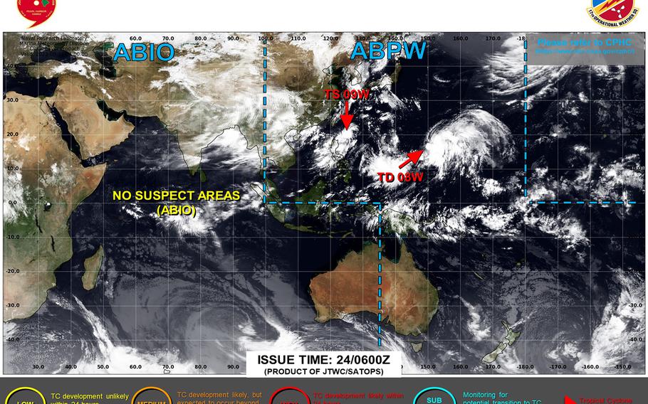
11:30 p.m. Thursday, Aug. 24, Japan time: Tropical Storm Saola continues to struggle to find a clear direction, while Tropical Depression 08W continues to struggle to develop, according to Joint Typhoon Warning Center’s latest forecast tracks.
At 9 p.m., Saola was 478 miles south-southwest of Kadena Air Base, tracking west-northwest at 5 mph and had strengthened to 52-mph sustained winds and 63-mph gusts. U.S. bases on Okinawa remain in seasonal Tropical Cyclone Condition of Readiness 4.
JTWC continues to depict Saola wandering near the northeast Philippines in a circular pattern, first to the south, then back up north over the next few days, peaking at Category 4-equivalent intensity, 138-mph sustained winds and 167-mph gusts at center late Tuesday evening, the end of JTWC’s five-day forecast period.
Model-track guidance and forecast ensembles still aren’t clear on which way Saola might venture. Stay tuned.
As for 08W, it remains a weak tropical depression. At 9 p.m., it was 1,465 miles south-southeast of Yokosuka Naval Base and was quasi-stationary, holding steady at 29-mph sustained winds and 40-mph gusts. JTWC projects it to curve northwest in the coming days, passing 338 miles east of Yokosuka early Tuesday afternoon as a middling tropical storm, 52-mph sustained winds and 63-mph gusts.
