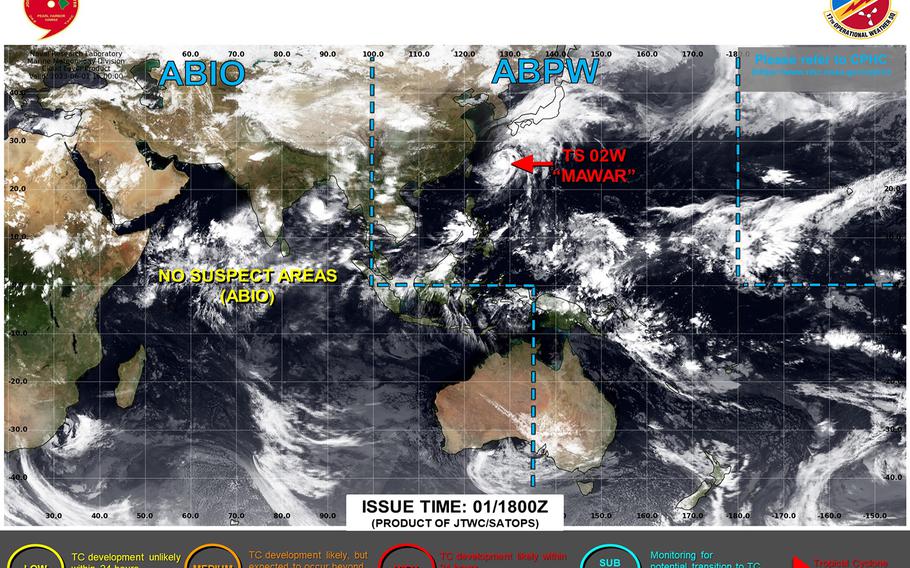
Mawar continues to weaken and picks up forward speed as it heads away from Okinawa toward open waters in the northwest Pacific. (Joint Typhoon Warning Center)
12:30 p.m. Friday, June 2, Japan time: Tropical Storm Mawar continues to weaken and pick up forward speed as it bids a less-than-civil adieu to Okinawa and its companion southwestern Japan islands.
Eight people were injured, one seriously, as Mawar passed over Okinawa overnight Thursday, dumping as much as six inches on Kadena Air Base and surrounding area and as much as a foot elsewhere, particularly on the island’s south end, where peak gusts of 71 mph were felt.
At 9 a.m., Mawar was 116 miles east-northeast of Kadena and had put the pedal to the metal, traveling east-northeast at 15 mph with 52-mph sustained winds and 63-mph gusts at center. U.S. bases on Okinawa remain in seasonal Tropical Cyclone Condition of Readiness 4.
Joint Typhoon Warning Center projects Mawar to remain well off the south coast of Japan’s main islands, and should remain 245 miles southeast of Yokosuka Naval Base as it passes the Kanto Plain early Sunday morning, with 52-mph gusts forecast late Saturday. Unless things change, this is Storm Tracker’s final report on Mawar.
