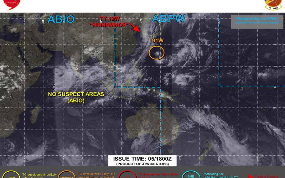
Daegu, Sasebo revert to TCCOR All Clear, Chinhae enters TCCOR 1-R as Hinnamnor exits Korean Peninsula into Sea of Japan. (Joint Typhoon Warning Center)
12:15 p.m. Tuesday, Sept. 6, Korea time: That huge collective sigh of relief is from thousands in southeastern Korea and southwestern Japan as Typhoon Hinnamnor exits the Korean peninsula into the Sea of Japan (East Sea) as a Category 1-equivalent system.
Sasebo Naval Base and Daegu-Area IV have entered Tropical Cyclone Condition of Readiness All Clear. Chinhae Naval Base, which bore the brunt of Hinnamnor, is in TCCOR 1-R (recovery) as they clean up from the storm. Marine Corps Air Station Iwakuni remains in TCCOR Storm Watch.
Joint Typhoon Warning Center has issued its final warning on Hinnamnor. At 9 a.m., Hinnmanor was 128 miles northeast of Busan, trucking northeast at 36 mph, still packing 86-mph sustained winds and 104-mph gusts at center. The worst is over, though winds and stray showers will remain until evening.
***
6 a.m. Tuesday, Sept. 6, Korea time: It’s happening. Typhoon Hinnamnor, a Category 2-equivalent storm, has roared ashore over the southeastern tip of the Korean Peninsula, passing almost directly over Chinhae Naval Base and just west of Busan, packing 104-mph sustained winds and 127-mph gusts. Closest point of approach to Chinhae, Sasebo Naval Base and Daegu-Area IV has come and gone.
Korean media is reporting Hinnamnor could be one of the strongest to ever hit the Peninsula. The good news is, Hinnamnor should not hang around long; it’s moving northeast at 25 mph. Stay indoors and stay safe until the all-clear is sounded.
***
11:15 p.m. Monday, Sept. 5, Korea time: Hinnamnor has been downgraded to a Category 2-equivalent typhoon. But it remains a dangerous system and continues bearing down on the southeastern tip of the Korean peninsula for an early Tuesday-morning rendezvous.
And the TCCOR scoreboard is busy and could get busier as the night progresses:
Chinhae Naval Base, Kunsan Air Base and Daegu-Area IV in South Korea and Sasebo Naval Base in southwestern Japan remained in Tropical Cyclone Condition of Readiness 1 through Sunday evening. DODEA schools throughout Peninsula are to be closed Tuesday along with most non-essential services.
Should winds exceed 35 knots or 40 mph, TCCOR 1-C (caution) would be issued; should winds exceed 50 knots or 58 mph, we’d then see TCCOR 1-E (emergency). Monitor your command’s official Facebook page or your local command TV access channels for any changes; we’ll do our best to keep you abreast as well. TCCOR changes could come at any time, without warning.
At 9 p.m., Hinnamnor was 233 miles southwest of Pusan, South Korea, moving north-northeast at 19 mph, packing 115-mph sustained winds and 144-mph gusts at center. Joint Typhoon Warning Center forecasts it to pass 15 miles west of Chinhae, 28 southeast of Daegu and 124 northwest of Sasebo between 2 and 6 a.m. Tuesday.
***
6 p.m. Monday, Sept. 5, Korea time: Chinhae Naval Base and Daegu-Area IV remain in Tropical Cyclone Condition of Readiness 1, girding for the arrival of what Korean news reports are calling possibly the strongest tropical cyclone to ever make landfall in the country. Sasebo Naval Base in southwestern Japan remains in TCCOR 2, with TCCOR 1 expected to be issued at about 7 p.m.
Korea Meteorological Agency has classified Typhoon Hinnamnor, a Category 3-equivalent system, as a “super strong” typhoon, the highest of four alert categories used by KMA, according to Korea Times. Korea is forecast to get between 4 to 12 inches of rain, with some south coastal areas and Cheju Island getting between 16 and 24 inches, KMA said via Korea Times.
Hinnamnor could possibly bring record strong winds to the Peninsula and Cheju to the south. The record for Korea is 63.7 meters per second, or 142 mph, recorded in Sokcho on Korea’s east coast on Oct. 23, 2006.
At 3 p.m., Hinnamnor was 346 miles southwest of Pusan, South Korea, moving northeast at 16 mph packing 121-mph sustained winds and 150-mph gusts at center.
Joint Typhoon Warning Center forecasts Hinnamnor to pass 6 miles west of Chinhae at 5 a.m. Tuesday and 29 miles southeast of Daegu at 6 a.m. as a Category 2-equivalent typhoon, packing 104-mph sustained winds and 127-mph gusts at center.
All hands at Chinhae were directed to shelter in place at noon Monday until Hinnamnor passes sometime Tuesday afternoon or evening. All services at Chinhae and Area IV Army bases in Daegu are suspended Tuesday and schools on base are closed.
The same pretty much goes at Sasebo, where services are suspended Monday evening and Tuesday. Sasebo’s forecast calls for gale-force winds, with peak 75-mph gusts, and heavy rain early Tuesday morning. JTWC projects Hinnamnor to pass 128 miles northwest of Sasebo at 2 a.m. Tuesday.
Marine Corps Air Station Iwakuni directed TCCOR Storm Watch at 3 p.m. Monday. Hinnamnor is forecast to pass about 210 miles northwest of MCAS at 7 a.m. Tuesday.
***
12:15 p.m. Monday, Sept. 5, Japan-Korea time: Chinhae Naval Base, on the Korean peninsula’s southeast coast, has entered Tropical Cyclone Condition of Readiness 1, and Joint Typhoon Warning Center’s latest forecast track puts Typhoon Hinnamnor on course for a beeline toward Chinhae as a Category 2-equivalent system.
At 9 a.m., Hinnamnor was 439 miles southwest of Pusan, Chinhae’s neighbor to the east, moving north at 14 mph and packing 127-mph sustained winds and 155-mph gusts at center. All hands at Chinhae have been directed to shelter in place starting at noon until Hinnamnor clears the area Tuesday evening.
If Hinnamnor continues on current heading, JTWC projects it to make a direct or near-direct pass over Chinhae at about 6 a.m. Tuesday, packing 104-mph sustained winds and 127-mph gusts. Between 6 and 10 inches of rain is forecast, along with maximum 104-mph sustained winds and 115-mph gusts on station. Absolutely no joke, campers.
Elsewhere, Daegu-Area IV entered TCCOR 2 at 10 p.m. Sunday. Hinnamnor is forecast to pass 33 miles southeast of Daegu at 7 a.m. Tuesday.
Sasebo Naval Base entered TCCOR 2 at 11 a.m. Monday, with TCCOR 1 expected to be issued at about 7 p.m. Hinnamnor is forecast to pass 133 miles northwest of Sasebo at about 4 a.m. Tuesday. Sasebo’s forecast calls for maximum southerly 46- to 52-mph sustained winds and 75-mph gusts at about 6 a.m. Tuesday.
Marine Corps Air Station Iwakuni remains in TCCOR 3 and continues to be somewhat out of harm’s way; Hinnamnor is forecast to pass 201 miles northwest of MCAS, but the vast wind field should put Iwakuni inside Hinnamnor’s outer wind and rain bands.
U.S. bases on Okinawa reverted to seasonal TCCOR 4 at noon Monday, with Hinnamnor moving out of the area. High winds and heavy rain remain in the area, though; part-residue of the storm as it exits the area.
***
6 a.m. Monday, Sept. 5, Japan time: U.S. bases on Okinawa have entered Tropical Cyclone Condition of Readiness 1-R (recovery). Gusts of 69 mph are no longer occurring.
Two words: STAY INSIDE. If anything, TCCOR 1-R can be equally dangerous, if not more, than TCCOR 1-E.
First responders and staff civil will be fanning out to establish safe zones, check for damage, downed power lines, flooding, downed trees and branches.
All of which can cause injury, even death, if you venture into the wrong places whilst all that work and inspection is going on.
There is no set time that TCCOR 1-R begins and ends. It could be awhile, given how long those gusts were occurring and TCCOR 1-E lasted.
Wait until the all-clear is issued/we revert to seasonal TCCOR 4. You only get one chance. Keep your safe on!
Hinnamnor remains a dangerous Category 3-equivalent system. At 3 a.m., Hinnamnor was 518 miles south-southwest of Busan, South Korea, headed north at 11 mph, packing 121-mph sustained winds and 150-mph gusts at center.
If Hinnamnor remains on present heading, Joint Typhoon Warning Center projects it to peak as a Category 4-equivalent typhoon at mid-morning Monday, then curve northeast, reaching Korea’s southeast coast as a Category 2-equivalent system, packing 110-mph sustained winds and 132-mph gusts at center as it makes a near-direct hit on Busan.
Area IV installations in South Korea entered TCCOR 2 at 10 p.m. Sunday. Peak 104-mph sustained winds and 115-mph gusts are forecast for Tuesday morning at Chinhae Naval Base; JTWC forecasts Hinnamnor to pass 22 miles easts of Chinhae at 8 a.m. Tuesday.
Sasebo Naval Base remained in TCCOR 3 overnight Sunday into Monday; upgrade could occur at any time. Sasebo’s forecast calls for peak southerly sustained 46- to 52-mph with 75-mph gusts at about 8 a.m. Tuesday.
***
12:45 a.m. Monday, Sept. 5, Japan-Korea time: Hinnamnor remains a strong Category 3-equivalent typhoon as it moves north away from Okinawa. Joint Typhoon Warning Center’s latest forecast track continues to show an early Tuesday morning rendezvous with the southeast coast of Korea and Kyushu in southwestern Japan as a possible Category 2-equivalent storm.
At 9 p.m., Hinnamnor was 210 miles west-northwest of Kadena Air Base, moving north at 10 mph, packing 121-mph sustained winds and 150-mph gusts at center. U.S. bases on Okinawa remained in Tropical Cyclone Condition of Readiness 1-E (emergency) from 8:30 a.m. Sunday.
Okinawa has stayed in TCCOR 1-E for as long as it has, because it’s still getting lashed by 69-mph gusts, which meet TCCOR 1-E criteria. There’s no set time for U.S. bases to move into TCCOR 1-R (recovery); as long as current conditions persist, we’ll remain in TCCOR 1-E. It’s wait and see at this point.
Thus far, Kadena has recorded sustained 46-mph winds and 66-mph gusts, while 52-mph sustained winds and 71-mph gusts were observed at Itokazu. Between 11 and 13 inches of rain are forecast, according to Kadena’s 18th Wing Weather Flight.
Here’s a quick recap of preparations and TCCORs posted at bases in southeastern Korea and Kyushu:
-- Chinhae Naval Base remained in TCCOR 3 through Sunday evening. An upgrade could come by early morning. All hands there are being told to shelter in place no later than noon Monday. JTWC forecasts Chinhae to pass 22 miles east at 8 a.m. Tuesday packing 110-mph sustained winds and 132-mph gusts at center. Fleet Activities Chinhae’s forecast calls for 6 to 9 inches of rain with maximum 104-mph sustained winds and 115-mph gusts at mid-morning Tuesday.
-- Sasebo Naval Base remained in TCCOR 3 through Sunday evening. Fleet Activities Yokosuka should see a TCCOR upgrade early Monday as well. JTWC projects Hinnamnor to pass 113 miles northwest of Sasebo at about 5 a.m. Tuesday. Fleet Activities Sasebo said it plans to direct TCCOR 1 at about 7 p.m. Monday. Sasebo’s weather forecast shows a gale warning between 3 a.m. and noon Tuesday, with maximum gusts up to 75 mph forecast at about 8 a.m. Tuesday.
-- Daegu-Area IV also remained in TCCOR 3 throughout Sunday. Upgrade there should come early Monday as well. Hinnamnor is forecast to pass 48 miles southeast of Daegu at about 9 a.m. Tuesday. Winds and heavy rainfall are expected there as well.
-- Marine Corps Air Station Iwakuni remained in TCCOR 3 into Sunday evening. Iwakuni should be further out of harm’s way, with Hinnamnor forecast to pass 185 miles northwest at about 10 a.m. Tuesday. The windfield should be quite wide, with MCAS well inside Hinnamnor’s forecast outer wind and rain bands.
Campers, this typhoon, simply put, is no joke. Prepare well. Check in with your command’s official Facebook pages, AFN the Eagle, your local base command access TV channels, and of course Storm Tracker will do its best to keep you updated.
***
7 p.m. Sunday, Sept. 4, Japan-Korea time: Hinnamnor continues to strengthen, now up to a Category 3-equivalent typhoon. It continues its journey north, its wind field continues to widen, and Joint Typhoon Warning Center’s latest forecast track continues to put the Korean peninsula’s southeast coast and Kyushu in southwestern Japan in Hinnamnor’s sights.
At 3 p.m., Hinnamnor was 200 miles west of Kadena Air Base, Okinawa, headed north at 11 mph and packing 121-mph sustained winds and 150-mph gusts at center. U.S. bases on Okinawa remain in Tropical Cyclone Condition of Readiness 1-E (emergency), with 69-mph gusts and heavy showers continuing to lash the island.
Hinnamnor continues to be one seriously strong beast. JTWC forecasts Hinnamnor to regain Category 4-equivalent intensity early Monday morning, then weaken some – but not a great deal – as it curves northeast toward the southeastern edges of Korea as a Category 3-equivalent system.
Here’s a rundown on areas elsewhere and their level of typhoon readiness:
-- Chinhae Naval Base remained in TCCOR 3 through Sunday afternoon. An upgrade could come by evening. All hands there are being told to shelter in place no later than noon Monday. JTWC forecasts Chinhae to pass just 11 miles east at 7 a.m. Tuesday packing 115-mph sustained winds and 144-mph gusts at center. Fleet Activities Chinhae’s forecast calls for 6 to 9 inches of rain with maximum 104-mph sustained winds and 115-mph gusts at mid-morning Tuesday.
-- Sasebo Naval Base remained in TCCOR 3 through Sunday afternoon. Expect an upgrade by evening or early Monday. JTWC projects Hinnamnor to pass 118 miles northwest of Sasebo at about 5 a.m. Tuesday. Fleet Activities Sasebo said it plans to direct TCCOR 1 at about 7 p.m. Monday. Sasebo’s weather forecast calls for winds to pick up Monday evening, with maximum gusts up to 75 mph forecast at about 8 a.m. Tuesday.
-- Daegu-Area IV also remained in TCCOR 3 throughout Sunday. Hinnamnor is forecast to pass 39 miles southeast of Daegu at about 8 a.m. Tuesday. Winds and heavy rainfall are expected there as well.
-- Marine Corps Air Station Iwakuni remained in TCCOR 3 into Sunday evening. Iwakuni should be further out of harm’s way, with Hinnamnor forecast to pass 194 miles northwest at 9 a.m. Tuesday, but again, the windfield should be quite wide, with MCAS well inside Hinnamnor’s forecast outer wind and rain bands.
***
3 p.m. Sunday, Sept. 4, Japan time: U.S. bases on Okinawa have entered Tropical Cyclone Condition of Readiness 1-R (recovery). Gusts of 69 mph are no longer occurring. STAY INSIDE. First responders and staff civil will be fanning out to establish safe zones, check for damage, downed power lines, flooding, downed trees and branches. There is no set time that TCCOR 1-R begins and ends. Wait until the all-clear is issued/we revert to seasonal TCCOR 4.
***
12:30 p.m. Sunday, Sept. 4, Japan-Korea time: This Typhoon Hinnamnor is no joke. It is strengthening, its wind field is vast, it’s headed for southeastern Korea and southwestern Japan and it could strike the Pusan area of South Korea as a Category 2-equivalent beast. Interests there should be preparing for Hinnamnor’s forecast arrival Tuesday morning.
At 9 a.m., Hinnamnor was 206 miles west of Kadena Air Base, Okinawa, moving north at 12 mph, packing 121-mph sustained winds and 150-mph gusts at center. U.S. bases on Okinawa remained in Tropical Cyclone Condition of Readiness 1-E (emergency) through noon Sunday.
Here’s the rundown of preparations and TCCORs elsewhere:
-- Chinhae Naval Base is in TCCOR 3; expect upgrade by evening. All hands there are being told to shelter in place no later than noon Monday. Joint Typhoon Warning Center forecasts Chinhae to pass just 12 miles east at 8 a.m. Tuesday packing 104-mph sustained winds and 127-mph gusts at center. Expect 6 to 9 inches of rain with maximum 104-mph sustained winds and 115-mph gusts at mid-morning Tuesday.
-- Sasebo Naval Base entered TCCOR 3 at 11:30 a.m. Sunday; expect upgrade by evening or early Monday. JTWC projects Hinnamnor to pass 122 miles northwest of Sasebo at about 5 a.m. Tuesday. Fleet Activities Sasebo announced it plans to invoke TCCOR 1 at about 7 p.m. Monday. Maximum gusts up to 75 mph are forecast at about 8 a.m. Tuesday.
-- Daegu-Area IV entered TCCOR 3 at noon Sunday. Hinnamnor is forecast to pass 40 miles southeast of Daegu at about 9 a.m. Tuesday. Winds and heavy rainfall are expected there as well.
-- Marine Corps Air Station Iwakuni remained in TCCOR 3 through Sunday morning. Iwakuni should be further out of harm’s way, with Hinnamnor forecast to pass 193 miles northwest at 10 a.m. Tuesday, but again, the storm carries a vast windfield.
-- U.S. bases on Okinawa remain in TCCOR 1-E (emergency). Gusts up to 74 mph are occurring on island. STAY INSIDE and remain there.
Even after TCCOR 1-R (recovery) is declared, DO NOT GO OUTSIDE. In fact, it’s the worst time to be outside, whether on base or off. On-base staff civil and first responders will fan out to survey damage, clear safe spots, check for damaged buildings, fallen trees and power lines, etc. Same thing off base. They’ll get power and water service there restored as soon as they can. STAY INDOORS until the all-clear is issued.
Sustained 52-mph winds and 74-mph gusts are forecast to subside by mid-afternoon Sunday.
***
UPDATED at 9 a.m. Sunday, Sept. 4, Japan/Korea time: Here is the latest wind-forecast timeline for Okinawa from Kadena Air Base’s 18th Wing Weather Flight for Typhoon Hinnamnor. U.S. bases on Okinawa remain in Tropical Cyclone Condition of Readiness 1-E. Between 10 to 12 inches of rain associated with Hinnamnor are forecast:
-- Onset of 40-mph sustained winds: Occurring.
-- Onset of 74-mph gusts: Occurring.
-- Peak 46-mph sustained winds, 69-mph gusts for Kadena; 52-mph sustained winds and 74-mph gusts in southern Okinawa: 10 a.m. Sunday.
-- Gusts of 69 mph subsiding: 3 p.m. Sunday.
-- Winds subsiding below 40-mph sustained: 6 a.m. Monday.
Hinnamnor is forecast to pass 206 miles west of Kadena at 9 a.m. Sunday. Peak winds Sunday morning were 35-mph sustained and 53-mph gusts at Kadena and 46-mph sustained with 63-mph gusts at Naha.
The latest forecast for Chinhae Naval Base in southeastern Korea and surrounding areas. Chinhae and Daegu-Area IV are in TCCOR 4; expect upgrades later Sunday. Hinnamnor is forecast to make a beeline for Kimhae International Airport, pass 15 miles east of Chinhae and 38 miles southeast of Daegu between 9 and 10 a.m. Tuesday as a Category 2-equivalent typhoon:
- 6-9” in total precipitation between Sunday and Tuesday.- High-tide aligned storm surge of 2 to 5 feet above mean sea level in Busan and 4 to 8 feet in Chinhae. Storm surge in the north near Incheon could be as high as 12 feet above mean sea level overnight Monday into Tuesday.
- Onset of 40-mph winds forecast for noon Monday, subsiding at 11 p.m. Tuesday. Subsiding of 40-mph winds at Pohang could be up to 8 hours later due to terrain effects.
- Onset of 58-mph winds forecast for midnight Monday, subsiding at about 9 p.m. Tuesday. Other areas expecting greater than 58 mph include Cheju Island, Daegu, Kunsan Air Base and Pohang.
- Max sustained winds of 104 mph with gusts up to 115 mph about 9 a.m. Tuesday.
- Expect TCCOR III declared tomorrow.
-All hands should prepare to shelter in place no later than noon Monday until the storm clears Tuesday evening.
Elsewhere, Marine Corps Air Station Iwakuni remains in TCCOR 3 and Sasebo Naval Base in TCCOR 4. Hinnamnor is forecast to pass 108 miles northwest of Sasebo at 6 a.m. Tuesday and 206 miles northwest of Iwakuni five hours later as a Category 2-equivalent typhoon.
Sasebo’s forecast calls for winds picking up at mid-day Monday and subsiding Tuesday evening, with peak southerly winds between 46 and 52 mph sustained with 75-mph gusts early Tuesday morning.
Hinnamnor remains a Category 2-equivalent typhoon for now. Joint Typhoon Warning Center forecasts Hinnamnor to peak as a Category 4-equivalent typhoon at mid-afternoon Monday before curving northeast and heading toward Korea’s south coast.
***
12:40 a.m. Sunday, Sept. 4, Japan time: Here is the latest wind-forecast timeline from Kadena Air Base’s 18th Wing Weather Flight for Typhoon Hinnamnor. U.S. bases on Okinawa remain in Tropical Cyclone Condition of Readiness 1-C. Between 5 to 7 inches of rain associated with Hinnamnor are forecast:
-- Onset of 40-mph sustained winds: Occurring
-- Onset of 74-mph gusts: 3 a.m. Sunday (meets criteria for upgrade to TCCOR 1-E)
-- Peak 46-mph sustained winds, 69-mph gusts for Kadena; 52-mph sustained winds and 74-mph gusts in southern Okinawa: 10 a.m. Sunday.
-- Gusts of 69 mph subsiding: 3 p.m. Sunday.
-- Winds subsiding below 40-mph sustained: 6 a.m. Monday.
Gusts subsiding below 69 mph is now forecast for 3 p.m. Sunday, six hours earlier than previously reported. Highest winds observed earlier Saturday were 32-mph sustained and 50-mph gusts at Kadena and 42-mph sustained with 52-mph gusts at Naha.
Hinnamnor is forecast to pass 212 miles west of Kadena at about 9 a.m. Sunday, packing 110-mph sustained winds and 127-mph gusts at center.
***
Midnight Saturday, Sept. 3, Japan time: Quite a bit of activity on the TCCOR scoreboard as we bid farewell to the old week and hello to the new. Here’s the rundown as of midnight:
-- Marine Corps Air Station Iwakuni is in Tropical Cyclone Condition of Readiness 3. Destructive winds of 58 mph or greater are possible within 48 hours. Typhoon Hinnamnor is forecast to pass 175 miles northwest of Iwakuni at 11 a.m. Tuesday, packing 75-mph sustained winds and 92-mph gusts at center.
-- Chinhae Naval Base on Korea’s south coast has entered TCCOR 4. Destructive winds of 58 mph or greater are possible within 72 hours. Hinnamnor is forecast to pass 30 miles east of Chinhae at 9 a.m. Tuesday, packing Category 1-equivalent force. Upgrade to TCCOR 3 is expected sometime Sunday. All hands are being told to shelter in place no later than noon Monday.
-- Sasebo Naval Base in southwestern Kyushu remains in TCCOR 4. Hinnamnor is forecast to pass 98 miles northwest of Sasebo at about 6 a.m. Tuesday.
-- And U.S. bases on Okinawa remain in TCCOR 1-C (caution), with sustained 40- to 57-mph winds occurring at one or more bases on island. Upgrade to TCCOR 1-E is possible soon; forecast calls for 69-mph gusts, which meet the criteria for such an upgrade, to begin at about 3 a.m. Sunday.
***
8 p.m. Saturday, Sept. 3, Japan time: U.S. bases on Okinawa have entered Tropical Cyclone Condition of Readiness 1-C (caution). Sustained 40- to 57-mph winds are occurring on one or more bases on the island. Time to get indoors and stay there until the all-clear is sounded/we return to seasonal TCCOR 4.
***
7 p.m. Saturday, Sept. 3, Japan time: Here is the latest wind-forecast timeline from Kadena Air Base’s 18th Wing Weather Flight for Typhoon Hinnamnor. U.S. bases on Okinawa remain in Tropical Cyclone Condition of Readiness 1. Upgrade could come at any time. Between 5 to 7 inches of rain associated with Hinnamnor are forecast:
-- Onset of 40-mph sustained winds: 8 p.m. Saturday (meets criteria for upgrade to TCCOR 1-C)
-- Onset of 74-mph gusts: 3 a.m. Sunday (meets criteria for upgrade to TCCOR 1-E)
-- Peak 46-mph sustained winds, 69-mph gusts for Kadena; 52-mph sustained winds and 74-mph gusts in southern Okinawa: 10 a.m. Sunday.
-- Gusts of 69 mph subsiding: 9 p.m. Sunday.
-- Winds subsiding below 40-mph sustained: 6 a.m. Monday.
Hinnamnor has regained some strength and again been upgraded to a Category 2-equivalent typhoon. According to the Joint Typhoon Warning Center’s latest forecast track, it could max out at Category 3-equivalent intensity as it moves north and northeast, barreling toward the southeastern tip of the Korean peninsula on Tuesday.
At 3 p.m., Hinnamnor was 274 miles southwest of Kadena, moving north at 7 mph packing 98-mph sustained winds and 121-mph gusts at center. Hinnamnor is forecast to pass 222 miles west of Kadena at 8 a.m. Sunday, packing 110-mph sustained winds and 127-mph gusts.
After exiting the Okinawa neighborhood, Hinnamnor is forecast to keep moving north, peaking at 127-mph sustained winds and 155-mph gusts at center early Monday morning before curving northeast, grazing the east edges of Cheju Island.
JTWC projects Hinnamnor to make a beeline for Kimhae International Airport, passing 13 miles east of Chinhae Naval Base and 121 miles northwest of Sasebo Naval Base between 9 a.m. and noon Tuesday, packing 92-mph sustained winds and 115-mph gusts, a strong Category 1-equivalent storm. It should then move rapidly into the Sea of Japan (East Sea) as a tropical storm.
***
1 p.m. Saturday, Sept. 3, Japan time: Here is the latest wind-forecast timeline from Kadena Air Base’s 18th Wing Weather Flight for Typhoon Hinnamnor. U.S. bases on Okinawa remain in Tropical Cyclone Condition of Readiness 1. Between 5 to 7 inches of rain associated with Hinnamnor are forecast:
-- Onset of 40-mph sustained winds: 7 p.m. Saturday (meets criteria for upgrade to TCCOR 1-C)
-- Onset of 74-mph gusts: 3 a.m. Sunday (meets criteria for upgrade to TCCOR 1-E)
-- Peak 46-mph sustained winds, 69-mph gusts for Kadena; 52-mph sustained winds and 74-mph gusts in southern Okinawa: 10 a.m. Sunday.
-- Gusts of 69 mph subsiding: 9 p.m. Sunday.
-- Winds subsiding below 40-mph sustained: 6 a.m. Monday.
Forecast start of 40-mph sustained winds, which meet criteria for upgrade to TCCOR 1-C, has been delayed to 7 p.m. due to Hinnamnor tracking more slowly than expected, according to the Weather Flight.
As Hinnamnor has begun moving north, so, too, has it begun restrengthening, and is forecast to reach Category 3-equivalent intensity as it passes more than 200 miles west of Okinawa at mid-morning Sunday, according to Joint Typhoon Warning Center.
At 9 a.m., Hinnamnor was 305 miles southwest of Kadena, moving north at 8 mph packing 92-mph sustained winds and 115-mph gusts at center. U.S. bases on Okinawa remained in TCCOR 1 through Saturday morning. Sasebo Naval Base in southwestern Japan remained in TCCOR 4 through the morning.
If Hinnamnor stays on present heading, JTWC projects it to strengthen to 115-mph sustained winds and 144-mph gusts as it passes 212 miles west of Kadena at about 9 a.m. Sunday. With the typically more fierce east quadrants facing Okinawa, the island could be in for more than just a close shave.
And Hinnamnor’s work continues once it exits the Okinawa vicinity. JTWC forecasts it to peak at 132-mph sustained winds and 161-mph gusts, Category 4-equivalent strength, at mid-morning Monday.
Hinnamnor is then due to weaken as it turns northeast, but remain a strong Category 2-equivalent typhoon as it plows into the south coast of the Korean Peninsula, making a near-beeline for Chinhae Naval Base, packing 104-mph sustained winds and 127-mph gusts at center as it roars ashore at about 9 a.m. Tuesday.
Sasebo isn’t out of the woods; Hinnamnor is due to pass 123 miles northwest at 8 a.m. Tuesday, with the naval base sitting on the edge of Hinnamnor’s JTWC-forecast destructive 50-knot wind bands.
Interesting Labor Day weekend and beyond. Get your safe on!
***
7:30 a.m. Saturday, Sept. 3, Japan time: Here is the latest wind-forecast timeline from Kadena Air Base’s 18th Wing Weather Flight for Typhoon Hinnamnor. U.S. bases on Okinawa remain in Tropical Cyclone Condition of Readiness 1. Between 5 to 7 inches of rain associated with Hinnamnor are forecast:
-- Onset of 40-mph sustained winds: 3 p.m. Saturday (meets criteria for upgrade to TCCOR 1-C)
-- Onset of 74-mph gusts: 3 a.m. Sunday (meets criteria for upgrade to TCCOR 1-E)
-- Peak 46-mph sustained winds, 69-mph gusts for Kadena; 52-mph sustained winds and 74-mph gusts in southern Okinawa: 10 a.m. Sunday.
-- Gusts of 69 mph subsiding: 9 p.m. Sunday.
-- Winds subsiding below 40-mph sustained: 6 a.m. Monday.
One thing to note: Winds on Okinawa are forecast to be quite gusty, up to 46 mph, before TCCOR 1-C is issued at mid-afternoon, according to the Weather Flight.
Should Hinnamnor stay on present heading, Joint Typhoon Warning Center projects it to rev back up to a Category 2-equivant typhoon as it roars past Okinawa, 221 miles west at about noon Sunday.
Hinnamnor is forecast to briefly reach Category 3-equivalent intensity, then weaken as it curves northeast toward Cheju Island off Korea’s south coast.
Up north, Sasebo Naval Base in southwestern Kyushu and Chinhae Naval Base along Korea’s southeast coast are girding for Hinnamnor’s passing early Tuesday, bringing high winds and heavy rain to those areas.
JTWC projects Hinnamnor to remain a Category 1-equivalent system as it passes 17 miles southeast of Chinhae Naval Base and 116 miles northwest of Sasebo Naval Base in southwestern Japan between 6 and 9 a.m. Tuesday. Sasebo remains in TCCOR 4.
Fleet Activities Chinhae’s forecast continues to call for 6 to 10 inches of rain between Sunday and Tuesday, onset of 40-mph wings at 3 p.m. Monday through 6 p.m. Tuesday, onset of 58-mph winds at midnight Monday and maximum 110-mph gusts about 5 a.m. Tuesday.
***
Midnight Friday, Sept. 2, Japan time: Hinnamnor remains a typhoon, but has been downgraded to a Category 1-equivalent storm. It remains on course to pass more than 200 miles west of Okinawa at mid-day Sunday as a Category 2-equivalent typhoon, bringing a forecast of high winds and heavy showers.
At 9 p.m., Hinnamnor was 352 miles south-southwest of Kadena Air Base, crawling north at 5 mph with 92-mph sustained winds and 115-mph gusts at center. U.S. bases on Okinawa remain in Tropical Cyclone Condition of Readiness 1; upgrade to TCCOR 1-C is possible at mid-day Saturday. Sasebo Naval Base is still in TCCOR 4.
If Hinnamnor continues on present heading, Joint Typhoon Warning Center projects it to regain Category 2-equivalent intensity as it passes 221 miles west of Kadena at 1 p.m. Sunday, packing 104-mph sustained winds and 127-mph gusts at storm’s center.
Okinawa can still expect maximum 52-mph sustained winds and 74-mph gusts at morning to mid-day Sunday along with day-long showers, heavy at times, starting at mid-day Saturday and continuing into Monday and perhaps Tuesday.
Once Hinnamnor exits the Okinawa area, JTWC forecasts it to arc northeast, briefly regaining Category 3-equivalent intensity, then diminish as it passes over Cheju Island of Korea’s southern coast at mid-evening Monday, pass 16 miles northwest of Chinhae Naval Base about 10 hours later and into the Sea of Japan (East Sea) as a severe tropical storm.
***
7:30 p.m. Friday, Sept. 2, Japan time: Here is the latest wind-forecast timeline from Kadena Air Base’s 18th Wing Weather Flight for Typhoon Hinnamnor. U.S. bases on Okinawa remain in Tropical Cyclone Condition of Readiness 1. Between 5 to 7 inches of rain associated with Hinnamnor are forecast:
-- Onset of 40-mph sustained winds: Noon Saturday (meets criteria for upgrade to TCCOR 1-C)
-- Onset of 74-mph gusts: 3 a.m. Sunday (meets criteria for upgrade to TCCOR 1-E)
-- Peak 46-mph sustained winds, 69-mph gusts for Kadena; 52-mph sustained winds and 74-mph gusts in southern Okinawa: 10 a.m. Sunday.
-- Gusts of 69 mph subsiding: 9 p.m. Sunday.
-- Winds subsiding below 40-mph sustained: 6 a.m. Monday.
Hinnamnor has been downgraded to a Category 2-equivalent typhoon, but remains a strong system and remains forecast to pass more than 200 miles west of Kadena at mid-morning Sunday, giving the island more than just a little close shave.
At 6 p.m., Hinnamnor was 354 miles south-southwest of Kadena and had finally begun its trek north, moving northwest at 5 mph, packing 98-mph sustained winds and 121-mph gusts at center.
If Hinnamnor continues on present course, Joint Typhoon Warning Center projects it to remain a Category 2-equivalent system as it passes 217 miles west of Kadena at 10 a.m. Sunday, 110-mph sustained winds and 132-mph gusts.
Hinnamnor’s wind field has expanded and Okinawa remains well within JTWC’s forecast 34-knot wind bands, with the more fierce east quadrants facing the island.
The key thing to remember when the heavy stuff rolls in and if TCCOR 1-C or 1-E are issued: STAY INSIDE! Do not venture outdoors. Even severe tropical-storm or Category 1-equivalent winds can turn the most benign objects into dangerous projectiles. Even a garbage can lid can cause quite the bruising if it hits you.
And you might see the locals driving about, making their local rounds as if nothing’s happening. To them, it isn’t because they’re used to it. They’ve lived here all their lives. For the average American hailing from Bozeman, Mont., or Peoria, Ill., who’s never seen a typhoon, it’s a different story. You only get one chance. Always err on the side of caution.
Once Hinnamnor exits the Okinawa neighborhood, it remains forecast to curve northeast, grazing the southeastern tip of the Korean peninsula.
JTWC projects Hinnamnor to remain a Category 1-equivalent system as it passes 17 miles southeast of Chinhae Naval Base and 116 miles northwest of Sasebo Naval Base in southwestern Japan between 6 and 9 a.m. Tuesday. Sasebo remains in TCCOR 4.
Fleet Activities Chinhae’s forecast calls for 6 to 10 inches of rain between Sunday and Tuesday, onset of 40-mph wings at 3 p.m. Monday through 6 p.m. Tuesday, onset of 58-mph winds at midnight Monday and maximum 110-mph gusts about 5 a.m. Tuesday.
Get your safe on!
***
6 p.m. Friday, Sept. 2, Japan time: U.S. bases on Okinawa have entered Tropical Cyclone Condition of Readiness 1 in advance of Typhoon Hinnamnor. Destructive winds of 58 mph or greater or gusts of 69 mph or greater are anticipated within 12 hours.
***
1 p.m. Friday, Sept. 2, Japan time: Hinnamnor has been downgraded to a Category 2-equivalent typhoon. Core winds have weakened some, but it remains a dangerous monster, and Okinawa can still expect a blustery, showery weekend, according to local weather forecasts and the Joint Typhoon Warning Center.
At 9 a.m., Hinnamnor was 377 miles south-southwest of Kadena Air Base and remained quasi-stationary over the previous six hours. U.S. bases on Okinawa remained in Tropical Cyclone Condition of Readiness 2 from 6 a.m. Sasebo Naval Base in southwestern Japan has upgraded to TCCOR 4; its seasonal condition is TCCOR 5.
If Hinnamnor stays on present course, JTWC projects it to kick start north overnight Friday into Saturday, maintaining Category 2-equivalent intensity as it passes about 220 miles west of Kadena at about 7 a.m. Sunday, still packing 110-mph sustained winds and 132-mph gusts at center.
Wind-forecast timeline for Okinawa as provided by Kadena’s 18th Wing Weather Flight remains unchanged from this morning:
-- Onset of 40-mph sustained winds: Noon Saturday (meets criteria for upgrade to TCCOR 1-C)
-- Onset of 74-mph gusts: 3 a.m. Sunday (meets criteria for upgrade to TCCOR 1-E)
-- Peak 46-mph sustained winds, 69-mph gusts for Kadena; 52-mph sustained winds and 74-mph gusts in southern Okinawa: 10 a.m. Sunday.
-- Gusts of 69 mph subsiding: 9 p.m. Sunday.
-- Winds subsiding below 40-mph sustained: 6 a.m. Monday.
Hinnamnor is forecast to briefly regain Category 4-equivalent intensity at mid-morning Monday once past Okinawa, then weaken again as it hooks northeast, grazing the southeast coast of the Korean Peninsula and giving Kyushu in southwestern Japan something of a close shave.
JTWC projects Hinnamnor to pass 106 miles northwest of Sasebo and 23 miles southeast of Chinhae Naval Base between 9 a.m. and noon Tuesday, packing Category 2-equivalent strength, before hurtling into the Sea of Japan (East Sea) as a Category 1-equivalent storm.
***
8 a.m. Friday, Sept. 2, Japan time: Here is the wind-forecast timeline as of 7 a.m. Friday from Kadena Air Base’s 18th Wing Weather Flight for Typhoon Hinnamnor. U.S. bases on Okinawa remain in Tropical Cyclone Condition of Readiness 3 for now. Between 6 and 7 inches of rain from Hinnamnor are forecast.
-- Onset of 40-mph sustained winds: Noon Saturday (meets criteria for upgrade to TCCOR 1-C)
-- Onset of 74-mph gusts: 3 a.m. Sunday (meets criteria for upgrade to TCCOR 1-E)
-- Peak 52-mph sustained winds and 74-mph gusts: 10 a.m. Sunday.
-- Gusts of 69 mph subsiding: 9 p.m. Sunday.
-- Winds subsiding below 40-mph sustained: 6 a.m. Monday.
At 6 a.m., Hinnamnor was 437 miles south-southwest of Kadena and sitting quasi-stationary, packing 132-mph sustained winds and 161-mph gusts at center, Category 4-equivalent intensity.
Joint Typhoon Warning Center projects Hinnamnor to turn north later Friday, pass 216 miles west of Kadena at about 11 a.m. Sunday as a Category 2-equivalent typhoon, 110-mph sustained winds and 127-mph gusts at center, then continue moving north and northeast toward the Tsushima Strait late Monday into Tuesday.
Hinnamnor is forecast to pass 104 miles northwest of Sasebo Naval Base and 30 miles southeast of Chinhae Naval Base on Korea’s southeast coast between 11 a.m. and 2 p.m. Tuesday as a Category 1-equivalent typhoon. Sasebo remains in TCCOR Storm Watch.
***
11:30 p.m. Thursday, Sept. 1, Japan time: Hinnamnor has once more shed its super-typhoon status, but remains a powerful Category 4-equivalent typhoon.
Hinnamnor’s wind field has widened considerably, after having begun its life five days ago as quite the compact system. Hinnamnor also appears as if its southerly drift away from Okinawa has ceased, and that sharp turn north orecast by the Joint Typhoon Warning Center could happen at any point.
At 9 p.m., Hinnamnor was 385 south-southwest of Kadena Air Base and had slowed considerably, tracking south at 6 mph, packing 138-mph sustained winds and 167-mph gusts at center. Hinnamnor is sitting in an area east of the Philippines’ Batanes island group and well south of Ishigaki and Miyako islands in southwestern Japan.
U.S. bases on Okinawa remained in Tropical Cyclone Condition of Readiness 3 through Thursday evening. Sasebo Naval Base in Kyushu in southwestern Japan remains in TCCOR Storm Watch.
If Hinnamnor remains on present heading, JTWC projects it to do an about-face overnight Thursday into Friday and begin a lengthy trek north. Hinnamon should lose some of its punch as it turns about, but remain a Category 2- or Category 3-equivalent beast as it moves.
JTWC forecasts Hinnamnor to regenerate into a Category 4-equivalent monster as it passes 229 miles west of Kadena at about 8 p.m. Sunday, packing 132-mph sustained winds and 161-mph gusts at center.
Seems a goodly distance, but Hinnamnor’s east quadrants – typically the more fierce of the four – are forecast to be facing the island throughout the weekend. Okinawa can still expect peak 52-mph sustained winds and 74-mph gusts Sunday as Hinnamnor roars past.
Southeastern Korea and Sasebo also remain potential targets. Hinnamnor should weaken into a Category 1-equivalent typhoon as it reaches the Tsushima Strait, 86-mph sustained winds and 104-mph gusts as it passes 85 miles northwest of Sasebo and 52 miles southeast of Chinhae Naval Base between 1 and 4 p.m. Tuesday before cruising into the Sea of Japan (East Sea).
***
7:15 p.m. Thursday, Sept. 1, Japan time: And so it begins. Super Typhoon Hinnamnor – the most powerful tropical cyclone this calendar year in any hemisphere – has U.S. bases on Okinawa raising the alert level, just in case the worst-case scenario happens.
Hinnamnor enjoyed a brief resurgence as a Category 5-equivalent super typhoon, but has been relegated again to Category 4-equivalent status. Still a vicious beast, due to pass more than 200 miles west of Okinawa on Sunday, bringing maximum gusts of 74 mph to the island early that morning.
At 3 p.m., Hinnamnor was 354 miles south-southwest of Kadena Air Base, moving south-southwest at 8 mph and packing 155-mph sustained winds and 190-mph gusts at center. U.S. bases on Okinawa entered Tropical Cyclone Condition of Readiness 3 at 6 p.m.
If Hinnamnor remains on present heading, Joint Typhoon Warning Center projects it to be downgraded from super typhoon early Friday morning and continue to weaken slightly, to Category 3-equivalent intensity as it makes a sharp turn north at mid-morning Friday.
JTWC forecasts Hinnamnor to pick up speed north and regain Category 4-equivalent strength, 132-mph sustained winds and 161-mph gusts at center as it passes 235 miles west of Kadena at midnight Sunday.
Okinawa is projected to be out of reach of Hinnamnor’s forecast destructive wind bands, but the east quadrants, typically the more vicious of the four, would be facing the island, which would be well within the outer rain and wind bands.
The latest wind-forecast timeline from Kadena’s 18th Wing Weather Flight reads as follows:
-- Onset of 40-mph sustained winds: Noon Saturday.
-- Onset of 69-mph gusts: 3 a.m. Sunday.
-- Peak 46-mph sustained winds and 69-mph gusts for Kadena, 52-mph sustained winds and 74-mph gusts in southern Okinawa: 6 a.m. Sunday.
-- Gusts subsiding below 69 mph: 6 p.m. Sunday.
-- Sustained winds subsiding below 40 mph: 9 a.m. Monday.
And Hinnamnor would be far from finished tormenting the region. JTWC projects Hinnamnor to keep moving north and arc northeast toward the Tsushima Strait as a Category 1-equivalent storm, 92-mph sustained winds and 115-mph gusts as it passes 73 miles northwest of Sasebo Naval Base and 62 miles southeast of Chinhae Naval Base between 11 a.m. and 1 p.m. Tuesday.
***
6 p.m. Thursday, Sept. 1, Japan time: U.S. bases on Okinawa have entered Tropical Cyclone Condition of Readiness 3 in advance of Super Typhoon Hinnamnor, which has been downgraded to a Category 4-equivalent cyclone. Destructive sustained winds of 58 mph or greater or 69-mph gusts are possible within 48 hours.
Begin a general cleanup around homes and office. Bring inside or tie down those bicycles to a concrete structure. Take down the trampoline and move it inside. Do the same with the hibachi or barbeque. Even plastic pails can become dangerous projectiles in a storm. Note: Do NOT tape windows; these days, windows of both on- and off-base structures are coated to protect from UV rays and are also designed to withstand sustained destructive winds for extended periods. Taping them might damage them. If you’ve not visited the PX or commissary, now’s the time to do so, to avoid the late rush.
***
2 p.m. Thursday, Sept. 1, Japan time: This vicious beast has become really vicious again.
Hinnamnor has regained Category 5-equivalent super-typhoon status. It continues moving southwest, and Joint Typhoon Warning Center continues to forecast it turning north by the weekend and passing more than 200 miles west of Okinawa late Sunday evening as a Category 4-equivalent storm.
At noon, Hinnamnor was 374 miles south-southwest of Kadena Air Base, headed south-southwest at 16 mph and packing 161-mph sustained winds and 196-mph gusts at center. U.S. bases on Okinawa remained in seasonal Tropical Cyclone Condition of Readiness 4 through mid-day Thursday.
While Hinnamnor is forecast to remain powerful, JTWC’s latest forecast track takes it 221 miles west of Kadena at 11 p.m. Sunday, still packing 132-mph sustained winds and 161-mph gusts at center.
The latest wind-forecast timeline from Kadena’s 18th Wing Weather Flight reads as follows:
-- Onset of 40-mph sustained winds: Noon Saturday.
-- Onset of 69-mph gusts: 3 a.m. Sunday.
-- Peak 46-mph sustained winds and 69-mph gusts for Kadena, 52-mph sustained winds and 74-mph gusts in southern Okinawa: 6 a.m. Sunday.
-- Gusts subsiding below 69 mph: 6 p.m. Sunday.
-- Sustained winds subsiding below 40 mph: 9 a.m. Monday.
So, Okinawa is not out of the woods yet. The forecast track could change and edge closer to Okinawa, or move further away. Best advice is to stay prepared. Get your safe on!
And once past Okinawa, Hinnamnor is forecast to retain some fairly strong power. JTWC projects it to move north through the East China Sea, retaining Category 4-equivalent strength through Monday, then curving northeast toward the Tsushima Strait between the south coast of the Korean peninsula and northwest Kyushu. Stay tuned.
And JTWC has issued its final warning on Tropical Depression 13W, which pretty much got absorbed by the all-powerful Hinnamnor. Short-lived, indeed.
***
1 a.m. Thursday, Sept. 1, Japan time: Here is the wind-forecast timeline as of midnight Aug. 31 from Kadena Air Base’s 18th Wing Weather Flight for Typhoon Hinnamnor. U.S. bases on Okinawa remain in seasonal Tropical Cyclone Condition of Readiness 4 for now. Between 6 and 7 inches of rain from Hinnamnor are forecast.
-- Onset of 40-mph sustained winds: Noon Saturday (meets criteria for upgrade to TCCOR 1-C)
-- Onset of 74-mph gusts: 3 a.m. Sunday (meets criteria for upgrade to TCCOR 1-E)
-- Peak 52-mph sustained winds and 74-mph gusts: 6 a.m. Sunday.
-- Gusts of 69 mph subsiding: 3 a.m. Monday.
-- Winds subsiding below 40-mph sustained: 9 a.m. Monday.
***
11 p.m. Wednesday, Aug. 31, Japan time: Hinnamnor, as expected, was downgraded from super-typhoon status, but remains a strong Category 4-equivalent cyclone, and is forecast to remain in the Okinawa area long enough to cause some gusty winds and showers come Labor Day weekend.
At 9 p.m., Hinnamnor was 117 miles south of Kadena Air Base, cruising west-southwest at 15 mph and packing 144-mph sustained winds and 173-mph gusts. U.S. bases on Okinawa remained in seasonal Tropical Cyclone Condition of Readiness 4 throughout the period and through Wednesday evening.
Hinnamnor’s Joint Typhoon Warning Center forecast track remains pretty much the same as it has the last couple of days. It’s projected to remain a Category 3-equivalent storm, and arc southwest to a point parallel to the southern tip of Taiwan (only hundreds of miles east), and southwest of Okinawa and south of Ishigaki and Miyako.
Then about mid-morning Friday, Hinnamnor is forecast to curve sharply north, gradually reintensify to a Category 4-equivalent typhoon with its wind field widening greatly.
Hinnamnor’s east quadrants, typically a typhoon’s fiercest, are forecast to face Okinawa, which should get a goodly dose of its outer wind and rain bands as it passes west of the island and on a headlong charge north toward the general direction of the Yellow Sea (West Sea).
As for Tropical Depression 13W, it remains about 450 miles southeast of Kadena and holding steady at 35-mph sustained winds and 46-mph gusts.
***
6:30 p.m. Wednesday, Aug. 31, Japan time: Hinnamnor is barely clinging to its status as a Category 4-equivalent super typhoon, according to the Joint Typhoon Warning Center’s latest forecast track, and it could be downgraded again before the evening is over.
At 3 p.m., Hinnamnor was 106 miles southeast of Kadena Air Base, Okinawa, moving west-southwest at 15 mph packing 150-mph sustained winds and 184-mph gusts at center. U.S. bases on Okinawa remained in seasonal Tropical Cyclone Condition of Readiness 4 through Wednesday afternoon.
JTWC depicted Hinnamnor’s closest point of approach to Kadena as 99 miles southeast of Kadena at 5 p.m., which has come and gone. Okinawa remains just out of reach of Hinnamnor’s forecast destructive wind bands.
Kadena’s 18th Wing Weather Flight reported sustained 24-mph winds and 37-mph gusts at Kadena and 34-mph sustained winds at Okinawa’s southern tip. There is no change to previous wind-forecast timelines reported below.
If Hinnamnor continues on present course, it remains on track to curve southwest away from Okinawa, and south of Miyako and Ishigaki Islands through early Friday morning, remaining a vicious Category 3-equivalent storm as it rumbles southwest.
From there, Hinnamnor is forecast to make a sharp turn north, bull its way over Ishigaki and pass well to Okinawa’s west. JTWC does project Hinnamnor’s wind field to expand widely enough that its outer wind and rain bands from the more vicious east quadrants could reach Okinawa through the weekend.
Then, there’s pesky little Tropical Depression 13W, which at 3 p.m. was 492 miles southeast of Kadena, crawling north at 6 mph and holding steady at 35-mph sustained winds and 46-mph gusts. It’s due to pass 155 miles south of Kadena at midnight Thursday as a tropical storm.
***
1 p.m. Wednesday, July 31, Japan time: Hinnamnor has been downgraded, but remains a compact and powerful Category 4-equivalent super typhoon.
It remains on course to pass just southeast of Okinawa later Wednesday, with its destructive force close by, but just out of reach of the island, according to the Joint Typhoon Warning Center.
At 9 a.m., Hinnamnor was 160 miles east of Kadena Air Base, moving west-southwest at 17 mph, packing 155-mph sustained winds and 190-mph gusts at center. U.S. bases on Okinawa remained in seasonal Tropical Cyclone Condition of Readiness 4 through Wednesday morning.
If Hinnamnor remains on present heading, JTWC projects it to pass 95 miles southeast of Kadena at about 6 p.m. Wednesday. It should then continue southwest into Friday morning, weakening to a Category 3-equivalent storm when it ceases moving south late Thursday, well away from Okinawa and south of Ishigaki and Miyako Islands.
Hinnamnor is forecast to curve sharply north at mid-morning Friday, pick up forward speed and pass west of Okinawa, but in the neighborhood and close enough that the island should feel its outer bands of the more fierce east quadrants Saturday into Sunday.
From there, Hinnamnor is forecast to re-strengthen into a Category 4-equivalent typhoon and move north in the general direction Japan’s southwestern Kyushu Island and Korea’s south coast. But it’s way too early to determine where specifically it might go.
As for Tropical Depression 13W, it remains a factor, 512 miles to Okinawa’s southeast at 9 a.m., moving north at 6 mph and holding steady at 35-mph sustained winds and 46-mph gusts. 13W is due to pass 87 miles south of Kadena at 10 p.m. Thursday as a tropical storm.
***
7:45 a.m. Wednesday, July 31, Japan time: Here is the latest wind-forecast timeline from Kadena Air Base’s 18th Wing Weather Flight. Super Typhoon Hinnamnor is forecast to pass 93 miles southeast of Kadena at 7 p.m. Wednesday. U.S. bases on Okinawa remain in seasonal Tropical Cyclone Condition of Readiness 4 for now. Between 9 to 10 inches of rain from Hinnamnor are forecast.
-- Onset of 40-mph sustained winds: 6 a.m. Saturday (meets criteria for upgrade to TCCOR 1-C)
-- Onset of 69-mph gusts: 9 a.m. Sunday (meets criteria for upgrade to TCCOR 1-E)
-- Peak 46-mph sustained winds and 69-mph gusts: Noon Sunday.
-- Gusts of 69 mph subsiding: Midnight Sunday.
-- Winds subsiding below 40-mph sustained: 6 a.m. Monday.
***
7 a.m. Wednesday, July 31, Japan time: Hinnamnor has mushroomed into a Category 5-equivalent super typhoon, and is joined south of Okinawa by Tropical Depression 13W, which spawned overnight Tuesday but is not expected to have much of a shelf life.
At 3 a.m., Hinnamnor was 254 miles east of Kadena Air Base, moving west-southwest at 18 mph, packing 161-mph sustained winds and 196-mph gusts at center. 13W was 554 miles southeast of Kadena, crawling northeast at 5 mph with 35-mph sustained winds and 46-mph gusts at center.
U.S. bases on Okinawa remained in seasonal Tropical Cyclone Condition of Readiness 4 through Tuesday evening into Wednesday.
If Hinnamnor remains on present heading, Joint Typhoon Warning Center projects it to pass 90 miles southeast of Kadena at 6 p.m. Wednesday, weaken into a Category 2-equivalent storm as it continues southwest through early Friday morning, then curve north Friday into Saturday, well away from Okinawa.
As it moves north, JTWC forecasts it to regain its punch, back to a Category 4-equivalent storm, 132-mph sustained winds and 161-mph gusts as it passes west of Okinawa.
But Hinnamnor’s wind field is forecast to widen considerably, enough that Okinawa should feel Hinnamnor’s outer bands from its east quadrants, typically the stronger of the four.
As for 13W, JTWC projects it to become a tropical storm, passing 72 miles south of Kadena at 11 p.m. Thursday. But it’s expected to interact with and perhaps merge with Hinnamnor in the coming days.
***
1:30 a.m. Wednesday, Aug. 31, Japan time: Here is the latest wind-forecast timeline from Kadena Air Base’s 18th Wing Weather Flight. Super Typhoon Hinnamnor is now forecast to pass 93 miles southeast of Kadena at 7 p.m. Wednesday. U.S. bases on Okinawa remain in seasonal Tropical Cyclone Condition of Readiness 4 for now. Between 5 to 6 inches of rain from Hinnamnor are forecast.
-- Onset of 40-mph sustained winds: 6 a.m. Saturday (meets criteria for upgrade to TCCOR 1-C)
-- Onset of 69-mph gusts: 9 a.m. Sunday (meets criteria for upgrade to TCCOR 1-E)
-- Peak 46-mph sustained winds and 69-mph gusts: Noon Sunday.
-- Gusts of 69 mph subsiding: Midnight Sunday.
-- Winds subsiding below 40-mph sustained: 6 a.m. Monday.
***
11:30 p.m. Tuesday, Aug. 30, Japan time: Hinnamnor has been upgraded to a Category 4-equivalent super typhoon by the Joint Typhoon Warning Center.
It remains on course to make a slow, wide curve around Okinawa over the weekend, then turn sharply north, giving the western edges of Okinawa something of a close shave on Sunday.
At 9 p.m., Hinnamnor was 358 miles east of Kadena Air Base and trucking west at 18 mph, packing 150-mph sustained winds and 184-mph gusts at center. U.S. bases on Okinawa remained in seasonal Tropical Cyclone Condition of Readiness 4 through Tuesday evening.
JTWC projects Hinnamnor to peak at 155-mph sustained winds and 190-mph gusts at mid-morning Wednesday. Closest point of approach to Kadena is forecast to be 93 miles south-southeast at 7 p.m. Wednesday, still packing Category 4-equivalent intensity.
Although Hinnamnor is forecast to remain a Category 4-equivalent super typhoon for the next day or so, it remains a compact storm, with JTWC forecasting Okinawa to be north of Hinnamnor’s destructive wind bands.
A complicated steering environment is expected to push Hinnamnor southwest, on course around Okinawa, south of Miyako and Ishigaki islands, then make a sharp bend north, weakening slightly as it goes, to Category 2-equivalent intensity by mid-evening Friday.
Then comes the sharp curve north on Saturday. With it, Hinnamnor’s wind field is projected to widen, catching Okinawa in its forecast 34-knot (40-mph) wind bands through the weekend, into late Sunday evening.
There still remains some uncertainty regarding the forecast track. Always better to err on the side of caution; in so doing, DODEA-Pacific postponed Friday’s scheduled high school football game pitting Kubasaki of Okinawa at Nile C. Kinnick of Yokosuka Naval Base, Japan. Not because Kubasaki might not get there; the Dragons might not have been able to fly home Saturday, giving the forecast winds.
So as always, take special care. I’m told that commissary shelves were pretty much swept clear the past couple of days; good! People are supplying up. Make sure to gas up and hit the ATM to get some cash and local currency to last a few days, in case power goes out. Prepare, don’t panic and get your safe on!
***
5:45 p.m. Tuesday, Aug. 30, Japan time: Typhoon Hinnamnor has enjoyed a strength bounce, back to 144-mph sustained winds, and is forecast to become a strong Category 4-equivalent super typhoon overnight Tuesday into Wednesday, according to the Joint Typhoon Warning Center.
The good news, if there is such a thing regarding typhoons, is the latest forecast track continues to show Hinnamnor not making a direct hit on Okinawa, but making something of a wide swath, southwest of Okinawa, then curving sharply north, but remaining well west of the island as it moves north through the weekend.
At 3 p.m., Hinnamnor was 469 miles east of Kadena Air Base, trucking west at 21 mph and had intensified to 144-mph sustained winds and 173-mph gusts at center. U.S. bases on Okinawa remained in seasonal Tropical Cyclone Condition of Readiness 4 through Tuesday afternoon.
If Hinnamnor continues on present heading, JTWC projects it to pass 97 miles southeast of Kadena at about 8 p.m. Wednesday, packing 155-mph sustained winds and 190-mph gusts at center. JTWC’s warning graphic shows Okinawa to be outside of Hinnamnor’s forecast destructive wind bands.
JTWC next forecasts Hinnamnor to arc southwest, weakening slightly to Category 3-equivalent intensity, 127-mph sustained winds and 155-mph gusts at center at mid-afternoon Friday.
Hinnamnor is then forecast to curve sharply north, weakening to Category 2-equivalent status, but with its wind field expanding widely as it passes well west of Okinawa at mid-afternoon Sunday.
And to Hinnamnor’s south, JTWC has issued to tropical cyclone formation alert on disturbance 98W Invest. It could become a tropical cyclone in its own right or get absorbed by Hinnamnor.
Bottom line: Still much uncertainty remains. Continue preparing, don’t panic and may safety be with you!
***
3 p.m. Tuesday, Aug. 30, Japan time: Here is the latest wind-forecast timeline from Kadena Air Base’s 18th Wing Weather Flight. Typhoon Hinnamnor is now forecast to pass 130 miles southeast of Kadena at 10 p.m. Wednesday. U.S. bases on Okinawa remain in seasonal Tropical Cyclone Condition of Readiness 4 for now. Between 5 to 6 inches of rain from Hinnamnor are forecast.
-- Onset of 40-mph sustained winds: 6 a.m. Saturday (meets criteria for upgrade to TCCOR 1-C)
-- Onset of 69-mph gusts: 9 a.m. Sunday (meets criteria for upgrade to TCCOR 1-E)
-- Peak 46-mph sustained winds and 69-mph gusts: Noon Sunday.
-- Gusts of 69 mph subsiding: Midnight Sunday.
-- Winds subsiding below 40-mph sustained: 6 a.m. Monday.
***
Noon Tuesday, Aug. 30, Japan time: Typhoon Hinnamnor has weakened slightly, but continues its relentless push toward Okinawa. The island could be spared Hinnamnor’s full fury, according to Joint Typhoon Warning Center’s latest forecast track, but gusty winds and heavy rain are still on tap for the weekend.
At 9 a.m., Hinnamnor was 595 miles east of Kadena Air Base and 278 west-northwest of Iwo Jima, moving west at 20 mph, packing 132-mph sustained winds and 161-mph gusts at center. U.S. bases on Okinawa remained in seasonal Tropical Cyclone Condition of Readiness 4 through Tuesday morning.
The news does get better, slightly, for Okinawa regarding JTWC’s forecast track. If Hinnamnor keeps moving as forecast, JTWC projects it to pass 130 miles southeast of Kadena at 10 p.m. Wednesday, as a Category 5-equivalent typhoon.
That’s the bad news. The good news is, JTWC projects Okinawa to be outside even Hinnamnor’s 34-knot (40-mph) wind bands at forecast closest point of approach. So there is that. But a storm of that intensity and size could still cause gusts and squalls, some of them quite heavy.
Long term, JTWC forecasts Hinnamnor to arc southwest, weakening as it moves south of Okinawa overnight Thursday into Friday, then curving sharply north at mid-day Friday. The wind field is forecast to expand as Hinnamnor presses north, remaining a significant Category 2-equivalent storm and giving Okinawa a somewhat close shave in the process.
And on top of all this, comes the news of 98W Invest, lurking south of Hinnamnor and Okinawa, which could become a tropical cyclone in its own right, or be absorbed into Hinnamnor. We’re keeping an eye on this one as well. Busy, busy, busy …
***
8:30 a.m. Tuesday, Aug. 30, Japan time: Here is the latest wind-forecast timeline from Kadena Air Base’s 18th Wing Weather Flight. Typhoon Hinnamnor is now forecast to pass 130 miles southeast of Kadena at 11 p.m. Wednesday. U.S. bases on Okinawa remain in seasonal Tropical Cyclone Condition of Readiness 4 for now. Between 5 to 6 inches of rain from Hinnamnor are forecast.
-- Onset of 40-mph sustained winds: 6 p.m. Friday (meets criteria for upgrade to TCCOR 1-C)
-- Onset of 69-mph gusts: 3 p.m. Sunday (meets criteria for upgrade to TCCOR 1-E)
-- Peak 46-mph sustained winds and 69-mph gusts: 3 p.m. Sunday.
-- Gusts of 69 mph subsiding: 6 o,n, Sunday.
-- Winds subsiding below 40-mph sustained: Midnight Sunday.
Slightly better news, but Okinawa is far from out of the woods. Hinnamnor has intensified into a Category 4-equivalent typhoon and is still tracking to become a super typhoon in the coming hours, though it’s forecast to weaken as it curves south around Okinawa during the weekend.
At 3 a.m., Hinnamnor was 713 miles east of Kadena, moving west at 21 mph and continues to rapidly strengthen, now up to 144-mph sustained winds and 173-mph gusts at center. U.S. bases on Okinawa remained in seasonal Tropical Cyclone Condition of Readiness 4 overnight Monday.
If Hinnamnor remains on present heading, Joint Typhoon Warning Center projects it to peak at 167-mph sustained winds and 201-mph gusts at mid-afternoon Wednesday, Category 5-equivalent intensity.
The track bends southwest, then curves sharply north starting early Saturday morning, with Hinnamnor weakening as it moves north, its eastern quadrants forecast to graze Okinawa to its west, still packing 110-mph sustained winds and 132-mph gusts at center. Still Category 2-equivalent strength.
There is still a lot of uncertainty regarding the forecast track. Hinnamnor could track closer or further away. A lot can change over the next couple of days. Best advice is to keep preparing for the worst-case. Get your safe on!
***
11:30 p.m. Monday, Aug. 29, Japan time: What a beast Hinnamnor is turning into.
Just 1½ days after spinning up into a tropical storm, Hinnanmor has revved into a Category 3-equivalent monster. It continues to hurtle west toward Okinawa, forecast to peak as a violent Category 5-equivalent super typhoon at mid-morning Wednesday, before weakening and curving around Okinawa to its south during the weekend.
At 9 p.m., Hinnamnor was 833 miles east of Kadena Air Base, rumbling west at 19 mph and packing 115-mph sustained winds and 144-mph gusts at center. U.S. bases on Okinawa remained in seasonal Tropical Cyclone Condition of Readiness 4, but be prepared for a TCCOR upgrade at any time.
If Hinnamnor remains on present heading, Joint Typhoon Warning Center projects Hinnamnor to peak at 167-mph sustained winds and 201-mph gusts at center at 9 a.m. Wednesday, still well east of Okinawa, but getting closer. From there, Hinnamnor is forecast to arc southwest, losing strength – but not that much – and curving north toward Okinawa late Saturday evening, still packing a pretty good wallop.
JTWC forecasts Hinnamnor to creep within 100 miles south-southwest of Kadena at 9 p.m. Saturday, still packing 121-mph sustained winds and 150-mph gusts, Category 3-equivalent intensity.
It’s still hundreds of miles east, but don’t wait to prepare for its arrival. Now is a good time to break down the trampoline, move the bicycles and barbecues indoors or secure them to something solid. Keep supplying up and checking your list to see if you’re missing anything. Don’t forget the diapers and wipes for the young’uns and food for the furry family friends.
Get your safe on, Okinawa!
***
7:40 p.m. Monday, Aug. 29, Japan time: Here is the latest typhoon timeline for Typhoon Hinnamnor from Kadena Air Base’s 18th Wing Weather Flight. Hinnamnor is forecast to pass 105 miles south of Kadena at 3 p.m. Saturday. U.S. bases on Okinawa remain in seasonal Tropical Cyclone Condition of Readiness 4 for now. Between 8 to 10 inches of rain from Hinnamnor are forecast.
-- Onset of 40-mph sustained winds: 9 p.m. Friday (meets criteria for upgrade to TCCOR 1-C)
-- Onset of 58-mph sustained winds: 3 a.m. Saturday (meets criteria for upgrade to TCCOR 1-E)
-- Peak 58-mph sustained winds and 81-mph gusts for Kadena, peak 63-mph sustained winds and 92-mph gusts for elsewhere on island: 3 p.m. Sunday.
-- Winds subsiding below 58-mph sustained: Midnight Sunday.
-- Winds subsiding below 40-mph sustained: 6 a.m. Monday.
***
5:45 p.m. Monday, Aug. 29, Japan time: With every passing Joint Typhoon Warning Center update, the news gets ever more grim for Okinawa regarding Typhoon Hinnamnor.
At 3 p.m., the Category 1-equivalent typhoon was 949 miles east of Kadena Air Base, trucking west at 22 mph over the previous six hours and had strengthened to 81-mph sustained winds and 98-mph gusts at center.
U.S. bases on Okinawa remained in seasonal Tropical Cyclone Condition of Readiness 4 through Monday afternoon. Given the current distance of Hinnamnor from Okinawa and that its forecast closest point of approach to the island isn’t until mid-afternoon Saturday, expect a TCCOR upgrade sometime Wednesday.
If Hinnamnor remains on present course, JTWC projects it to peak at Category 5-equivalent intensity, 161-mph sustained winds and 196-mph gusts at center at mid-afternoon Wednesday – which would make it the strongest tropical cyclone in the hemisphere this season.
JTWC forecasts Hinnamnor to weaken slightly as it arcs south of Okinawa at mid-day Friday, then curve sharply north-northwest, edging within 105 miles of Kadena at about 3 p.m. Saturday, still packing 121-mph sustained winds and 150-mph gusts at center.
An updated wind-forecast timeline will be posted later this evening.
***
1:45 p.m. Monday, Aug. 29, Japan time: Here is the initial wind-forecast timeline from Kadena Air Base’s 18th Wing Weather Flight for Tropical Storm Hinnamnor, forecast to approach 82 miles east of Kadena at 9 a.m. Saturday. U.S. bases on Okinawa remain in seasonal Tropical Cyclone Condition of Readiness 4. Between 8 to 10 inches of rain are forecast.
-- Onset of 40-mph sustained winds: 9 p.m. Friday (meets criteria for upgrade to TCCOR 1-C)
-- Onset of 58-mph sustained winds: 3 a.m. Saturday (meets criteria for upgrade to TCCOR 1-E)
-- Peak 58-mph sustained winds and 81-mph gusts for Kadena, peak 63-mph sustained winds and 81-mph gusts for elsewhere on island.
-- Winds subsiding below 58-mph sustained: Midnight Sunday.
-- Winds subsiding below 40-mph sustained: 6 a.m. Monday.
***
Noon Monday, Aug. 29, Japan time: Not looking good, sports fans.
Joint Typhoon Warning Center now forecasts Hinnamnor to become a Category 4-equivalent super typhoon and remain a powerful Category 3-equivalent storm as it approaches Okinawa at mid-morning Saturday.
There’s still plenty of time to prepare. At 9 a.m., Hinnamnor was 1,078 miles east of Kadena Air Base, moving west at 16 mph packing 63-mph sustained winds and 81-mph gusts at center.
U.S. bases on Okinawa remained in seasonal Tropical Cyclone Condition of Readiness 4 through the morning. Expect that to change in the coming days as Hinnamnor makes its way toward the island.
JTWC projects Hinnamnor to peak at 150-mph sustained winds and 184-mph gusts at mid-morning Thursday, still well east of Okinawa, then weaken slightly as it makes its way toward the island, still packing 115-mph sustained winds and 144-mph gusts as it edges within 82 miles of Kadena at about 9 a.m. Saturday.
The key is prepare; don’t panic. Listen to official channels and avoid the rumor mill. Start checking what’s in your closet and make plans to supply up. One thing to remember: Gas up and hit the ATM to get enough cash and yen to last three days. And don’t forget your furry friends when it comes to supplying the home.
Get your safe on, Okinawa!
***
2:30 a.m. Monday, Aug. 29, Japan time: Things have definitely taken a turn for the worse regarding Tropical Storm Hinnamnor and its forecast proximity to Okinawa in the coming days.
Joint Typhoon Warning Center’s latest forecast track shows Hinnamnor now projected to peak as a Category 3-equivalent typhoon, 115-mph sustained winds and 144-mph gusts at center, passing 120 northeast of Kadena Air Base at about 1 p.m. Friday.
U.S. bases on Okinawa remain in seasonal Tropical Cyclone Condition of Readiness 4 for the moment. We’ll know more in the coming hours what this may mean for the island in terms of forecast winds and when they might occur.
It might be a good idea to begin preparing, do a general cleanup around home and office, check what’s in your closet and plan a visit to the commissary and exchange to supply up, just in case.
***
8:15 p.m. Sunday, Aug. 28, Japan time: This shoe, we’ve been waiting to drop for a few days. Will there be a typhoon coming to Okinawa this weekend or not? If not, then what? If so, then how strong and when?
Well, Joint Typhoon Warning Center has come out with its initial warning on Tropical Storm Hinnamnor (Laotian for a national protected area). And for the moment, the news looks pretty good for Okinawa. U.S. bases there remain in seasonal Tropical Cyclone Condition of Readiness 4.
If Hinnamnor remains on present heading, JTWC projects it to peak at 50 knots (58 mph) at mid-afternoon Thursday, and pass 321 miles northeast of Kadena Air Base at about 7 p.m. Thursday before curving north toward the east coast of Kyushu Island, opposite side of the island from Sasebo Naval Base.
It’s been back and forth, back and forth, so hopefully, we’ve begun to get some sense of the thing. Model-track guidance and the GFS forecast ensemble generally agree with the JTWC’s initial forecast track. We’ll see where things lead.
