Tokyo area deluged by heavy rain early Saturday evening; Yokosuka remains in TCCOR 3, Atsugi in TCCOR Storm Watch for now. (Joint Typhoon Warning Center)
11:30 p.m. Saturday, July 13, Japan time: Wow. Wasn’t that deluge around 6 and 7 p.m. something? What an inundation! Hoping everybody made it through safely.
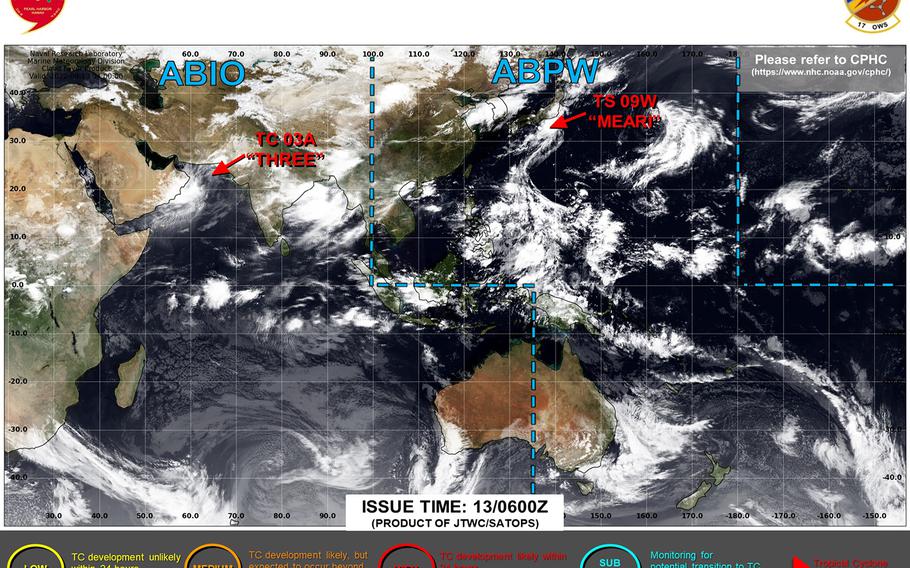
But the worst, for the most part, is over. Tropical Depression Meari is forecast by Joint Typhoon Warning Center to head back out over open water and away from Japan as the weekend progresses.
At 9 p.m., JTWC reported that Meari was about 36 miles northeast of Yokosuka Naval Base, tracking northeast at 21 mph and holding steady at 35-mph sustained winds and 46-mph gusts at center.
Fleet Activities Yokosuka remained in Tropical Cyclone Condition of Readiness 3 and Naval Air Facility Atsugi in TCCOR Storm Watch through Saturday evening; expect both commands to resume seasonal TCCORs once Meari has moved out of the area.
JTWC projects Meari to pick up forward speed and regain tropical-storm strength, though that would be inconsequential for U.S. bases in the Kanto Plain as the forecast track takes it away from Japan and into the northwest Pacific Ocean.
***
5:15 p.m. Saturday, Aug. 13, Japan time: Meari has been downgraded to a tropical depression, and remains on track to pass through the Kanto Plain early this evening, not so much a wind event, but very much a rain event for the Tokyo area.
At 3 p.m., Joint Typhoon Warning Center reported that Meari was about 90 miles west-southwest of Yokosuka Naval Base, moving northeast at 15 mph and had weakened to 35-mph sustained winds and 46-mph gusts at center.
Yokosuka remained in Tropical Cyclone Condition of Readiness 3 and Naval Air Facility Atsugi in TCCOR Storm Watch through Saturday afternoon. All other U.S. bases in the Kanto Plain remained in season TCCORs.
The Kanto Plain can expect gusty winds and rain, heavy at times, in the Yokosuka and Fussa areas next to Fleet Activities Yokosuka and Yokota Air Base. If you must go outdoors, drive very carefully and take care to avoid flooding in low-lying areas.
JTWC forecasts Meari to pass 10 miles northwest of Atsugi and Camp Zama, 12 miles southeast of Yokota and 25 miles northwest of Yokosuka at about 7 p.m.
***
1 p.m. Saturday, Aug. 13, Japan time: Tropical Storm Meari has turned northeast and remains on course for the Tokyo area by Saturday evening, bringing gale-force winds and showers, heavy at times, to the Kanto Plain, according to the Joint Typhoon Warning Center.
At 9 a.m., Meari was about 176 miles southwest of Yokosuka Naval Base, moving northeast at 10 mph and holding steady at 40-mph sustained winds and 52-mph gusts.
Yokosuka remains in Tropical Cyclone Condition of Readiness 3. A thunderstorm warning is in effect until 11 p.m. and a gale warning from 5 p.m. until midnight, with peak winds forecast to be between 40 and 46 mph sustained and 58-mph gusts, according to Yokosuka’s weather report. Local forecasts call for rain and wind peaking at about 6 p.m.
Naval Air Facility Atsugi remains in TCCOR Storm Watch. All other U.S. bases in the Kanto Plain remain in season TCCORs.
If Meari remains on present heading, JTWC projects it to pick up forward speed and peak at 46-mph sustained winds and 58-mph gusts as it passes the Tokyo area, make landfall over the Izu Peninsula late this afternoon, then pass 8 miles southeast of Atsugi and Camp Zama, 18 miles northwest of Yokosuka and 21 miles southeast of Yokota Air Base between 6 and 7 p.m.
***
6 a.m. Saturday, Aug. 13, Japan time: Tropical Storm Meari continues its struggle to strengthen as it moves closer to the Tokyo area, though gale-force winds and rain, heavy at times, remains forecast for the Kanto Plain later today.
At 3 a.m., Meari was about 233 miles southwest of Yokosuka Naval Base, moving north at 13 mph and still holding steady at 40-mph sustained winds and 52-mph gusts. Fleet Activities Yokosuka remained in Tropical Cyclone Condition of Readiness 3 and Naval Air Facility Atsugi in TCCOR Storm Watch overnight Friday into Saturday.
If Meari stays on present heading, Joint Typhoon Warning Center projects it to push northeast, peaking at 46-mph sustained winds and 58-mph gusts as it reaches the Tokyo area at mid-afternoon. JTWC forecasts passage eight miles southeast of Atsugi and Camp Zama, 21 miles southeast of Yokota Air Base and 15 miles northwest of Yokosuka at about 2 p.m.
***
11:15 p.m. Friday, Aug. 12, Japan time: Tropical Storm Meari remains on course to reach the Tokyo area late Saturday afternoon, but it’s still struggling to strengthen and continues to produce only mild tropical-storm force, according to the Joint Typhoon Warning Center.
At 9 p.m., Meari was about 290 miles southwest of Yokosuka Naval Base, headed north at 13 mph and holding steady at 40-mph sustained winds and 52-mph gusts at center. Fleet Activities Yokosuka remained in Tropical Cyclone Condition of Readiness 3 and Naval Air Facility Atsugi in TCCOR Storm Watch through Friday evening.
Wind shear continues to impact Meari and hinder its development as it moves north. If Meari stays on present heading, JTWC projects it to peak at 52-mph sustained winds and 63-mph gusts after it passes through the Kanto Plain.
JTWC forecasts Meari to make landfall over the Izu Peninsula at about mid-day Saturday, then pass 6 miles northwest of Atsugi and Camp Zama, 18 miles southeast of Yokota Air Base and 23 miles northwest of Yokosuka between 5 and 6 p.m. Saturday, then head back out over open water late Saturday evening.
***
5:30 p.m. Friday, Aug. 12, Japan time: Tropical Storm Meari continues on its journey toward the Tokyo area. Tropical Cyclone Condition of Readiness 3 remains in effect at Commander Fleet Activities Yokosuka and its satellite properties and TCCOR Storm Watch at Naval Air Facility Atsugi.
At 3 p.m., Joint Typhoon Warning Center reported Meari to be about 361 miles south-southwest of Yokosuka, moving northeast at 6 mph and holding steady at 40-mph sustained winds and 52-mph gusts at center.
If Meari remains on current heading, JTWC projects it to keep curving northeast, peak at 58-mph sustained winds and 75-mph gusts at mid-afternoon Saturday, then make landfall over the Chiba Peninsula, passing 10 miles southeast of Yokosuka, 31 miles southeast of Atsugi and Camp Zama and 44 miles southeast of Yokota Air Base between 4 and 5 p.m. Saturday.
Be prepared for any TCCOR upgrades; give this a look just as a refresher. Make sure you have supplies, have gassed up your vehicles and acquired enough cash and yen to last a few days, just in case the power goes out for any length of time. And get your safe on.
***
Noon Friday, Aug. 12, Japan time: Tropical Cyclone Condition of Readiness 3 has been issued for Commander Fleet Activities Yokosuka and its satellites and TCCOR Storm Watch has been set for Naval Air Facility Atsugi in advance of Tropical Storm Meari. Click here and scroll down for TCCORs and their meaning.
At 9 a.m., Meari was about 394 miles south-southwest of Yokosuka Naval Base, moving north at 18 mph and holding steady at 40-mph sustained winds and 52-mph gusts.
If Meari remains on present heading, Joint Typhoon Warning Center projects it to gradually arc northeast, strengthening as it goes, graze the southern coast of Honshu between Hamamatsu and Shizuoka, peak at 58-mph sustained winds and 75-mph gusts and make landfall over the Izu Peninsula at mid-afternoon Saturday.
JTWC forecasts Meari to pass 10 miles northwest of Atsugi and Camp Zama, 10 southeast of Yokota Air Base and 29 miles northwest of Yokosuka at about 6 p.m. Saturday. Yokosuka’s weather forecast calls for showers and scattered thunderstorms with southerly winds peaking between 38 and 44 mph sustained and 58-mph gusts late Saturday afternoon.
***
7 a.m. Friday, Aug. 12, Japan time: Tropical Storm Meari continues to lurk south-southwest of the Tokyo area and remains forecast to bring severe gusts and heavy rain to the Kanto Plain Saturday afternoon into Sunday.
At 3 a.m., Meari was 503 miles south-southwest of Yokosuka Naval Base, crawling north at just 2 mph and holding steady at 40-mph sustained winds and 52-mph gusts. U.S. bases in the Kanto Plain remained in seasonal Tropical Cyclone Conditions of Readiness overnight; that could change at any point given the Joint Typhoon Warning Center’s latest forecast track.
If Meari stays on present heading, JTWC projects it to begin moving north as Friday progresses and strengthen as it heads northeast, making landfall over the Izu Peninsula late Saturday afternoon and peaking at 63-mph sustained winds and 81-mph gusts at center, just below typhoon intensity.
JTWC forecasts Meari to make a near-direct pass over Yokosuka, 18 miles southeast of Naval Air Facility Atsugi and Camp Zama and 33 miles southeast of Yokota Air Base at about 8 p.m. Saturday.
Yokosuka’s forecast calls for showers and scattered thunderstorms Saturday afternoon into Sunday, with southerly winds peaking between 38 and 44 mph sustained with 58-mph gusts at around 5 p.m. Saturday, gradually diminishing through the evening into Sunday.
Still time to prepare for Meari’s arrival. Give this a look to know what to do to prepare and what TCCORs mean. Get your safe on.
***
Midnight Thursday, Aug. 11, Japan time: 09W has been upgraded to a tropical storm by Joint Typhoon Warning Center. Its latest forecast track continues to put it on course for Saturday evening passage over the Kanto Plain at just-below typhoon intensity.
At 9 p.m. Thursday, 09W was 513 miles south-southwest of Yokosuka Naval Base, crawling south-southeast at 2 mph, pretty much quasi-stationary, almost like the proverbial lion waiting to pounce. It had strengthened to 40-mph sustained winds and 52-mph gusts at center. U.S. bases on the Kanto Plain remain in seasonal Tropical Cyclone Conditions of Readiness, for now; that could change any time.
If the current forecast holds, JTWC projects 09W to start tracking north and northeast by mid-morning Friday, intensifying as it moves, with landfall over the Izu Peninsula early Saturday evening, packing 69-mph sustained winds and 86-mph gusts.
JTWC forecasts 09W to make a beeline over Camp Zama and Naval Air Facility Atsugi, pass 24 miles northwest of Yokosuka and 14 miles southeast of Yokota Air Base at about 8 p.m. Saturday at just-below typhoon intensity.
Again, always best to be safe. Know your TCCORs. Gather some non-perishable foods, plenty of drinking water, flashlights, batteries, hand-cranked or battery-operated radio, diapers and wipes for the young’uns and food and drink for your furry friends. Make sure to gas up at the gasoline stand and withdraw sufficient cash and local currency to last three days. Just in case.
Stay tuned to your base weather channels and Web sites, AFN Eagle 810-AM radio and your commanders’ access TV channels for the latest storm information. Storm Tracker will keep you updated as well.
Above all else, three words: Prepare. Don’t panic.
***
6:30 p.m. Thursday, Aug. 11, Japan time: Say hello to the ninth numbered storm of the northwest Pacific’s tropical cyclone season.
And the outlook is anything but benign for the Tokyo area this weekend, as we’re looking at a possible severe tropical storm, or worse, passing through the Kanto Plain, with peak winds and rain forecast for Saturday afternoon.
At 3 p.m., Tropical Depression 09W was 503 miles south-southwest of Yokosuka Naval Base, crawling west at 6 mph with 29-mph sustained winds and 40-mph gusts.
All U.S. bases in the Kanto Plain remain in seasonal Tropical Cyclone Conditions of Readiness for the moment; expect those to change as the night progresses and 09W begins its forecast trek north and northeast.
If 09W stays on its Joint Typhoon Warning Center forecast track, it’s projected to steadily intensify as it moves toward land, passing almost directly over Naval Air Facility Atsugi and Camp Zama and between Yokota Air Base, 19 miles southeast, and Yokosuka, 21 miles to its northwest, between 4 and 5 p.m. Saturday, packing 69-mph sustained winds and 86-mph gusts at center. Just below typhoon strength.
Here is a typhoon primer for those new to the Pacific. Ensure that you prepare yourselves, your homes and your offices for come what may.
In brief: Non-perishable foods, plenty of drinking water, flashlights, batteries, hand-cranked or battery-operated radio, diapers and wipes for the young’uns and food and drink for your furry friends. Make sure to gas up at the gasoline stand and withdraw sufficient cash and local currency to last three days.
Stay tuned to your base weather channels and Web sites, AFN Eagle 810-AM radio and your commanders’ access TV channels for the latest storm information. Storm Tracker will keep you updated as well.
Above all else, three words: Prepare. Don’t panic.
***
11:20 a.m. Thursday, Aug. 11, Japan time: A tropical cyclone formation alert has been issued by the Joint Typhoon Warning Center on a tropical disturbance labeled 90W Invest, developing southwest of the Tokyo area.
It’s not projected to become a typhoon, but it could develop into a tropical depression or storm by the weekend, bringing a forecast of heavy rain and gusty winds Saturday.
Yokosuka Naval Base’s weather forecast calls for rain and thunderstorms Saturday, with south-southwesterly winds peaking at 25- to 30-mph sustained and 40-mph gusts between 7 p.m. Saturday and 2 a.m. Sunday.
At 10:30 a.m., it was 482 miles south-southwest of Yokosuka. Model track guidance and the GFS and ECMEF forecast ensembles agree on a curve northeast toward or through the Tokyo Kanto Plain over the weekend.
