Rai strengthens slightly, remains forecast to move northeast, dissipating early Wednesday morning just west of Taiwan. (Joint Typhoon Warning Center)
4:15 a.m. Tuesday, Dec. 21, Hong Kong time: Rai simply doesn’t want to go away quietly. Joint Typhoon Warning Center still rates it a tropical storm, but its latest forecast track shows it curving northeast, weakening and dissipating early Wednesday morning just west of Taiwan. Standby Signal 1 remains raised by the Hong Kong Observatory. Unless it retains its intensity, this should be Storm Tracker’s final report on Rai.
***
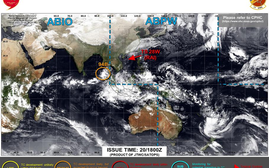
11 p.m. Monday, Dec. 20, Hong Kong time: Rai has been downgraded to a tropical depression by the Joint Typhoon Warning Center.
Standby Signal 1 remained raised by the Hong Kong Observatory into late Monday evening, though JTWC projects that Rai will dissipate within 12 hours.
At 8 p.m., Rai was 265 miles south-southwest of Hong Kong, moving northeast at 9 mph, with 29-mph sustained winds and 40-mph gusts at center.
Death toll in the Philippines climbed to 375 with at least 56 missing and 500 injured as the country continues to assess damage.
This is the final report on Tropical Depression Rai.
***
5:20 p.m. Monday, Dec. 20, Hong Kong time: Rai has weakened considerably from its peak as a Category 5-equivalent super typhoon; it has been downgraded to a tropical storm by the Joint Typhoon Warning Center, is on a northeasterly course and is forecast to die out at mid-afternoon Tuesday.
At 2 p.m., Rai was 316 miles south-southwest of Hong Kong, moving northeast at 15 mph and had weakened to 52-mph sustained winds and 63-mph gusts at center.
Standby Signal 1 has been raised as a precaution by the Hong Kong Observatory; if winds strengthen further overnight, HKO states it will consider upgrading to Strong Wind Signal 3.
If Rai continues on present heading, JTWC forecasts it to keep diminishing rapidly, passing 108 miles southeast of Hong Kong as a tropical depression at about mid-day Tuesday.
***
3:30 a.m. Monday, Dec. 20, Vietnam time: Rai continues to weaken and has been downgraded to a Category 2-equivalent typhoon. It remains on a northerly path, off the east coast of Vietnam, on a Joint Typhoon Warning Center forecast track taking it off southeastern China and dying out Wednesday near southern Taiwan.
At 1 a.m., Rai had made its closest point of approach, 153 miles east of Da Nang, heading north at 14 mph, packing 104-mph sustained winds and 127-mph gusts at center.
Multiple media outlets are reporting that at least 167 souls perished in the Philippines as a result of Rai, and officials are pleading for help in the wake of what was twice a Category 5-equivalent super typhoon.
If Rai stays on its present course, JTWC projects it to keep weakening, passing 98 miles southeast of Hong Kong at 10 a.m. Tuesday as a tropical storm, then keep dying out 51 miles south-southeast of Kaohsiung, Taiwan, at about 8 p.m. Wednesday as a tropical depression. Next update late Monday afternoon.
***
9 p.m. Sunday, Dec. 19, Vietnam time: Rai has been downgraded to a Category 3-equivalent typhoon, and heavy weather warnings have been posted along Vietnam’s east coast, from Da Nang through Bien Thuan, almost as far south as Ho Chi Minh City, according to Joint Typhoon Warning Center and Vietnam’s weather authority.
At 7 p.m., Rai was 183 miles east-southeast of Da Nang, moving almost due north at 10 mph and is still a vicious beast, packing 121-mph sustained winds and 150-mph gusts at center.
If Rai continues moving according to the JTWC forecast, it’s projected keep weakening rapidly as it moves north through Monday, passing 169 miles east of Da Nang at midnight Sunday, then arc northeast, passing 98 miles southeast of Hong Kong at 10 a.m. Tuesday, and dying out as it approaches the southern tip of Taiwan at mid-afternoon Wednesday.
***
10 a.m. Sunday, Dec. 19, Vietnam time: Rai didn’t have a lengthy life as a super typhoon this time around. But it remains a vicious Category 4-equivalent system, rumbling northwest on a Joint Typhoon Warning Center forecast track taking it just east of the Vietnam coast.
At 7 a.m., Rai was 288 miles southeast of Da Nang, moving northwest at 12 mph, still packing 144-mph sustained winds and 173-mph gusts at center.
If Rai stays on present course, JTWC forecasts it to curve north, weakening steadily, grazing Vietnam’s coast, passing 164 miles east of Da Nang at 11 p.m. Sunday, then arc northeast, passing 103 miles southeast of Hong Kong at 8 a.m. Tuesday as a tropical storm, then dying out just before reaching Taiwan’s southern tip at mid-morning Wednesday.
***
4:30 a.m. Sunday, Dec. 19, Philippines time: Not only has Rai shown itself to be an extreme weather maker, it’s proving to be a record breaker and history maker, as well.
Rai has been upgraded to a super typhoon for the second time in its six-day life span – but it’s the first Category 5-equivalent super typhoon on record in the South China Sea in the month of December.
And it’s only the fourth super typhoon in the South China Sea in any month since records began being kept by Japan Meteorological Agency in 1951.
The previous three were Rammasun in July 2014, Pamela in October-November 1954 and Gloria, which peaked as a Category 4-equivalent system, in December 1952. Meranti, in September 2016, just missed making that list, passing over the Batanes Islands as a Category 5-equivalent system.
But Rai, by far, is the strongest ever recorded over the South China Sea in any month.
At 2 a.m., Rai was 355 miles southeast of Da Nang, Vietnam, moving west-northwest at 16 mph and packing 167-mph sustained winds and 201-mph gusts at center, according to the Joint Typhoon Warning Center. That’s an increase from 132-mph sustained winds late Saturday evening.
If Rai continues on present heading, JTWC forecasts it to arc north, weakening steadily as it passes 168 miles east of Da Nang at about 11 p.m. Sunday, then curve northeast, passing 117 miles south-southeast of Hong Kong at 11 a.m. Tuesday as a tropical storm, then die out as it moves just south of the Formosa Strait early Thursday.
***
10:05 p.m. Saturday, Dec. 18, Philippines time: Rai simply doesn’t want to go away quietly. It’s been upgraded to a Category 4-equivalent typhoon, has made its way past the Kalayaan Islands west of the Philippines’ Palawan province and is on course to pass east of the Vietnam coastline, according to the Joint Typhoon Warning Center.
At 8 p.m., Rai was 449 miles southeast of Da Nang, Vietnam, headed west-northwest at 17 mph, packing 132-mph sustained winds and 161-mph gusts. It most likely maintained that intensity as it roared through Pag-asa Island in the Kalayaans, flat and dreadfully exposed in the middle of the South China Sea.
Tropical Cyclone Wind Signal 3 remained raised for the Kalayaans early Saturday evening, according to the national weather authority PAGASA. Wind signals have been lowered for all other areas of the Philippines.
If Rai stays on present heading, JTWC forecasts it to be downgraded back to a Category 3-equivalent system by mid-morning Sunday, then Category 2 as it passes 156 miles east of Da Nang at about midnight Sunday. From there, JTWC projects Rai to curve northeast and die out 153 miles southeast of Hong Kong at about 8 p.m. Tuesday.
***
5 p.m. Saturday, Dec. 18, Philippines time: Typhoon Rai is now well out over the South China Sea, but it remains a powerful Category 3-equivalent system, vast enough that the Kalayaan Islands and the west coast of Palwan remain under wind signal.
Rai, named Odette by the Philippines national weather authority PAGASA, has left a wide swath of destruction in its wake; it may take a long time for areas of the south-central Philippines to get back on their feet.
At 2 p.m., Rai was 547 miles southeast of Da Nang, Vietnam, and was moving west-northwest at 13 mph, packing 127-mph sustained winds and 155-mph gusts at center. Tropical Cyclone Wind Signal 3 remains raised for the Kalayaans, PAGASA reported.
If Rai continues moving as forecast, Joint Typhoon Warning Center projects it to start arcing northwest, then north, passing just off Vietnam’s east coast, 162 miles east of Da Nang at 2 a.m. Monday, then curving northeast, dying out off China’s southeast coast by mid-week.
***
5:15 a.m. Saturday, Dec. 18, Philippines time: Typhoon Rai has exited the west-central Philippines, has re-intensified into a Category 3-equivalent system and is tracking into the South China Sea, on course to pass east of Vietnam early Monday morning before dying out southeast of China by middle of next week.
At 2 a.m., Rai was 367 miles southwest of Metro Manila, rumbling west-northwest at 14 mph and packing 115-mph sustained winds and 144-mph gusts at center.
Tropical Cyclone Wind Signal 2 remained raised for central Palawan Island and Signal 1 for outer portions of Palawan, according to the national weather authority PAGASA.
Should Rai stay on present heading, Joint Typhoon Warning Center forecasts it to remain a Category 3-equivalent storm through Saturday, curving northwest and brushing just off the Vietnam coast, passing 137 miles east of Da Nang at 4 a.m. Monday, steadily weakening as it curves north, then northeast.
***
10:30 p.m. Friday, Dec. 17, Philippines time: Typhoon Rai has weakened slightly, but remains a powerful Category 2-equivalent system. It’s moving west of Palawan Island, leaving a trail of death, flooding and destruction in its wake throughout the Visayas Islands and northern Mindanao in the central Philippines.
At 8 p.m., Rai was 342 miles southwest of Metro Manila, moving west at 16 mph and packing 104-mph sustained winds and 127-mph gusts at center.
Tropical Cyclone Wind Signal 3 remains raised for northern Palawan, Signal 2 for portions of southern Palawan and Signal 1 for the southern tip of the island, according to the national weather authority PAGASA. All wind signals for the rest of the region have been canceled.
If Rai stays on present heading, Joint Typhoon Warning Center continues to project it regaining Category 3-equivalent intensity, gradually arcing northwest into the weekend, passing 137 miles east of Da Nang, Vietnam, at 4 a.m. Monday, then curving northeast and dying out southeast of China late Wednesday.
***
5:10 p.m. Friday, Dec. 17, Philippines time: With the onset of evening, Typhoon Rai was downgraded to a Category 2-equivalent typhoon, but according to the Joint Typhoon Warning Center’s latest update, not for very long, once it moves west of Palawan Island in the west-central Philippines.
At 2 p.m., Rai was 320 miles south-southwest of Metro Manila, churning west at 14 mph and had decreased to 110-mph sustained winds and 132-mph gusts at center.
Tropical Cyclone Wind Signal 3 remains raised for northern Palawan and Signal 2 elsewhere in west-central Visayas, according to the national weather authority PAGASA.
If Rai stays on present heading, JTWC projects it to keep moving west-northwest into the South China Sea overnight Friday into Saturday, gradually arcing north east of the Vietnam coast through the weekend, then curving northeast and dying out as a tropical depression southeast of China by the middle of next week.
***
11:25 a.m. Friday, Dec. 17, Philippines time: As mid-day approached, Typhoon Rai was moving through the Sulu Sea toward Palawan in the western Philippines, leaving a trail of flooding and destruction as the Category 3-equivalent system continues rumbling toward the South China Sea.
At 8 a.m., Rai was 317 miles south of Metro Manila, churning west at 16 mph and packing 115-mph sustained winds and 144-mph gusts at center.
Tropical Cyclone Wind Signal 3 remains raised for northern Palawan, the Cuyo Islands and Antique and Iloilo in southern Panay Island and TCWS 2 elsewhere in the west-central Philippines, according to the national weather authority PAGASA.
If Rai continues on present course, Joint Typhoon Warning Center projects it to pass 31 miles north-northeast of Puerto Princesa at 6 p.m. Friday, then move into the South China Sea, remaining a strong Category 3-equivalent storm as it arcs north and northeast just off the Vietnam coast, then dying out just off China’s southeastern coast.
***
4:45 a.m. Friday, Dec. 17, Philippines time: Typhoon Rai remains a powerful Category 3-equivalent system, moving west past Negros province and on toward the northern tip of Palawan, which Joint Typhoon Warning Center projects Rai to reach by mid-afternoon Friday before pushing into the South China Sea.
At 2 a.m., Rai was 320 miles south-southeast of Metro Manila, rumbling west at 20 mph, still packing 127-mph sustained winds and 155-mph gusts at center.
Tropical Cyclone Wind Signal 4 remains raised for Negros and Signal 3 for southern Panay Island and northern Palawan, according to the national weather authority PAGASA.
If Rai stays on present heading, JTWC projects it to keep moving almost due west, then make a gradual arc north and northeast, passing just off the coast of Vietnam before fading out off the southeast China coast early next week.
***
11:15 p.m. Thursday, Dec. 16, Philippines time: Rai has been downgraded from a super typhoon, but remains a powerful Category 4-equivalent system, buzz-sawing its way through the central Philippines on course to exit the islands into the South China Sea this weekend.
At 8 p.m., Rai was passing directly over Cebu City in the Visayas and 382 miles southeast of Metro Manila, rumbling west at 19 mph packing 132-mph sustained winds and 161-mph gusts at center.
Tropical Cyclone Wind Signal 4 remains raised for the southern Visayas, Signal 3 for areas close by and Signal 2 for the rest of Visayas and northern Mindanao, according to the national weather authority PAGASA.
If Rai remains on present course, Joint Typhoon Warning Center projects it to move west-northwest, weakening slightly as it passes over southern Panay Island and over the northern tip of Palawan in the next day or so, then exit into the South China Sea and regain strength. Rai is forecast to then arc east of Vietnam and weaken into a tropical depression as it passes near southeastern China.
***
1:30 p.m. Thursday, Dec. 16, Philippines time: Rai has been upgraded to a Category 5-equivalent super typhoon and is making its way over Surigao del Norte and the southern Visayas in the south-central Philippines. Tropical Cyclone Wind Signal 4 has been raised for those areas, according to the national weather authority PAGASA.
If Rai maintains its present heading, Joint Typhoon Warning Center projects it to move west through northern Mindanao and southern Visayas, losing some intensity as it rumbles through the islands over the next 1½ days, then restrengthening as it enters the South China Sea.
***
5 a.m. Thursday, December 16, Philippines time: Talk about exiting like a lion. The 2021 northwest Pacific typhoon season simply refuses to go away quietly, thanks to Typhoon Rai, which experienced an extremely rapid intensification overnight and is forecast to make landfall over the Philippines as a Category 5-equivalent super typhoon Thursday afternoon.
At 2 a.m., Rai was 643 miles east-southeast of Metro Manila, moving west-northwest at 13 mph and had strengthened to 132-mph sustained winds and 161-mph gusts at storm’s center. That’s about 30 mph stronger than the Joint Typhoon Warning Center’s previous report at 8 p.m. Wednesday.
If Rai remains on present heading, JTWC projects it to peak at 161-mph sustained winds and 196-mph gusts at center as it reaches land just over the northern tip of the Philippines’ largest island, Mindanao, maintaining Category 4-equivalent strength as it moves across the southern Visayas islands through Friday afternoon.
Tropical Cyclone Wind Signal 3 is raised for southern Visayas and northern Mindanao, from southern Leyte to Surigao del Norte, and TCWS 2 elsewhere in Mindanao and Visayas, according to the Philippines’ national weather authority PAGASA. Expect those to move west as Rai moves west.
JTWC forecasts Rai to weaken some as it exits Palawan Island, but re-intensify as it moves through the South China Sea, curving north before reaching Vietnam and heading toward southeastern China as the new week begins.
