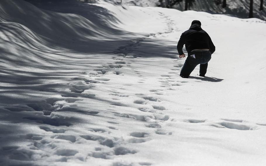
A volunteer postholes through deep snow as he checks on area residents in the San Bernardino Mountain community on March 7, 2023, in Crestline, Calif. (Brian van der Brug, Los Angeles Times/TNS)
(Tribune News Service) — California’s latest atmospheric rivers are sending rainfall higher into the mountains and onto the state’s crucial snowpack. The rain alone is a problem for low-lying areas already dealing with destructive flooding, but the prospect of rain on the deep mountain snow has triggered widespread flood warnings.
When rain falls on snow, it creates complex flood risks that are hard to forecast. Those risks are also rising with climate change.
For much of the United States, storms with heavy rainfall can coincide with seasonal snow cover. When that happens, the resulting runoff of water can be much greater than what is produced from rain or snowmelt alone. The combination has resulted in some of the nation’s most destructive and costly floods, including the 1996 Midwest floods and the 2017 flood that damaged California’s Oroville Dam.
But rainfall itself has limited energy to melt snow. Rather, it is the warm temperatures, strong winds and high humidity — which can transport substantial energy in the form of latent and sensible heat — that predominantly drive snowmelt during rain-on-snow events.
Snowpack has air spaces that water can move through. As the rain falls, the water can travel relatively rapidly through the snowpack’s layers to reach the underlying soil. How streams respond to that runoff depends on how much water is already flowing and how saturated the soil is.
When the soil isn’t yet saturated, it can dampen or delay a flood response by soaking up rain and melting snow. But when the ground is saturated, snowmelt combined with rainfall can lead to fast and devastating flooding.
To predict whether a flood will occur requires knowledge of weather and hydrological conditions. It requires knowing the soil moisture and snowpack conditions before the storm, the elevation at which rain transitions to snow, the rainfall rate, the wind speed, air temperature and humidity, and estimates of how those factors contribute to snowmelt. Additionally, each factor varies in time and in complex ways during a storm, especially across a mountainous landscape.
That’s why so little is known about rain-on-snow floods, considered compound extreme events, despite the extensive damage they can cause.
In the California mountains right now, it’s the middle elevations — where either substantial rainfall or snowfall can occur — that face the most severe effects. The lower elevations have primarily seen rainfall rather than snow, so there is less snowpack to melt. And at the highest elevations, colder temperatures ensure the deep snowpack continues to accumulate and rainfall is less likely.
If all storms were created equal, there would be well-defined rain zones and snow zones, and the rain-on-snow flood risk would be low. But instead, not only does the snow zone elevation vary during an event, but it also varies substantially from one storm to the next.
The most destructive rain-on-snow events occur when rivers are already running high and soils are saturated, as is happening in California after a series of warm atmospheric rivers. The order in which these storms occur is especially important for assessing flood risk because these events are caused in part by rapid shifts between cold periods of snow accumulation followed by warm rainfall.
How rain-on-snow flood risk will change as the planet warms is still not well understood. Will increases in precipitation extremes and winter rainfall increase rain-on-snow occurrence and the flood risk? Or will less snow cover and larger soil-moisture deficits reduce rain-on-snow flood risk in a warmer climate?
A few points are becoming clearer. In a warming climate, there will be less risk of precipitation falling on snow in the lower elevations as the snowpack declines, particularly in warmer regions such as the Pacific Northwest. But at higher elevations, there may be more frequent rain-on-snow events. Increased flood risk comes from the rain-snow transition zone expanding higher in elevation to include alpine areas that historically received snowfall.
Flood control and reservoir management systems in these mountainous regions will have to consider these shifts — in addition to changes in rainfall intensity and storm sequencing — to fully understand and prepare for future local flood risks.
As the planet warms, the rain-on-snow effect is only one of many costly risks local communities will need to account for. This week, California is seeing what might become a more common phenomenon as a result of climate change.
Keith Musselman is an assistant professor in geography, mountain hydrology and climate change at the University of Colorado Boulder. This article was produced in partnership with The Conversation.
©2023 Los Angeles Times.
Visit at latimes.com.
Distributed by Tribune Content Agency, LLC.