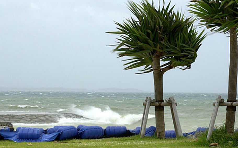
At Uken Beach near Camp Courtney, Okinawa, the surf crashed against the shore Saturday and the wind was blowing sand through the air hard enough to sting the skin. (Cindy Fisher / Stars and Stripes)
CAMP FOSTER, Okinawa — Typhoon Ewiniar unleashed gusty winds and rain showers over Okinawa overnight Saturday into Sunday, while a new storm developed well to the southeast of the island, strengthening into a tropical depression.
Meanwhile, it appeared Osan and Kunsan Air Bases in South Korea would be spared Ewiniar’s wrath. The Joint Typhoon Warning Center projected that the fourth storm of the northwest Pacific’s tropical cyclone season would move north into the Yellow Sea and skirt the Korean peninsula farther west than originally forecast.
Tropical Cyclone Condition of Readiness 1C (caution) was issued for Okinawa after winds exceeding 39 mph began raking the island around 5:30 p.m. Saturday, said Capt. Colin Reece, 18th Weather Flight commander, Kadena Air Base. TCCOR 1E (emergency), at which time all outdoor activities are prohibited, was declared at 1:45 a.m. Sunday.
Ewiniar’s closest point of approach to Okinawa was predicted to be 128 miles to the west at 1 a.m. Sunday. Reece indicated winds of 58 mph or greater were expected from midnight Saturday until 6 a.m. Sunday. Peak winds were forecast to be 69 mph at 3 a.m. “It should be pretty short-lived,” he said. “But it’s still a good idea to stay indoors.”
The storm should move rapidly north and lose strength as it approaches the Yellow Sea and cooler sea-surface temperatures in and around China, Japan and Korea, Reece said.
Ewiniar initially was forecast to make landfall on Korea’s southwest coast but the latest JTWC forecast instead has the storm passing well west of Osan, Kunsan and Seoul, making landfall near the North Korea-China border about 3 a.m. Tuesday.
At 6 p.m. Saturday, Ewiniar churned 161 miles southwest of Naha, Okinawa’s prefectural capital, rumbling north at 11½ mph with sustained winds of 98 mph and gusts of up to 121 mph.
JTWC forecasts call for Ewiniar to be downgraded to a tropical storm overnight Sunday into Monday as it heads for the Yellow Sea.
U.S. Forces Korea remained in TCCOR 4 although Osan and Kunsan reported remaining vigilant.
Ewiniar was forecast to pass 121 miles west of Kunsan at 6 p.m. Monday, 130 miles west of Osan at 11 p.m. Monday and 125 miles west of Yongsan Garrison at 1 a.m. Tuesday, packing sustained winds of 58 mph and gusts of up to 75 mph at its center.
General information was being passed to Osan and Kunsan bases through the commander’s access channel and American Forces Network TV and radio, Osan spokesman Tech Sgt. Michael O’Connor stated in a news release given to Stars and Stripes on Saturday.
The commands at Osan’s 51st Fighter Wing and Kunsan’s 8th Fighter Wing will review storm preparations and TCCOR levels on Sunday, the release stated.
Well to Okinawa’s southeast, an as-yet-unnamed tropical depression began gathering strength and moving away from Guam, where it began forming Friday.
At 6 p.m. Saturday, it was 236 miles west-southwest of Guam, moving northwest at 10 p.m. with sustained winds of 29 mph.
“It’s too early to tell” what the new storm might do, Reece said. “It does have the potential to be a threat to us.”
At Uken Beach near Camp Courtney, Okinawa, the surf crashed against the shore Saturday and the wind was blowing sand through the air hard enough to sting the skin. (Cindy Fisher / Stars and Stripes)
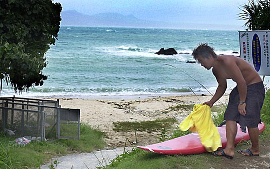
A Japanese man packs up his gear Saturday evening before leaving the shore near Camp Courtney, Okinawa, as Typhoon Ewiniar rolled in. (Cindy Fisher / Stars and Stripes)
