As of March 15, 2023, Mount Asama is under a level 2 advisory, meaning no one may approach closer than 1 1/4 miles of its summit. (Joseph Ditzler/Stars and Stripes)
Mount Asama is one of Japan’s most active volcanoes and its murderous 18th century eruption is a tragic page in the nation’s history.
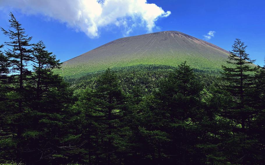
The 8,425-foot mountain killed more than 1,500 people on Aug. 5, 1783, when a pyroclastic flow — a fast-moving deluge of ash, lava and hot gases — blew out of Asama and started a mud flow that raced downslope into the Agatsuma River and continued for 125 miles.
The event is remembered as the Burning of Asama in Tenmei and probably contributed to the Great Tenmei Famine. Downstream, bodies were pulled from the muck and buried. Twenty-five survivors were carried with the mud as far as 25 miles from the volcano.
Today, Asama slumbers fitfully. It last erupted in August 2019, a monthlong fit of tremors and an ash plume that rose over a mile high. From time to time the crater emits noxious gas and sometimes at night an eerie incandescent glow illuminates the summit.
Since March 15, the mountain has been under a level 2 advisory from the Japan Meteorological Agency, meaning no one may come closer than 2 kilometers, 1 ¼ miles, from the summit. The mountain is expanding in places, however indiscernible to the naked eye, and the number of shallow, volcanic tremors has recently increased.
Still, the mountain is a popular hiking destination. Scores of people, including groups of seniors and children, filled a 7-mile loop trail on a Saturday in late July.
From Yokota Air Base in western Tokyo, the trip to the trailhead is just over two hours on the expressways and costs about $60 in tolls. A no-frills hike that skipped visits to the nearby volcano museum, onsens and shrine took just over seven hours.
A “lollipop” trail, one of several paths that reach the mountain, starts at the Takamine Kogen Hotel and visitor center at Takamine Kogen atop a twisty, two-lane mountain highway. Parking is free at the visitor center; come early for an open spot.
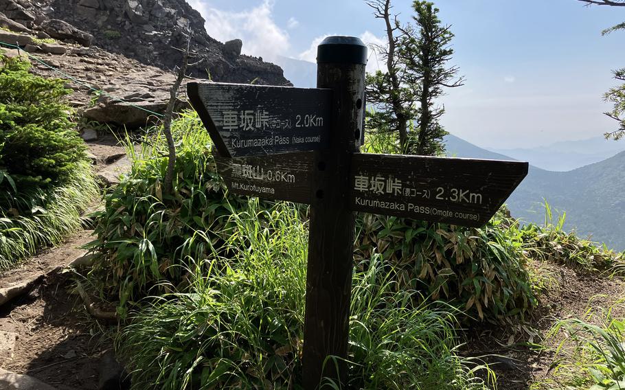
Trails are well-marked around Mount Asama, Japan. (Joseph Ditzler)
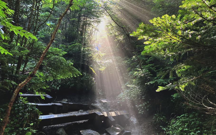
Morning mist beckons hikers along the trail to Mounta Asama, Japan, on July 29, 2023. (Joseph Ditzler)
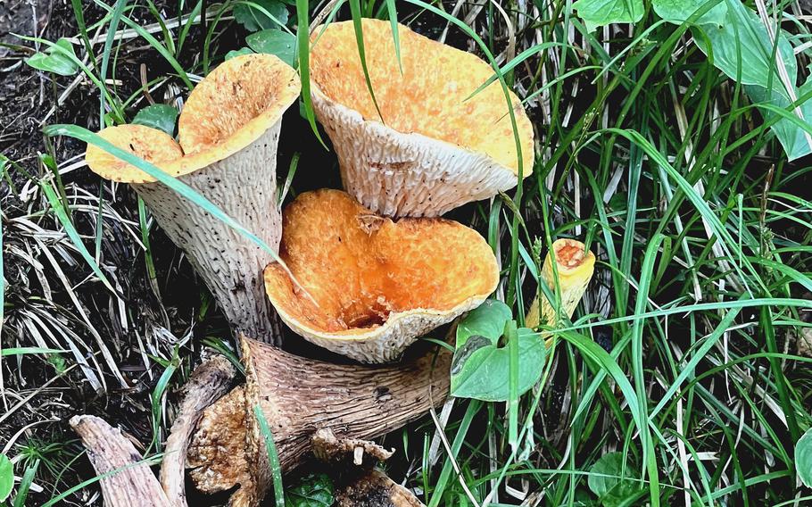
Orange cup fungi grow along the trail to Mount Asama, Japan, on July 29, 2023. (Joseph Ditzler)
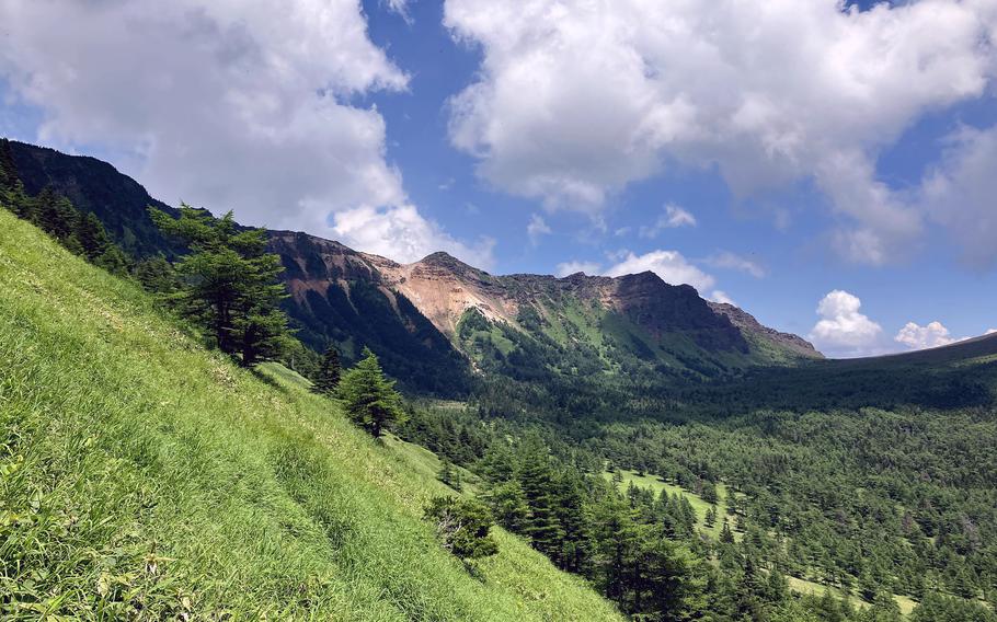
Morning mist floats through the forest of conifers until the trail breaks into the open with a vista of Asama and the long, high ridge to the north where the loop trail leads. Turn left to follow the trail to the ridgetop and several overlooks for a changing view of Asama and the neighboring cliffs as the sun and rising mist play on the mountains.
The area is part of Joshin-etsu Kogen National Park and the shallow valley between the ridge and volcano rivals any view in Colorado or California. East of the volcano is Onioshidashi Volcanic Park, which preserves the landscape left behind by that 1783 disaster.
The loop trail is a challenging hike, but some stretches of it are downright easygoing. Root- and rock-infested sections give way to hardpacked earth punctuated with the occasional stone. Undergrowth yields to an open forest and the slant of morning light offers fine photographic potential.
The ridge trail is well marked and passes two peaks, Mount Kurofu and Mount Jakotsu. At Jakotsu, however, its character shifts from easy striding to rock clambering. Signs warn hikers to move quickly off this section if they “sense” an eruption, because this narrow ridge line is prone to rock falls. The looming face of Asama evokes visions of incoming projectiles hurled in anger.
Eventually, the trail finds another junction and drops off the ridge to the valley floor at the foot of Asama, where the open landscape and intermittent vegetation will be familiar to any native of the Pacific Northwest. This is as close to the summit as hikers may get and as intimate a view.
The trail continues along the base, into a mixed conifer and deciduous forest to another trail junction. A left turn leads to Mount Maekake, one of two “summits” atop the volcanic cone and the one normally considered safe to visit. Instead, cables were strung across the trail, and signs in Japanese and English warn hikers to go no farther.
Instead, continue going straight and enjoy the relative ease of this charming footpath. Take a right turn at the Yunodaira branch and head through bamboo grass and groves of trees, past the rocky summits on your left, and begin the slog uphill toward Kurofu to close the loop.
A bold climb to the ridgetop facing Mount Asama, Japan, qualifies this 7-mile hike as "challenging." (Joseph Ditzler/Stars and Stripes)
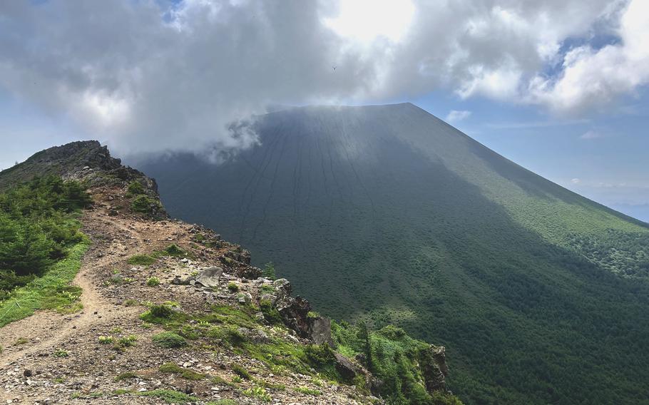
Morning clouds cling to the summit of Mount Asama, Japan, viewed from Mount Jakotsu on July 29, 2023. (Joseph Ditzler)
This section is out in the open, and though the temperature never exceeded 80 degrees at this altitude, the pitiless mid-afternoon sun called for a break or two and constant hydration. The slope at some points is in-your-face steep. This being Japan, however, a caretaker with shears stood at the highest sections clearing the grass and nettles crowding the trail.
Atop the ridge, at the Tominoatama trail intersection, do yourself a favor and opt for the shorter Naka return course. It’s a lot easier on the knees even though it, too, has a couple of steep, rocky parts that resemble empty streambeds more than they do footpaths.
Throughout the day, a steady flow of hikers grew stronger, evincing a disregard for the apparent hazard. Remember, if you go, the unpredictable volcano at any time may belch a cloud of deadly gas, choking ash or ballistic rock.
On the QT
Directions: Set your GPS for Takamine Kogen Visitor Center, a two-hour drive from Yokota Air Base via the Kanetsu and Joshinetsu expressways. Parking is available at the center. The trailhead is across the street on the mountain highway between the center and an adjacent hotel.
Times: Dawn to dusk.
Costs: 8,200 yen, or about $60, in tolls. The visitor center serves lunches and nearby onsens will ease those hiking muscles. Rail and bus service will get you there, too.
Food: Lunch is served at the Takamine Kogen Hotel and the adjacent visitor’s center.
Information: Online: asama2000.com/green