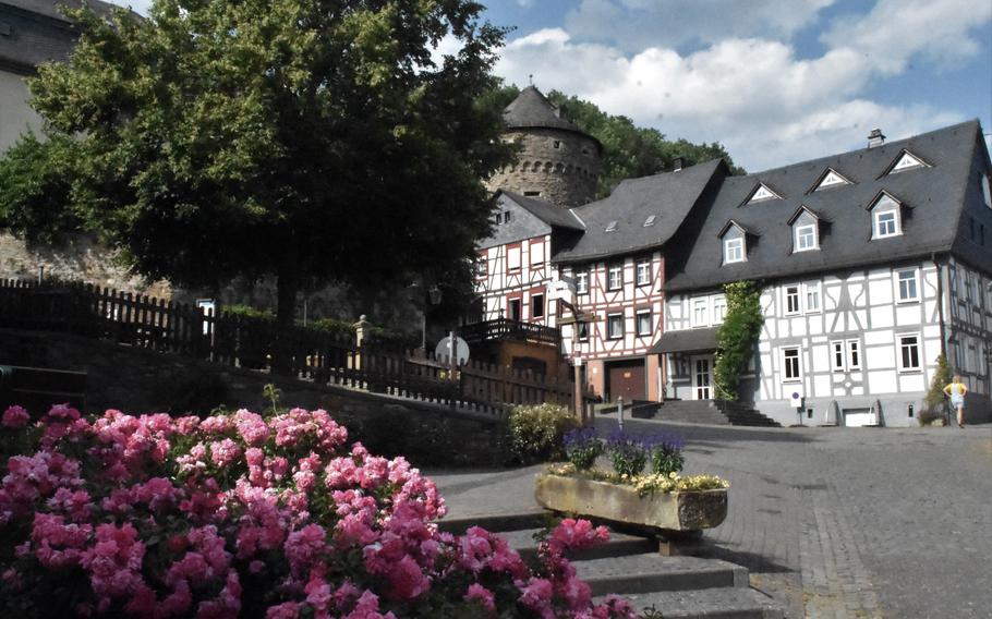
Herrstein is one of the most well-preserved medieval towns in Germany’s Nahe-Hunsrueck region, an area framed by the Saar, Moselle, Rhine and Nahe rivers northwest of the U.S. Army’s post at Baumholder. (Jennifer H. Svan/Stars and Stripes)
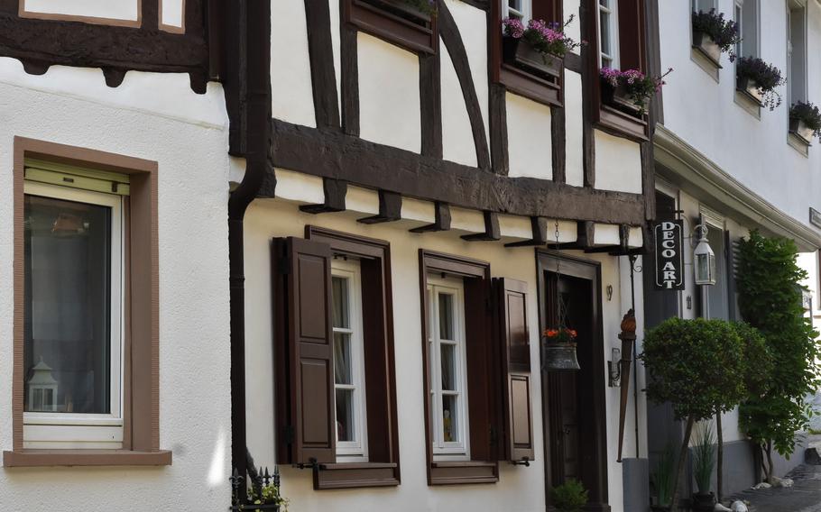
Wandering Herrstein’s narrow cobblestone streets lined with beautiful half-timbered homes feels like walking through a German-themed village at Disney World’s EPCOT theme park.
About 40 years ago, a project to restore the historic town along Germany’s Gem Road involved workers chipping away at gray plaster facades to reveal the original medieval timber-framed buildings.
More than 50 half-timbered homes dating back as far as the 16th century have been preserved in Herrstein, Germany, a medieval village about 18 miles north of the U.S. Army’s garrison at Baumholder. (Jennifer H. Svan/Stars and Stripes)
The oldest of the 60-some homes, most of them occupied by residents, dates to 1525. Colorful window flower boxes, antique metal benches etched with chickens and a chiming clock tower add to the Old World charm.
While Americans were celebrating the Fourth of July, a holiday that commemorates a 1776 “birthday,” my friend, son and I stood in a town square that may have been around as early as 1279.
The year is the earliest date that Herrstein and a knight named Ruther von Heresteyn are mentioned in historical documents, according to the town’s website.
My son tested out the neck shackles hanging in the square before we climbed the stairs to the castle church and passed the Schinderhannes tower, where legend has it that one of the region’s most famous bandits was once imprisoned for a night.
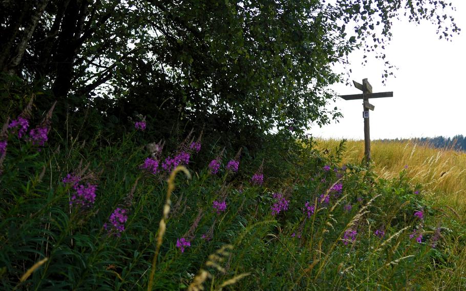
Much of the Path of the Middle Ages traverses meadows and cropland. The 5.2-mile loop starts in the historic town of Herrstein, Germany. (Jennifer H. Svan/Stars and Stripes)
It was the start of the Path of the Middle Ages, a 5.2-mile loop that begins and ends in Herrstein. We picked that route because it was voted Germany’s most beautiful hiking trail in 2010, according to the Outdooractive trail app.
With the town and the trailhead less than an hour’s drive from Kaiserslautern, it seemed like a good choice for a summer day that was about 10 degrees too cool for swimming.
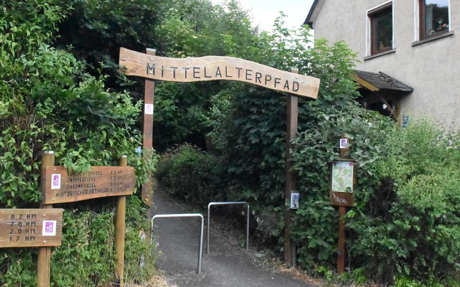
A sign marks the start of the Path of the Middle Ages, a 5.2-mile loop that starts in the historic medieval village of Herrstein, Germany. (Jennifer H. Svan/Stars and Stripes)
It turns out we picked the right day. Most of the trail traversed open fields, offering panoramic vistas of the surrounding valley but little shade. The path at times crisscrossed forest, but only for short stretches.
Overall, we kept waiting to be wowed to validate the trail’s No. 1 ranking, but nothing along the route struck us as being extraordinary. Nevertheless, we enjoyed ambling through fields of wheat and wildflowers billowing in the day’s gentle breeze.
The path at times meandered along two streams, the Hosenbach and Fischbach, and there was even a tower to climb for a bird’s-eye view of the rolling countryside.
Besides a chance to enjoy nature, the trail offered some history lessons. Signs along the way described how the area intersected a former trade route used by the Romans from about 50 B.C. through the fifth century; some of the field and forest paths were ancient Roman roads.
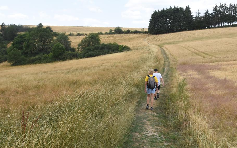
Hikers cross an open field along the Path of the Middle Ages, a 5.2-mile loop that starts in the town of Herrstein, Germany, north of the U.S. Army’s Baumholder post. (Jennifer H. Svan/Stars and Stripes)
The trail also is close to the village of Niederhosenbach, considered the birthplace of Hildegard von Bingen, a 12th-century Benedictine nun proclaimed a saint by Pope Benedict XVI in 2012.
Signs at the start of the Middle Ages trail show replicas of von Bingen’s illustrations, describing some of the 26 religious visions she experienced, including God on a mountaintop with two female figures at the foot of the mountain.
A giant oak tree along the path is the only one remaining from an old forest in which villagers hid from marauding Spanish and Croatian troops during the Thirty Years War in the 17th century.
The oak survived a fire set by the invaders that killed many villagers, according to a sign by the tree.
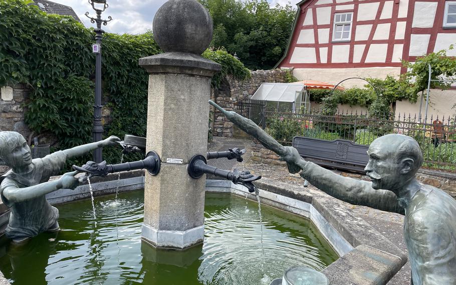
The Hankelbrunnen fountain, which portrays a boy appearing to splash a well-to-do man with water, adds to the charm of Herrstein, Germany. (Jennifer H. Svan/Stars and Stripes)
After more than three hours meandering along footpaths worn into the dirt centuries ago, we wandered some more through the streets of Herrstein. The town has a few gem shops and a local history museum. The latter is open from 2 to 5 p.m. on Sundays.
The biggest draw on the Tuesday afternoon when we visited was Cafe Zehntscheune, a restaurant that was formerly a tithe barn, where farmers brought crops to be paid to the local prince as taxes.
One of the house specialties is stuffed potato dumplings. A variety of homemade cakes, fruit cobblers and tortes are also on the menu.
Seats in the courtyard were full on the day we stopped by. The restaurant also has inside seating and takes reservations, so we plan to go back with the goal of getting a seat and some potato dumplings next time.
Herrstein
Directions: Herrstein is about 37 miles north of Kaiserslautern and 18 miles north of Baumholder. It’s an easy drive along one of two main routes for most of the way, either autobahn A62 or highway B270.
Food: Cafe Zehntscheune; Online: zehntscheune.de
Information: For details online about hiking routes around Herrstein, outdooractive.com/de; for more about Herrstein itself, herrstein.de.