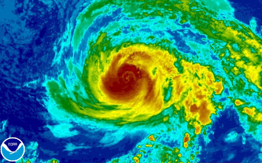
Hurricane Fernanda has been churning northwest in the general direction of Hawaii for the last week. (NOAA.gov)
11 p.m. Sunday, July 30, Taiwan time:Haitang has been downgraded to a tropical depression by the Joint Typhoon Warning Center and is making its way northwest through western Taiwan toward final landfall Monday morning over southeastern China.
At 8 p.m., Haitang was 158 miles south-southwest of Taipei, the island’s capital, heading north at 15 mph, 35-mph sustained winds and 46-mph gusts at center. A tropical storm warning remains in effect for Taiwan. In the Philippines, Tropical Cyclone Warning Signal 1 remains up for Batanes, Ilocos Norte and northwestern Cagayan.
What a wild ride it’s been for Taiwan the last couple of days – first time since 1977 that typhoon warnings were raised due to two tropical cyclones by Taiwan’s Central Weather Bureau.
Typhoon Nesat alone caused more than 110 injuries. Coastal towns were flooded, more than 10,000 – mostly in southern areas – were evacuated before the typhoon and 1,612 were still in shelters Sunday morning. Some 145 flights were canceled, 200 more delayed and power was lost to nearly a half million households, according to The Associated Press.
6 p.m. Sunday, July 30, Taiwan time: Tropical Storm Haitang has picked up more forward speed, barreling toward landfall this evening over southern Taiwan while maintaining minimal tropical-storm strength, according to the Joint Typhoon Warning Center.
Haitang made landfall at about 6 p.m. in Pintung County in southern Taiwan, 15 miles west of Kaohsiung. Haitang is due to pass 106 miles west of Taipei, the capital, eight hours later before hooking left toward southeastern China. A tropical storm warning remains in effect for Taiwan. Haitang also remains within the Philippines area of responsibility, but should exit rather rapidly as Haitang, named Huaning in the Philippines, moves north. Tropical Cyclone Warning Signal 1 remains raised for Batanes and Babuyan island groups and Ilocos Norte. 12:15 p.m. Sunday, July 30, Taiwan time: Tropical Storm Haitang has curved a bit further northeast and picked up forward speed, making possible Sunday evening passage over a larger part of Taiwan possible than previously reported.
At 8 a.m., Haitang was 368 miles south-southwest of Taipei, Taiwan’s capital and is now headed east-northeast at 14 mph, maintaining 40-mph sustained winds and 52-mph gusts at center. Haitang remains forecast to peak at 46-mph sustained and 58-mph gusts as it reaches land 9 miles east of Kaohsiung at 7 p.m.
From there, Haitang should begin curving north and northwest, passing 86 miles west of Taipei at 5 a.m. Sunday, just before making secondary landfall over southeastern China.
A tropical storm warning has been issued for Taiwan due to Haitang’s approach by Taiwan’s Central Weather Bureau.
Haitang has also entered the Philippines’ area of responsibility and is named Huaning there. Tropical Cyclone Warning Signal 1 is up for Ilocos Norte, Ilocos Sur, Apayao, Abra and northwestern Cagayan, including the Babuyan group of islands as well as the Batanes group of islands north of Luzonm according to national weather authority PAGASA.
8 a.m. Sunday, July 30, Taiwan time: Little change, other than Tropical Storm Haitang’s forecast track giving Kaohsiung almost a direct hit from projected peak 46-mph sustained winds and 58-mph gusts as it brushes Taiwan’s west coast, according to the Joint Typhoon Warning Center.
At 2 a.m., Haitang was 312 miles southeast of Hong Kong, crawling northeast at 8 mph, still with 40-mph sustained winds and 52-mph gusts at center. Haitang is forecast to edge withing 4 miles of Kaohsiung on the southwest coast at 8 p.m. Sunday and 98 miles west of Taipei, the island’s capital, eight hours later. Secondary landfall over southeastern China is forecast for early Monday morning.
11 p.m. Saturday, July 29, Taiwan time: Tropical Storm Haitang has picked up forward speed and its latest Joint Typhoon Warning updated track takes it just inside the west coast of Taiwan than just offshore, as previously forecast.
At 8 p.m., Haitang was 302 miles southeast of Hong Kong, moving northeast at 9 mph, with 40-mph sustained winds and 52-mph gusts. If Haitang remains on its current path, it’s due to pass 13 miles west of Kaohsiung at 4 p.m. Sunday and 75 miles west of Taipei, Taiwan’s capital, nine hours later. Peak winds are forecast to be 46-mph sustained and 58-mph gusts as it brushes Taiwan’s west coast.
Midnight Thursday, July 20, Hawaii time: Little change to Tropical Storm Fernanda other than the latest Central Pacific Hurricane Center forecast track edging slightly closer to Hilo on the Big Island, about 160 miles north at 8 p.m. Sunday as a tropical depression, 30-mph sustained winds and 40-mph gusts.
AccuWeather.com continues to caution swimmers and boaters about high surf and rip currents projected along east- and north-facing beaches over the weekend.
6:30 a.m. Thursday, July 20: Hawaii time: Fernanda has been downgraded to a tropical storm by the Central Pacific Hurricane Center, its core wind speeds having dropped to 63-mph sustained and 81-mph gusts at center.
The latest track takes Fernanda just north of the island group as a tropical depression, with 30-mph sustained winds and 40-mph gusts -- about 200 miles north of Hilo on the Big Island at 2 a.m. Monday, 120 miles north of Camp H.M. Smith on Oahu 12 hours later and 118 miles north of Barbers Point on Kauai at 3 p.m.
No danger of damaging winds exceeding 58 mph lashing the island at this point. But high surf and rip currents are forecast for north- and east-facing beaches on all islands through the weekend into midweek, Accuweather.com reports.
8:30 p.m. Wednesday, July 19, Hawaii time: Fernanda is barely hanging onto Category 1 hurricane status, and is forecast to gradually diminish as it heads generally northwest on a path taking it north of the Hawaiian Islands, according to the Central Pacific Hurricane Center.
At 3 p.m., Fernanda was 1200 miles east of Hilo on the Big Island, headed west-northwest at 12 mph — but still packing 81-mph sustained winds and 98-mph gusts at center.
Fernanda is set to move over cooler waters and weaken into a tropical storm as it reaches Hawaiian waters. Once 225 miles north of Hilo, which is predicted to be around 8 a.m. Monday, it will likely be a tropical depression with 30-mph sustained winds and 40-mph gusts.
AccuWeather.com cautions that swimmers might have to forego the water for a few days, and small craft should exercise caution due to choppy seas later this week into the weekend — particularly on east and north-facing beaches.
Heavy showers and thunderstorms are also expected, and could be greater if Fernanda passes closer to the islands than currently forecast.
6:45 p.m. Tuesday, July 18, Hawaii time: Hurricane Fernanda, which has been churning northwest in the general direction of Hawaii since last week, is forecast to track northeast of the Aloha State early next week, according to Central Pacific Hurricane Center’s latest forecast track.
At 3 p.m. Hawaii time, Fernanda was still about 1,400 miles east of Hilo on the Big Island, moving northwest at 9 mph and packing 98-mph sustained winds and 121-mph gusts at center — a Category 2 hurricane.
CPHC projects Fernanda to gradually diminish as it rolls on a path taking it just northeast of the Big Island, though at that distance, the track could change. Fernanda is forecast to be 290 miles east-northeast of Hilo at 2 p.m. Sunday as a strong tropical depression, 35-mph sustained winds and 46-mph gusts.
It’s still too early to tell what kind of effect Fernanda might have on Hawaii's bases. Hawaii News Now reports that forecasters suggest now is the time to prepare. The National Weather Service in Honolulu stated a long-period swell from Fernanda could build for east-facing shores.
Fernanda is one of three active tropical cyclones in the eastern Pacific, joining Tropical Storm Greg, heading west about 260 miles south of Socorro Island off of Mexico’s west coast; and unnamed Tropical Depression 08E, a small storm southwest of Greg.
8 a.m. Sunday, July 30, Taiwan time: Little change, other than Tropical Storm Haitang’s forecast track giving Kaohsiung almost a direct hit from projected peak 46-mph sustained winds and 58-mph gusts as it brushes Taiwan’s west coast, according to the Joint Typhoon Warning Center.
8 a.m. Sunday, July 30, Taiwan time: Little change, other than Tropical Storm Haitang’s forecast track giving Kaohsiung almost a direct hit from projected peak 46-mph sustained winds and 58-mph gusts as it brushes Taiwan’s west coast, according to the Joint Typhoon Warning Center.
