Storm Tracker
PACIFIC STORM TRACKERTyphoon 14W (Faxai), # 33 FINAL
Stars and Stripes
September 6, 2019
(U.S. Navy)
9 a.m. Monday, Sept. 9, Japan time: U.S. bases in the Kanto Plain are in the process of directing all clear now that recovery teams have assessed their bases and the danger from Typhoon Faxai has passed. It is now moving northeast and out of the Tokyo area into the cooler waters of the northern Pacific Ocean.
Yokota Air Base set all clear at 6:47 a.m. and Camp Zama followed at 7:15 a.m. Naval Air Facility Atsugi entered all clear at 8:41 a.m. Yokosuka Naval Base, the base closest to Faxai and dreadfully exposed along the shoreline of Tokyo Bay went all clear at 11:15 a.m., remained in Tropical Cyclone Condition of Readiness 1-R as of 9 a.m.
Typhoon buffs are going to the record books to check. But count ‘em: Two typhoons to hit two northwest Pacific country capitals on back-to-back days. Faxai is believed to be the strongest to hit Tokyo in 80 years; it’s at least the worst in 26 years to hit Japan's main island of Honshu since Typhoon Yancy in summer 1993.
And Lingling, which battered the Korean peninsula on Saturday and left debris and shut off power at Camp Humphreys and Yongsan Garrison, is believed to be the first storm of Category 1-equivalent strength or greater to strike North Korea since records began being kept, in 1958.
What a weekend this has been. This will conclude Storm Tracker’s coverage of Faxai.
6:15 a.m. Monday, Sept. 9, Japan time: U.S. bases on the Kanto Plain have entered Tropical Cyclone Condition of Readiness 1-R (recovery). Recovery teams are in process of assessing damage to the base. All personnel are asked to stay inside until the all clear is sounded. Please refer to chains of command, base access TV channels and official Facebook pages for possible delays.
6 a.m. Monday, Sept. 9, Japan time: Folks in the Kanto Plain awoke Monday morning to the sound of howling wind and the sight of driving, sideways rain as Typhoon Faxai pushed through the Tokyo area, putting all U.S. bases in the Kanto Plain into Tropical Cyclone Condition of Readiness 1-E.
Faxai made landfall just before 5 a.m. in Chiba, just east of Tokyo, according to the Japan Meteorological Agency, pacing 104 mph sustained winds and 127 mph gusts at center. It is moving rapidly northeast and is expected to be out of the Kanto Plain area by this afternoon.
Destructive winds of 58 mph or greater began occurring on U.S. bases between 2 and 4 a.m. and they might last awhile. The closest point of approach to U.S. bases has come and gone, but the back side of Faxai continues to lash the area. Gates remain closed and all services are suspended until after the all clear is sounded.
When might the all clear be sounded? That all depends on how quickly Faxai moves out of the area and how quickly things can be made safe after TCCOR 1-R is issued. There is no set period for how long TCCOR 1-R will last. Safety officials, staff civil and first responders must get a chance to survey damage. Stay indoors until all that is done.
As for when duty hours resume and schools reopen, check with your base’s command access TV channel and official Facebook pages for information.
Midnight Sunday, Sept. 8, Japan time: It’s starting, folks. Typhoon Faxai continues to bear down on the Tokyo area and the U.S. bases in the Kanto Plain.
Hours ago, they all entered Tropical Cyclone Condition of Readiness 1; pay close attention to when/if your base upgrades to TCCOR 1-C (sustained winds of 40 mph or greater) and/or TCCOR 1-E (sustained winds of 58 mph or greater).
Joint Typhoon Warning Center projects Faxai to be packing 104 mph sustained winds and 127 mph gusts as it passes: • 60 miles east of Camp Fuji at 1 a.m. • 41 miles east-southeast of Naval Air Facility Atsugi and Camp Zama at 3 a.m. • 49 miles east-southeast of Yokota Air Base at 3 a.m. • 22 miles east-southeast of Yokosuka Naval Base at 3 a.m.
Faxai, naturally, has had its effects off base as well. More than 200 flights into and out of Tokyo-area airports and more than 120 high-speed bullet trains serving the Kanto Plain were canceled, according to Japan’s semi-official news agency NHK World.
A tip for newcomers to Japan: Once winds die down and TCCOR 1-R (recovery) is issued, please don’t take that as a sign that everything’s cool and the all clear is imminent. Stay indoors and out of the way of first responders, staff civil and recovery teams who are busy setting up safe zones around fallen trees, power lines and flooding. Wait until the all clear is directed.
5:30 p.m. Sunday, Sept. 8, Japan time: Yokosuka Naval Base appears to be in the crosshairs for a direct hit just past midnight Sunday from Typhoon Faxai, forecast to arc through the Tokyo area overnight in to early Monday. U.S. bases in the Kanto Plain remain in Tropical Cyclone Condition of Readiness 1; expect upgrades to TCCOR 1-C as sustained winds reach 40 mph and TCCOR 1-E as they reach 58 mph or greater. At 3 p.m., Faxai was bearing down on Tokyo packing 127-mph sustained winds and 155-mph gusts. Joint Typhoon Warning Center projects Faxai to pass directly over Yokosuka at 1 a.m., and 23 miles southeast of Naval Air Facility Atsugi and Camp Zama and 28 miles southeast of Yokota Air Base about an hour later, packing 104-mph sustained winds and 127-mph gusts at center. Gonna be a wild night, folks.4:15 p.m. Sunday, Sept. 8, Japan time: Here is a rundown on what to expect in the way of sheltering in place, closures and delays in reporting for duty and school on Monday, via Yokota Air Base’s, Yokosuka Naval Base’s, Naval Air Facility Atsugi’s and Camp Zama’s official Facebook pages. All U.S. bases in the Kanto Plain are in Tropical Cyclone Condition of Readiness 1.Schools – Expect two-hour delays to the start of school in the Yokota, Yokosuka and Zama/Atsugi communities. Buses will pick up students/pupils two hours after normal scheduled times. This also applies to child development centers. Delays in reporting for duty – At Zama, non-essential personnel are authorized a delay until 9:30 a.m. Monday. At Yokota, non-essential personnel have a three-hour reporting delay. Other bases, check with your commanders’ access TV channel and official Facebook pages. Shelter in place – Yokota has ordered non-essential personnel into quarters by 8 p.m., with the gates expected to close between 10 p.m. and midnight. All must be indoors when/if TCCOR 1-E is issued, at which time destructive winds of 58 mph or greater are occurring and all outdoor activity is prohibited, per USFJ Instruction. Yokosuka’s Womble Gate will close at 8 p.m. Services – Yokota: commissary, exchange and force support facilities will close at 5 p.m., when the last shuttle leaving the Yokota Community Center is scheduled to depart. All airport shuttle buses will go to the airport as scheduled. Haneda and the first Narita bus will return. The second and third buses from Narita to Yokota are canceled. On Monday, the exchange, commissary and food court will open at normal time, Rickenbacker’s will open at 9 a.m. and the post office, Par 3 and gym will open at 10 a.m. All shoppettes will open two hours after the all clear is given. Monday’s membership breakfast is canceled. Atsugi: All MWR facilities will close at 8 p.m. and open Monday at 9. Commissary will close at 6 p.m., mini-mart closes at 8 p.m. and opens at 9 a.m., food court closes at 8 p.m. and opens at 10:30 a.m., McDonald’s closes at 9 p.m. and opens at 8 a.m. The galley plans to operate on a normal schedule. The Pass and ID office closed at 4 p.m. Zama: Shoppettes will open at 10 a.m. Monday, food courts at noon and the main and home stores will open at 10 a.m. Yokosuka: Non-essential services ceased operations at 2 p.m. Exchange and commissary closed at 2 p.m. and its mini mart and gasoline stand at 4 p.m. The galley is open for evening meals. The base shuttles will halt after the 7 p.m. rotation. MWR facilities operating under normal hours Sunday and will open at 10 a.m. Monday. USO closed when TCCOR 1 was issued; it will reopen at 10 a.m. Monday. All of the above linked pages will update every so often with important information; check back from time to time. If at any point you're not sure what to do or where to go, always ... opt and err on the side of caution. You only get one chance. Stay indoors when the heavy stuff hits, and telephone base security if you have questions. Get your safe on, Kanto!2:30 p.m. Sunday, Sept. 8, Japan time: U.S. bases on the Kanto Plain have entered Tropical Cyclone Condition of Readiness 1 in advance of Typhoon Faxai. Destructive winds of 58 mph or greater are anticipated within 12 hours. Check your base’s official Facebook page or command access TV channel for information on sheltering in place, closures and delays in reporting for duty and school on Monday.
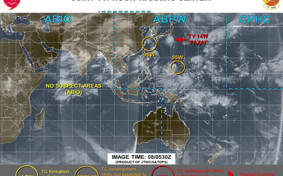
11:15 a.m. Sunday, Sept. 8, Japan time: Typhoon Faxai has peaked at 132-mph sustained winds and 161-mph gusts at 9 a.m. Sunday while still nearly 300 miles south of Yokosuka Naval Base, according to the Joint Typhoon Warning Center.
Faxai is forecast to weaken slightly, as it curves north and makes its way through the Tokyo-Chiba area overnight Sunday into Monday.
U.S. bases in the Kanto Plain remain in Tropical Cyclone Condition of Readiness 2 for the moment. Expect upgrade to TCCOR 1 in the afternoon, with possible higher upgrades to TCCOR 1-C if sustained winds of 40 mph or higher occur and 1-E if sustained winds meet or exceed 58 mph.
JTWC projects closest points of approach to be 13 miles southeast of Yokosuka at 2 a.m. Monday and 33 miles southeast of Naval Air Facility Atsugi and Camp Zama and 39 miles southeast of Yokota Air Base an hour later.
With Yokosuka the U.S. base forecast to be closest to Faxai, here’s the weather breakdown for Fleet Activities Yokosuka through Tuesday morning:
• Gale warning in effect from midnight Monday to 3 a.m. Wednesday. • Thunderstorm watch from 7 p.m. Sunday to 7 a.m. Monday. • Small-craft advisory in effect from 7 p.m. Sunday to 10 a.m. Monday. • Northeasterly winds picking up 18- to 23-mph sustained and 35-mph gusts mid-evening Sunday. • 29- to 35-mph sustained winds and 45-mph gusts late evening. • 40- to 52-mph sustained winds and 75-mph gusts overnight and early Monday morning. • 29- to 40-mph sustained winds and 52-mph gusts pre-dawn Monday. • 18- to 23-mph sustained winds and 35-mph gusts early Monday morning. Diminishing from there.
Expect non-essential services at bases to secure in the afternoon or early evening. Yokota’s commissary, exchange and force support facilities will close at 5 p.m., the enlisted club will close after brunch and the base plans to close gates for TCCOR 1-E, which its official Facebook page says is expected between 10 p.m. and midnight. Expect a three-hour delay in reporting for duty. Most services should open at normal hours. Other bases may follow suit.
According to its official Facebook page, Yokosuka’s exchange and commissary are to close at 2 p.m. and its mini mart and gasoline stand at 4 p.m. The galley is open for evening meals. The base shuttles will halt after the 7 p.m. rotation.
A two-hour delay to the start of school Monday in Yokosuka’s and Yokota’s school complex is anticipated at this point. School complexes at other bases may follow.
Stay tuned to Storm Tracker, your base command’s access TV channels and official Facebook pages for updates.
6 a.m. Sunday, Sept. 8, Japan time: Typhoon Faxai remains on course to curve just southeast of U.S. bases in the Tokyo area overnight Sunday into Monday, according to the Joint Typhoon Warning Center. Given forecast points of approach, expect peak winds just past midnight into the wee hours Monday. U.S. bases in the Kanto Plain remain in Tropical Cyclone Condition of Readiness 2. JTWC projects Faxai to pass 21 miles southeast of Yokosuka Naval Base at 2 a.m. Monday and 49 miles southeast of Yokota Air Base an hour later. Forecast for Yokosuka, the base forecast to be closest to Faxai, calls for: — East to northeasterly winds between 18 to 23 mph sustained and gusts up to 35 at mid-evening. — Northeasterly 29- to 35-mph sustained winds gusting to 52 late evening. — Peak 45- to 52-mph sustained winds and 69-mph gusts overnight into Monday. — 29- to 40-mph sustained winds and 52-mph gusts pre-dawn Monday. Diminishing from there as Faxai moves out of the area. Other bases further inland could see similar winds and heavy showers, although not quite as intense. But that all could change depending on Faxai’s forecast track and wind speed. Expect an upgrade to TCCOR 1 for all U.S. bases in Kanto at any point Sunday morning, and if winds exceed 40-mph sustained, a possible upgrade to TCCOR 1-C or higher could follow Sunday evening or Monday morning. Faxai is now forecast peak at 138-mph sustained winds and 167-mph gusts at mid-afternoon Sunday, then weaken markedly, down to 110-mph sustained and 132-mph gusts as it makes landfall over the Chiba Peninsula around midnight. It should continue to weaken as it briefly passes over land, then back out over cooler waters off northeastern Honshu. The only silver lining, and not much of one, to this is, Faxai’s western quadrants, typically the weaker of the four, would be facing the Tokyo area should Faxai remain on its current heading.
11:30 p.m. Saturday, Sept. 7, Japan time: Stronger, ever stronger, becomes Typhoon Faxai, now forecast to peak as a Category 4-equivalent typhoon at midmorning Sunday, then to subside gradually as it makes its approach to Tokyo, forecast for Sunday evening.
At 9 p.m., Faxai was 459 miles south-southeast of Yokosuka Naval Base, was tracking northwest at 18 mph, and had strengthened to 121 mph sustained winds and 150 mph gusts.
U.S. bases in the Kanto Plain remain in Tropical Cyclone Condition of Readiness 2; expect that to be upgraded to TCCOR 1 about daybreak Sunday or soon afterward.
If Faxai stays on its present heading, Joint Typhoon Warning Center projects Faxai to peak at 132 mph sustained winds and 161 mph gusts as it curves north toward Tokyo. As it approaches and passes closer to land and over cooler waters, Faxai is forecast to diminish slightly, to 115 mph sustained winds and 144 mph gusts at midevening Sunday, and just south of the Kanto Plain.
Faxai is forecast to make a near-direct hit on Narita International Airport and to pass 20 miles southeast of Yokosuka and 47 miles southeast of Yokota Air Base between midnight Sunday and 3 a.m. Monday before curving back out over the Pacific Ocean and churning rapidly northeast.
7:30 p.m. Saturday, Sept. 7, Japan time: All U.S. bases in the Kanto Plain entered Tropical Cyclone Condition of Readiness 2 at 6 p.m. Saturday. Destructive winds of 58 mph or greater are anticipated within 24 hours. Expect upgrade to TCCOR 1 early Sunday morning, pending Typhoon Faxai’s intensity and forecast track.
6 p.m. Saturday, Sept. 7, Japan time: Fleet Activities Yokosuka has set Tropical Cyclone Condition of Readiness 2. Destructive winds of 58 mph or greater are anticipated within 24 hours. Expect other bases in the Kanto Plain to follow suit, and depending on Typhoon Faxai’s forecast wind speeds and track locations, TCCOR 1 could be set sometime Sunday morning.
Faxai is moving faster as it approaches the Kanto Plain. At 3 p.m., Faxai was 551 miles south-southeast of Yokosuka Naval Base, moving northwest at 22 mph and had strengthened to 98-mph sustained winds and 121-mph gusts.
If Faxai stays on its present heading, Joint Typhoon Warning Center projects Faxai to peak at 121-mph sustained winds and 150-mph gusts at mid-afternoon Sunday as it curves north, then northeast.
Faxai is forecast to make a direct hit on Narita International Airport, pass 21 miles southeast of Yokosuka and 48 miles southeast of Yokota Air Base between 11 p.m. and midnight Sunday, weakening slightly to 104-mph sustained winds and 127-mph gusts as it moves back out over water early Monday morning.
The only school impact thus far is a two-hour delay for the Yokosuka school complex Monday morning, according to DODEA Pacific East. A call on the schools at other bases should be made later.
1 p.m. Saturday, Sept. 7, Japan time: Stronger, ever stronger, Typhoon Faxai is growing, and is now forecast to reach and then curve northeast of Tokyo overnight Sunday into Monday as a Category 3-equivalent typhoon, according to the Joint Typhoon Warning Center.
At 9 a.m., Faxai was 668 miles south-southeast of Yokosuka Naval Base, tracking northwest at 20 mph and had strengthened to 86-mph sustained winds and 104-mph gusts. It’s forecast to peak at 121-mph sustained winds and 150-mph gusts at mid-evening Sunday – just as it’s approaching the Chiba Peninsula, where JTWC projects it to make landfall.
If Faxai remains on its present heading, it’s forecast to pass almost directly over Narita International Airport, and 25 miles southeast of Yokosuka and 51 miles southeast of Yokota Air Base between midnight Sunday and 3 a.m. Monday.
U.S. bases in the Kanto Plain remain in Tropical Cyclone Condition of Readiness 3. Gauging the current closest points of approach to those bases, expect an upgrade to TCCOR 2 sometime Saturday evening and TCCOR 1 at mid-morning Sunday. All of that could change pending Faxai’s forecast strength and track speed and direction.
The time to prepare is now, before TCCOR changes could force facilities to secure. Fill the automobile and outdoor grill gasoline tanks, fill containers with water in case the base services go out, visit the ATM to get about a three-day supply of cash, make that last visit to the commissary to get non-perishable food, bottled water, diapers and wipes for the young’uns and food for the furry friends.
6:10 a.m. Saturday, Sept. 7, Japan time: Faxai has been upgraded to a Category 1-equivalent typhoon by the Joint Typhoon Warning Center, and remains forecast to move northwest at a slightly quicker pace, then curve just east of Tokyo Sunday evening as a Category 2-equivalent storm.
At 3 a.m., Faxai was 760 miles southeast of Yokosuka Naval Base, tracking northwest at 20 mph with 75-mph sustained winds and 92-mph gusts. U.S. bases in the Kanto Plain remain in Tropical Cyclone Condition of Readiness 3; expect that to be upgraded by mid-morning Saturday.
JTWC projects Faxai to peak at 110-mph sustained winds and 127-mph gusts as it arcs north, then northeast, skimming the east coast of the Chiba Peninsula and passing 26 miles southeast of Yokosuka and 53 miles southeast of Yokota Air Base between 1 and 2 a.m. Monday.
11:30 p.m. Friday, Sept. 6, Japan time: Forecast intensity for Tropical Storm Faxai has increased slightly. Joint Typhoon Warning Center now projects Faxai to be packing gusts as high as 121 mph as it curves north toward the Tokyo area at mid-evening Sunday.
At 9 p.m., Faxai was 898 miles southeast of Yokosuka Naval Base, tracking west-northwest at 23 mph and had strengthened to 63-mph sustained winds and 81-mph gusts. U.S. bases in the Kanto Plain remain in Tropical Cyclone Condition of Readiness 3; that should likely be upgraded to TCCOR 2 after daybreak Saturday morning.
JTWC projects Faxai to keep tracking northwest for the next 30 hours, curving north and peaking at 98-mph sustained winds and 121-mph gusts as it slams ashore at about 9 p.m. over the Chiba Peninsula, passing just 16 miles southeast of Yokosuka about two hours later.
Yokosuka’s extended weather forecast calls for winds to pick up Sunday, east-northeast between 20 and 25 mph sustained and 38-mph gusts in the early evening; shifting northeast between 35 and 40 mph sustained and 52-mph gusts late Sunday evening; shifting again, north-northeast between 46 and 58 mph sustained and 75-mph gusts overnight; finally turning northwest and down to 35 to 40-mph sustained and 52-mph gusts after dawn Monday.
Faxai is then forecast to turn northeast and head back into the Pacific Ocean, missing Misawa Air Base by about 200 miles at mid-afternoon Monday.
6:30 p.m. Friday, Sept. 6, Japan time: Tropical Storm Faxai continues to struggle to intensify, but that might not be a problem in the next day or so; Faxai is forecast to strengthen, packing gusts up to 115 mph, as it places Tokyo and U.S. bases in the Kanto Plain firmly in the crosshairs.
At 3 p.m. Faxai was 1,024 miles southeast of Yokosuka Naval Base, headed northwest at 24 mph, holding steady at 52-mph sustained winds and 63-mph gusts. U.S. bases in the Kanto Plain remain in Tropical Cyclone Condition of Readiness 3; expect an upgrade to TCCOR 2 early Saturday morning.
If Faxai stays on its present course, it’s forecast to peak at 92-mph sustained winds and 115-mph gusts after continuing to track northwest as it approaches the Tokyo area. It’s forecast to make landfall over the Chiba Peninsula Sunday evening, passing just 13 miles southeast of Yokosuka and 39 miles southeast of Yokota Air Base between 11 p.m. and midnight Sunday.
Joint Typhoon Warning Center projects Faxai to remain a typhoon even after passing 170 miles southeast of Misawa Air Base, which appears as if it might be spared Faxai’s full fury.
12:40 p.m. Friday, Sept. 6, Japan time: Tropical Storm Faxai has strengthened slightly and its new forecast track takes it a tad further east of U.S. bases in the Kanto Plain than previously reported. Still, Monday could be a gusty, showery one, depending on where precisely Faxai heads.
At 9 a.m., Faxai was 1,150 miles southeast of Yokosuka Naval Base, had intensified to 52-mph sustained winds and 63-mph gusts at center and had picked up forward speed, chugging northwest at almost 20 mph.
U.S. bases in the Kanto Plain remain in Tropical Cyclone Condition of Readiness 3; expect an upgrade to TCCOR 2 at some point Saturday morning or mid-day.
If Faxai continues on its present course, it’s forecast to reach Category 1-equivalent typhoon strength, 75-mph sustained winds and 92-mph gusts, at about mid-morning Saturday, then peak just below Category 2-equivalent intensity, 98-mph sustained winds and 121-mph gusts, as it begins a broad curve northeast toward the Tokyo area.
Faxai is forecast to make landfall over the Chiba peninsula east of Tokyo just before daybreak on Monday, still packing 86-mph sustained winds and 104-mph gusts as it barrels ashore, about 20 miles east-southeast of Yokosuka at around 1 a.m. Monday.
It appears as if Misawa Air Base could be spared Faxai’s full fury. Faxai is forecast to turn back out to sea over the northwest Pacific Ocean, passing about 160 miles southeast of Misawa at around 5 p.m. Monday.
8 a.m. Friday, Sept. 6, Japan time: U.S. bases in the Kanto Plain have entered Tropical Cyclone Condition of Readiness 3 in advance of Tropical Storm Faxai. Destructive winds of 58 mph or greater are possible within 48 hours.
3:40 a.m. Friday, Sept. 6, Japan time: Chances remain good that U.S. bases in the Kanto Plain might get direct or near-direct hits from Tropical Storm Faxai overnight Sunday into Monday. Joint Typhoon Warning Center projects Faxai to peak at 92-mph sustained winds and 115-mph gusts as it approaches the Izu Peninsula about 9 p.m. Sunday just before making landfall. Faxai is forecast to pass 15 miles southeast of Camp Fuji and almost directly over Yokota Air Base, Camp Zama and Naval Air Facility Atsugi between 2 and 4 a.m. Monday. U.S. bases in the Kanto Plain remain in Tropical Cyclone Condition of Readiness 4. Expect that to be upgraded sometime Friday morning, and again Saturday as Faxai continues approaching.6 p.m. Thursday, Sept. 5, Japan time: Finally, Tropical Storm 14W acquired a name: Faxai, contributed by Laos which stands for a Laotian woman's name. Faxai remains on course to track northwest toward the Tokyo area, and is now forecast to make near-direct hits on U.S. bases in the Kanto Plain, according to the Joint Typhoon Warning Center. U.S. bases in the Kanto Plain remain in Tropical Cyclone Condition of Readiness 4; expect an upgrade to TCCOR 3 sometime Friday morning. At 3 p.m., Faxai was 1,438 miles southeast of Yokosuka Naval Base, tracking northwest at 12 mph and continuing to hold steady at 40-mph sustained winds and 52-mph gusts. JTWC projects Faxai to keep intensifying as it moves northwest, peaking at 104-mph sustained winds and 127-mph gusts, Category 2-equivalent intensity, as it approaches and turns northeast toward the Izu Peninsula. Faxai is forecast to weaken rapidly, but maintain strong tropical-storm strength as it passes almost directly over Yokota Air Base at about 3 a.m. Monday, then push quickly northeast, passing 138 miles southeast of Misawa Air Base at 4 p.m. Monday and into the northwest Pacific Ocean.12:30 p.m. Thursday, Sept. 5, Japan time: Tropical Storm 14W continues to hold steady at 40-mph sustained winds and 52-mph gusts for a second straight day. But according to the Joint Typhoon Warning Center, that trend is about to end as TS 14W is forecast to intensify as it moves northwest and peak at Category 3-equivalent intensity as it approaches Japan’s main island of Honshu on Sunday. At 9 a.m., TS 14W was 1,512 miles southeast of Yokosuka Naval Base, headed northwest at 7 mph. It’s forecast to peak at 115-mph sustained winds and 144-mph gusts after tracking northwest for the next couple of days and as it comes closer to Honshu. U.S. bases in the Kanto Plain remain in Tropical Cyclone Condition of Readiness 4; expect that to be upgraded early to mid-morning on Friday as TS 14W intensifies. If it remains on its present course, TS 14W is forecast to pass 20 miles west of Camp Fuji and 34 miles west of Yokota Air Base between 3 and 5 a.m. Monday, still packing 81-mph sustained winds and 98-mph gusts at center.8 a.m. Thursday, Sept. 5, Japan time: U.S. bases in the Kanto Plain have entered Tropical Cyclone Condition of Readiness 4. Destructive winds of 58 mph or greater are possible within 72 hours.
6:30 a.m. Thursday, Sept. 5, Japan time: Naval Air Facility Atsugi has set Tropical Cyclone Condition of Readiness 5 in advance of Tropical Storm 14W’s forecast arrival overnight Sunday into Monday. Expect other U.S. bases in the Kanto Plain to follow, as the Joint Typhoon Warning Center’s forecast track takes TS 14W closer to them than previously reported.
At 3 a.m., 14W was 1,541 miles southeast of Yokosuka Naval Base and 644 miles west of Wake Island, heading west-northwest at 8 mph and still holding steady with 40 mph sustained winds and 52 mph gusts.
If 14W stays on its present course, it’s due to start intensifying, to pick up track speed and to head northwest toward Japan’s main island of Honshu, peaking with 110 mph sustained winds and 132 mph gusts early Sunday morning as it approaches land.
JTWC projects 14W to pass just 16 miles west of Camp Fuji and 37 miles west of Yokota Air Base between 2 and 4 a.m. Monday, still packing 81 mph sustained winds and 98 mph gusts at its center. JTWC also projects 14W’s 50 knot (58 mph) wind band to extend 58 miles northeast and 69 miles southeast of center, possibly putting U.S. bases in the Kanto Plain well within reach. Stay tuned and follow updated TCCORs closely.
11:30 p.m. Wednesday, Sept. 4, Japan time:Tropical Storm 14W’s forecast track has lurched directly west again, but the Joint Typhoon Warning Center still projects it to reach Category 2-equivalent intensity and to track inland over central Honshu overnight Sunday into Monday, and closer to U.S. bases in the Kanto Plain.
At 9 p.m., TS 14W was 1,601 miles southeast of Yokosuka Naval Base, tracking west at 10 mph and still holding steady at 40 mph sustained winds and 52 mph gusts. No tropical cyclone conditions of readiness have been directed at any Kanto bases to this point.
If TS 14W continues on its present heading, it’s forecast to resume a northwesterly track, peaking at 98 mph sustained winds and 121 mph gusts at 9 p.m. Sunday as it curves north toward Honshu.
It’s due to make landfall near Shizuoka overnight Sunday into Monday, to pass 34 miles west of Camp Fuji and 49 miles west of Yokota Air Base between 6 and 8 a.m. Monday, then to curve northeast and to get within 76 miles south of Misawa Air Base at 9 p.m. Tuesday, still packing 63 mph sustained winds and 81 mph gusts at center.
6:40 p.m. Wednesday, Sept. 4, Japan time: Little change at this point regarding Tropical Storm 14W. Joint Typhoon Warning Center keeps it on course to head northwest toward Japan’s main island of Honshu. But questions remain over its forward speed and where and when it curves over Honshu, and how close to U.S. bases in the Kanto Plain.
At 3 p.m., TS 14W was 1,643 miles southeast of Yokosuka Naval Base, headed west-northwest at 12 mph and has held steady for the last day at 40 mph sustained winds and 52 mph gusts.
JTWC projects TS 14W’s intensity to spike after the next day or so, peaking at Category 2-equivalent intensity, 104 mph sustained winds and 127-mph gusts as it approaches central Honshu.
At this point, TS 14W is forecast to pass 33 miles west of Camp Fuji and 51 miles west of Yokota Air Base between midnight Sunday and 2 a.m. Monday. JTWC then projects TS 14W to weaken as it traverses northeast Honshu in Misawa Air Base’s general direction coming with 123 miles of the base at the end of the current JTWC five-day forecast.
12:30 p.m. Wednesday, Sept. 4, Japan time: There remains little doubt, Tropical Storm 14W is forecast to slice through central Honshu come Sunday evening into Monday. The question remains, how close might it come to U.S. bases in the Kanto Plain.
At 9 a.m., TS 14W was 1,725 miles southeast of Yokosuka Naval Base, moving west-northwest at 7 mph and continued holding steady at 40-mph sustained winds and 52-mph gusts. No accelerated tropical cyclone conditions of readiness have been issued at this point.
If TS 14W stays on present course, it’s forecast to keep moving northwest in the general direction of Honshu, Japan’s main island, peaking at 104-mph sustained winds and 127-mph gusts, Category 2-equivalent strength, as it approaches.
Model track guidance and forecast ensembles each agree on a curve scenario with some outliers. Joint Typhoon Warning Center currently projects TS 14W to pass 41 miles west-northwest of Camp Fuji and 63 miles west-northwest of Naval Air Facility Atsugi between 10 and 11 p.m. Sunday at peak forecast intensity.
Will Misawa Air Base in northeastern Japan feel some effect? TS 14 W is forecast to be 160 miles southwest of Misawa at mid-morning Monday at the end of the JTWC’s current forecast period. Stay tuned. Misawa has been in a typhoon emergency condition before, three years ago.
6:15 a.m. Wednesday, Sept. 4, Japan time: It looks more and more like Tropical Storm 14W is forecast to peak at Category 2-equivalent intensity and to curve on Sunday toward central Japan, possibly threatening U.S. bases in the Kanto Plain.
At 3 a.m., 14W was 1,783 miles southeast of Yokosuka Naval Base, headed west-northwest at 6 mph, still packing 40 mph sustained winds and 52 mph gusts.
If 14W stays on its current heading, it is forecast to keep heading northwest, then, as the weekend comes, to curve north toward central Honshu, peaking at 104 mph sustained winds and 127 mph gusts, then to make landfall Sunday evening and to pass 48 miles west of Camp Fuji and 75 miles west of Naval Air Facility Atsugi. Its Joint Typhoon Warning Center-forecast 50-knot wind bands could be close enough to cause damaging winds.
Stay tuned to Storm Tracker, your official base access TV channel and official Facebook pages for more on accelerated Tropical Cyclone Conditions of Readiness and local forecasts.
11:30 p.m. Tuesday, Sept. 3, Japan time:Tropical Storm 14W has weakened slightly, but remains forecast to track west-northwest in the coming days, then curve north toward central Honshu by late Sunday evening.
At 9 p.m., TS 14W was 1,801 miles southeast of Yokosuka Naval Base, headed west at 10 mph and had weakened to 40-mph sustained winds and 52-mph gusts.
If TS 14W remains on its current heading, it’s due to track west-northwest, peaking at 104-mph sustained winds and 127-mph gusts as it turns north in the general direction of Hamamatsu in central Honshu at 9 p.m. Sunday. At that point, 14W is forecast to be 181 miles southwest of Camp Fuji.
It’ll take another day or so for models to come into better agreement on where and when TS 14W might curve. Stay tuned.
6:30 p.m. Tuesday, Sept. 3, Japan time: No question, Tropical Storm 14W is headed in the general direction of Japan. The question remains, where specifically might it strike?
At 3 p.m., TS 14W was 1,841 miles southeast of Yokosuka Naval Base, moving west at 14 mph and holding steady at 46-mph sustained winds and 58-mph gusts.
If 14W stays on its present heading, it’s due to keep tracking west-northwest, passing 171 miles northeast of Iwo Jima at 7 a.m. Saturday, steadily strengthening, peaking at 104-mph sustained winds and 127-mph gusts at mid-afternoon Sunday, the end of the Joint Typhoon Warning Center’s current forecast period.
At that juncture, 14W is forecast to be 237 miles southwest of Yokosuka Naval Base and 214 miles southwest of Camp Fuji.
But which direction will it head? JTWC reports a model solution spread of 173 miles five days out. That’s nearly as far as it is from Nagoya to Tokyo.
Model track guidance remains greatly divided, though it and the GFS and CMC ensemble best tracks agree on a curve northeast. The question being the timing of the curve and how strong 14W remains. Stay tuned. This could get interesting.
6:15 a.m. Tuesday, Sept. 3, Japan time: 14W was upgraded overnight to a tropical storm by the Joint Typhoon Warning Center. Where 14W will ultimately end up heading remains a guessing game at this point. At 3 a.m., 14W was 238 miles southwest of Wake Island and 1,955 miles southeast of Yokosuka Naval Base, Japan, headed west-northwest at 10 mph with 40-mph sustained winds and 52-mph gusts. If 14W remains on its present heading, it's due to keep tracking west-northwest for the next several days, peaking at Category 2-equivalent intensity, 104-mph sustained winds and 127-mph gusts, at 3 a.m. Sunday when it's forecast to be 292 miles south of Yokosuka.Model track guidance and the GFS and CMC ensemble best tracks each agree on a sharp curve northeast as it approaches the Kanto Plain. The question being, how soon will the curve be? JTWC reports there's a spread among solutions of 130 miles three days out and 477 miles five days out, so 14W's final destination remains something of a mystery. Stay tuned. Next update Tuesday evening.
5:45 p.m. Monday, Sept. 2, Japan time: Forecast peak strength for Tropical Depression 14W has increased markedly according to the Joint Typhoon Warning Center; it's projected to peak at Category 2-equivalent intensity at the end of the current five-day forecast. At 3 p.m., TD 14W was 2,576 miles east of Kadena Air Base, Okinawa, and 207 miles south of Wake Island, moving west-northwest at 16 mph and holding steady at 35-mph sustained winds and 46-mph gusts. If TD 14W stays on its current heading, it's due to keep heading west-northwest and peak at 98-mph sustained winds and 121-mph gusts as it passes 202 miles north-northeast of Iwo Jima at 1 p.m. Saturday.Model track guidance spreads out from there, as do the GFS and CMC ensembles. Each of the ensembles' best tracks agrees on a sharp curve northeast as TD 14W approaches the Tokyo area, but how strong it might be and when the turn happens remain open to question. It's a few days away. A lot can change. Stay tuned.
11:50 a.m. Monday, Sept. 2, Japan time: Little more to report than before. Tropical Depression 14W remains on a west-northwest course in Japan's general direction. It's forecast gradually strengthening until reaching Category 1-equivalent intensity at the end of the Joint Typhoon Warning Center's forecast period, coming within 196 miles northeast of Iwo Jima at 9 a.m. Saturday.Model track guidance and the GFS and CMC ensemble best tracks still indicate 14W curving sharply right and heading northeast; the question is the timing of the curve. Does it happen before it reaches the Tokyo area or after? And how strong might it be either way? More to come.
5:45 a.m. Monday, Sept. 2, Japan time: The 14th numbered storm of the northwest Pacific’s tropical cyclone season formed overnight Sunday southeast of Wake Island. The Joint Typhoon Warning Center’s initial forecast track shows it moving in Japan’s general direction at a fairly rapid pace over the next five days.
At 5:30 a.m., Tropical Depression 14W was 2,800 miles east of Kadena Air Base, Okinawa, and 358 miles southeast of Wake Island. Model track guidance indicates 14W moving west, then curving sharply right before reaching Japan and tracking northeast into the northern Pacific Ocean.