(U.S. Navy)
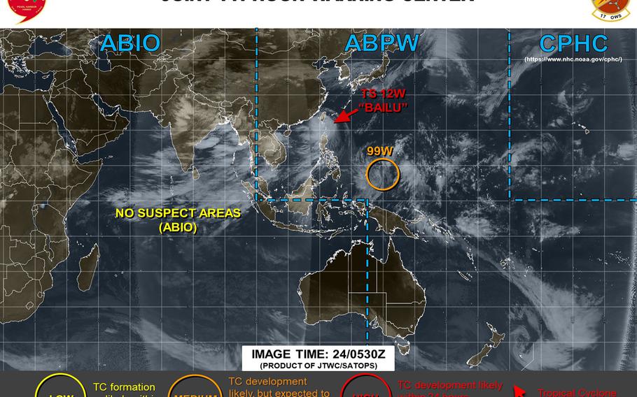
8:30 a.m. Sunday, Aug. 25, Hong Kong time: Tropical Storm Bailu made landfall over southeastern China at 2 a.m. Sunday and is making its way inland toward forecast landfall after passing 200 miles northeast of Hong Kong, around 2 p.m. Sunday.Standby Signal 1 remains raised for Hong Kong; Strong Wind Signal 3 is not expected to be raised. A tropical storm warning remains in effect for Taiwan and an extremely heavy rain advisory for southeastern Taitung County. This should be the last report on Bailu.10:30 p.m. Saturday, Aug. 24, Taiwan time: Tropical Storm Bailu is making its way across the Formosa Strait en route to forecast landfall early Sunday morning, having weakened slightly to 58-mph sustained winds and 75-mph gusts after having crossed Taiwan. A severe tropical storm warning remains in effect for Taiwan, along with heavy rain advisories for the southern part of the island nation, according to Taiwan's Central Weather Bureau.Standby Signal 1 remains raised for Hong Kong. Closest point of approach to Hong Kong is forecast for 201 miles northeast at 4 p.m. Sunday.8 p.m. Saturday, Aug. 24, Philippines time: All tropical cyclone warning signals have been canceled for the Batanes and Babuyan island groups in the northern Philippines. The national weather authority PAGASA reports that Tropical Storm Bailu has exited the Philippines' area of responsibility. Standby Signal 1 remains raised for Hong Kong.5 p.m. Saturday, Aug. 24, Taiwan time: Tropical Storm Bailu has made landfall over the southern tip of Taiwan. Closest point of approach to Kaohsiung has come and gone, 7 miles southwest at 5 p.m. and Bailu continues moving quickly northwest toward China, according to the Joint Typhoon Warning Center. A severe tropical storm warning remains in effect for Taiwan, and heavy rain advisories remain in effect for the south and east portions of the island nation. Elsewhere, Standby Signal 1 remains raised for Hong Kong, according to the Hong Kong Observatory, which reports that the chances of Strong Wind Signal 3 being raised before midnight are not high. And Tropical Cyclone Warning Signal 1 has been canceled for northern portions of Luzon Island in the Philippines. TCWS 2 remains raised for the Batanes island group and TCWS 1 for the Babuyan islands, according to the national weather authority PAGASA. Bailu, which is called Ineng by PAGASA for local purposes, is forecast to exit the Philippines area of responsibility this evening. At 2 p.m., Bailu was 198 miles south-southwest of Taipei, moving northwest at 15 mph and holding steady at 63-mph sustained winds and 81-mph gusts. If Bailu stays on its present heading, it's due to make secondary landfall over southeastern China at mid-day Sunday and pass 196 miles northeast of Hong Kong at about 5 p.m. Sunday.3 p.m. Saturday, Aug. 24, Hong Kong time: Standby Signal 1 has been raised by the Hong Kong Observatory in advance of Tropical Storm Bailu, HKO reports the chances of Strong Wind Signal 3 being raised are not high. Meanwhile, Tropical Cyclone Warning Signal 2 was lowered for the Babuyan islands in the northern Philippines, according to the national weather authority PAGASA. Signal 2 remains raised for the Batanes islands.5 a.m. Saturday, Aug. 24, Taiwan time: An extreme heavy rain advisory is set for Taitung County in southeastern Taiwan along with heavy rain advisories for most of the country’s east coast as Tropical Storm Bailu continues its approach to the island nation, according to the Central Weather Bureau and the Joint Typhoon Warning Center.
In the Philippines, Tropical Cyclone Warning Signal 2 remains raised for the Batanes and Babuyan island groups as Bailu approaches the Bashi Channel, according to the national weather authority PAGASA. The storm is named Ineng by PASAGA for local purposes.
At 2 a.m., Bailu was 230 miles east-southeast of Kaohsiung, moving northwest at 14 mph and had reached forecast peak intensity, 63-mph sustained winds and 81-mph gusts. It is not forecast to become a typhoon at this point. A strong tropical storm, yes, but not Category 1-equivalent intensity.
Bailu is forecast to cross the southern tip of Taiwan, making a near-direct hit on Kaohsiung at 4 p.m., cross the Formosa Strait and make secondary landfall over southeastern China, passing 187 miles northeast of Hong Kong at 4 p.m. Sunday.
11 p.m. Friday, Aug. 23, Taiwan time: A severe tropical storm warning remains in effect along with a heavy rain advisory for the east coast as Tropical Storm Bailu continues moving northwest toward Taiwan, according to the Central Weather Bureau.
Tropical Cyclone Warning Signal 2 has been extended to the Babuyan island group and remains raised for the Batanes islands in the northern Philippines, according to the national weather authority PAGASA. At 8 p.m., Bailu was 400 miles south-southeast of Taipei, moving northwest at 14 mph, had strengthened slightly, to 58-mph sustained winds and 75-mph gusts and is due to peak at 69-mph sustained winds and 86-mph gusts at mid-morning Saturday, just before forecast landfall over southern Taiwan. Bailu is forecast to make a near-direct hit over southern Kaohsiung and pass 190 miles south-southwest of Taipei between 3 and 5 p.m. Saturday, move quickly across the Formosa Strait before making secondary landfall early Sunday morning, passing 195 miles northeast of Hong Kong at 3 p.m. Sunday before dissipating inland.
11 a.m. Friday, Aug. 23, Taiwan time:A severe tropical storm warning has been issued by Taiwan’s Central Weather Bureau in advance of Tropical Storm Bailu. And it could be quickly upgraded to a typhoon warning, depending on Bailu’s intensity as it approaches the island nation, roughly one-third the size of the state of New York.
Elsewhere, Tropical Cyclone Warning Signal 2 remains in effect for the Philippines’ northern Batanes island group, while TCWS Signal 1 remains raised for northern provinces in Luzon Island, including the Babuyan island group, according to the national weather authority PAGASA. It has labeled Bailu a severe tropical storm, and for local purposes has named the storm Ineng.
That said, the news does get a bit better in that Bailu is no longer forecast to peak as a typhoon. It remains forecast to plow over Taiwan and make secondary landfall over southeastern China, but Joint Typhoon Warning Center projects Bailu to peak at 69-mph sustained winds and 86-mph gusts. Still strong, but not as bad as previously reported.
At 8 a.m., Bailu was 536 miles southeast of Taipei, 539 miles south of Kadena Air Base on Okinawa and 439 miles northeast of Manila, moving northwest at 15 mph and holding steady at 52-mph sustained winds and 63-mph gusts.
If Bailu stays on its current heading, it’s forecast to reach peak intensity at 8 a.m. Saturday, a few hours before making landfall over Taiwan, passing 25 miles north-northeast of Kaohsiung and 164 miles south-southwest of Taipei between 3 and 5 p.m. Saturday, still at peak intensity.
After a quick journey over the Formosa Strait, Bailu is due to make secondary landfall early Sunday morning, then pass 204 miles northeast of Hong Kong at 2 p.m. Sunday before dissipating inland. No tropical cyclone warning signal has been issued yet by the Hong Kong Observatory.
5 a.m. Friday, Aug. 23, Taiwan time: Tropical Storm Bailu’s forecast track has zagged back north, closer to where it was a day or so ago, possibly sparing portions of the northern Philippines and Hong Kong Bailu’s worst.
At 2 a.m., Bailu was 616 miles south of Kadena Air Base, Okinawa, 500 miles northeast of Manila and 666 miles southeast of Taipei, moving due north at 7 mph and had strengthened to 58-mph sustained winds and 75-mph gusts.
If Bailu stays on its present heading, it’s forecast to curve northwest again, picking up forward speed as it heads toward south-central Taiwan, peaking at 81-mph sustained winds and 98-mph gusts at 2 p.m. Saturday, Category 1-equivalent intensity.
Tropical Cyclone Warning Signal 2 has been raised for the Batanes island group, while TCWS 1 remains raised for northern Luzon and the Babuyan island group in the northern Philippines, according to the national weather authority PAGASA.
Landfall is forecast for late Saturday afternoon. Closest points of approach are forecast to be 42 miles north-northeast of Kaohsiung and 145 miles south-southwest of Taipei between 9 and 10 p.m. Saturday. No warnings have yet been issued by Taiwan’s Central Weather Bureau.
From there, Bailu is due to cross the Formosa Strait into southeastern China, passing 233 miles northeast of Hong Kong at 9 p.m. Sunday.
5:15 p.m. Thursday, Aug. 22, Taiwan time: Might more of the Philippines, or perhaps Hong Kong, feel some of the wrath of oncoming Tropical Storm Bailu?
Bailu’s latest forecast track from the Joint Typhoon Warning Center would indicate so. JTWC projects Bailu to peak at Category 1-equivalent intensity. But the track has moved further south, enough that Bailu could pass over more of northern Luzon and the northern Philippines islands, and pass closer to Hong Kong at the start of next week.
At 2 p.m., Bailu was 700 miles south of Kadena Air Base, Okinawa, moving almost due west at 8 mph and holding steady at 52-mph sustained winds and 63-mph gusts.
If Bailu remains on its current course, it’s forecast to pass well north of Luzon, 435 miles northeast of Manila at 2 p.m. Friday, but closer to the Batanes and Babuyan island groups north of Luzon. Tropical Cyclone Warning Signal 1 remains raised for northern Luzon and those island groups, according to the Philippines’ national weather authority PAGASA.
Bailu is forecast to peak at 86-mph sustained winds and 104-mph gusts before making landfall over southern Taiwan early Saturday afternoon, making a near-direct hit on Kaohsiung at 5 p.m. Saturday at that same intensity. No warnings are in effect yet for Taiwan; that could change by Friday, according to Taiwan’s Central Weather Bureau.
From there, Bailu is due to cross the Formosa Strait and make secondary landfall over southeastern China, passing 205 miles northeast of Hong Kong at 7 p.m. Sunday, still packing 58-mph sustained winds and 75-mph gusts at center as it passes. No warning signals have been raised yet by the Hong Kong Observatory.
11:30 a.m. Thursday, Aug. 22, Taiwan time: Whoa. Looks like Tropical Storm Bailu has decided it could become much stronger, Category 2-equivalent intensity, long term and remains forecast to plow through Taiwan and into China over the weekend, according to the Joint Typhoon Warning Center. Tropical Cyclone Warning Signal 1 has been raised for northern portions of Luzon Island, including the northern Batanes and Babuyan island groups, according to the Philippines' national weather authority PAGASA. At 8 a.m., Bailu was 553 miles east-northeast of Manila and 688 miles south of Kadena Air Base, Okinawa, moving west-northwest at 14 mph and had strengthened to 52-mph sustained winds and 63-mph gusts. U.S. bases on Okinawa remain out of harm's way for the moment and in seasonal Tropical Cyclone Condition of Readiness 4. Forecast closest point of approach to Kadena is 451 miles southwest at 7 p.m. Friday. If Bailu says on its current heading, it's due to keep heading northwest, peaking at 92-mph sustained winds and 115-mph gusts at mid-morning Saturday, equal to a Category 2 hurricane. Bailu is forecast to pass 38 miles north-northeast of Kaohsiung and 150 miles south-southwest of Taipei between 5 and 6 p.m. Saturday, then head across the Formosa Strait into southeastern China. No warnings have been issued by Taiwan's Central Weather Bureau yet. Hong Kong might also pay some attention to Bailu; forecast closest point of approach to Hong Kong is 235 miles northeast at 2 a.m. Monday, but weakening as it heads inland. Though there remains a spread among model solutions long term, the GFS and CMC ensembles are in general agreement on a west-northwest track. Expect this post to be updated sometime Thursday evening.5:45 a.m. Thursday, Aug. 22, Taiwan time: Bailu has been upgraded to a tropical storm by the Joint Typhoon Warning Center. It remains on course to cross Taiwan into China, peaking just below typhoon intensity and staying well out of Okinawa's way. At 2 a.m., Bailu was 730 miles south-southeast of Kadena Air Base, Okinawa, and 846 miles southeast of Taipei, Taiwan's capital, moving northwest at 6 mph and had strengthened to 40-mph sustained winds and 52-mph gusts. If Bailu stays on its present heading, it's forecast to peak at 69-mph sustained winds and 86-mph gusts as it crosses Taiwan, passing 48 miles north-northeast of Kaohsiung and 139 miles south-southwest of Taipei between 8 and 10 p.m. Saturday. Forecast closest point of approach to Okinawa is still a long way away, 432 miles southwest of Kadena at 3 a.m. local time Saturday. After a quick journey across the Formosa Strait, Bailu is forecast to make secondary landfall over southeastern China early Sunday, passing 263 miles northeast of Hong Kong at 9 p.m. Sunday before dissipating inland. Although GFS and CMC ensembles' best tracks continue to agree on a northwest track over Taiwan into China, there remains a spread in model guidance, JTWC reports, 132 miles two days out and more than 1,000 miles five days out. Bailu continues to bear watchingin the coming days.11;15 p.m. Wednesday, Aug. 21, Taiwan time: Tropical Depression Bailu has strengthened slightly and is forecast by the Joint Typhoon Warning Center to peak at Category 1-equivalent intensity as it crosses Taiwan into China this weekend, with Okinawa safely out of harm's way for the moment. At 8 p.m., Bailu was 775 miles south-southeast of Kadena Air Base, Okinawa, moving northwest at 10 mph and had intensified to 35-mph sustained winds and 46-mph gusts. If Bailu stays on its present heading, it's forecast to peak at 81-mph sustained winds and 98-mph gusts as it makes its way across south-central Taiwan, passing 52 miles north-northeast of Kaohsiung and 132 miles south-southwest of Taipei between 5 and 7 p.m. Saturday. Bailu is next due to cross the Formosa Strait and make secondary landfall early Sunday morning in southeastern China and dissipate inland. Bailu is forecast to pass nearly 300 miles northeast of Hong Kong late Sunday evening.Model track guidance has come into slightly better agreeement. Though JTWC reports there remains an 834-mile spread among model solutions, the GFS and CMC forecast ensemble best tracks agree on a track in Taiwan's and southeast China's general direction, with some outliers. U.S. bases on Okinawa remain in seasonal Tropical Cyclone Condition of Readiness 4, with Bailu forecast to pass 432 miles southwest at 4 a.m. local time Saturday. The Philippines' main islands appear as if they'll be out of harm's way as well, for the moment, according to the national weather authority PAGASA; only the northernmost Batanes islands might be threatened if Bailu stays on current course. No tropical cyclone warning signals have been raised for any part of the country at this point. This post should be updated around mid-day Thursday.6 p.m. Wednesday, Aug. 21, Japan time: Say hello to Tropical Depression Bailu, the 12th numbered and 11th named storm of the northwest Pacific's tropical cyclone season. Its initial Joint Typhoon Warning Center forecast track takes it toward central Taiwan this weekend, with Okinawa well out of harm's way, though there's a vast spread among model solutions. At 3 p.m., Bailu was about 825 miles south-southeast of Kadena Air Base, Okinawa, moving northwest at 8 mph with 29-mph sustained winds and 40-mph gusts. JTWC projects Bailu to peak at just below typhoon strength, 69-mph sustained winds and 86-mph gusts at mid-afternoon Saturday, just before making landfall over central Taiwan. It's forecast to pass 69 miles north-northeast of Kaohsiung and 116 miles south-southwest of Taipei between 9 p.m. and midnight local time Saturday. Closest point of approach to Kadena is forecast for 432 miles south-southwest at 6 a.m. Saturday.Kadena's long-range weather forecast calls for an increase in showers with 25-mph sustained east to southeast winds and 36-mph gusts. U.S. bases on Okinawa remain in seasonal Tropical Cyclone Condition of Readiness 4. Keep in mind, those are initial projections, and it's early in the life of a young storm. JTWC reports a spread of 989 miles among model solutions, with the GFS ensemble showing a northeast curve after passing over Taiwan, through the Formosa Strait toward southwestern Japan and Korea; while the CMC ensemble depicts a straight run into China. Bailu is the name that replaced the one given one of the most destructive tropical cyclones in northwest Pacific history, Haiyan, which laid waste to the central Philippines in late 2013. Bailu (second column, 16 down) means white deer, which stands for auspiciousness in Chinese language. Bailu's initial JTWC forecast track almost matches that posted by the Philippines' national weather authority PAGASA, which has labeled 12W Ineng for local purposes. PAGASA projects a straight run through Taiwan into China as well, with only the northern Batanes island group possibly in harm's way. No tropical cyclone warning signal has been raised yet by PAGASA. This post will be updated early Thursday morning.7 p.m. Tuesday, Aug. 20, Japan time: A tropical cyclone formation alert has been issued by the Joint Typhoon Warning Center on a tropical disturbance, 97W Invest, currently about 960 miles southeast of Kadena Air Base, Okinawa. Model guidance agrees on 97W tracking west-northwest in the general direction of Taiwan, but divided in the long term whether it will keep making a straight run or curve northward in Okinawa’s general direction. Too early to say at this point.
