Namtheun slows south of Sasebo, still on track for near-direct hit Sunday evening as tropical storm. (NOAA.gov)
8 a.m. Monday, Sept. 5, Japan time: Namtheun is barely holding onto tropical-storm characteristics, burrowing inland east of Sasebo Naval Base into the mountainous terrain of southwest Kyushu. Namtheun remains forecast to make its way back over water in the Sea of Japan and dying out southwest of Hokkaido sometime Tuesday afternoon. This should be PST’s last report on Namtheun.
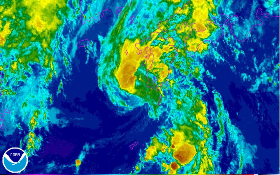
8 p.m. Sunday, Sept. 4, Japan time: Get ready, Sasebo, for Namtheun. Or what’s left of it, anyway.
Namtheun was downgraded to a tropical storm Sunday afternoon by the Joint Typhoon Warning Center. It’s still a gusty, rainy beast, but down to 63-mph sustained winds and 81-mph gusts at center as it lurked 77 miles south of Sasebo Naval Base at 3 p.m., creeping northward at 7 mph.
If it remains on its current course, Namtheun is forecast to drift ashore just south of Sasebo and pass 16 miles to its east at 11 p.m. Sunday evening, still packing 52-mph sustained winds and 63-mph gusts at center. Fleet Activities Sasebo remains in Tropical Cyclone Condition of Readiness 3; it could be upgraded if winds at Sasebo exceed 58-mph sustained.
From there, Namtheun is due to cross southwestern Kyushu and back over water in the Sea of Japan, splitting the difference between Honshu and the Korean peninsula before dying out Tuesday just west of Hokkaido.
9 a.m. Sunday, Sept. 4, Japan time: Namtheun slowed down and wobbled a bit west in its approach toward Sasebo Naval Base early Sunday, crawling north-northwest at just 5 mph and barely hanging on to Category 1-equivalent typhoon status, 75-mph sustained winds and 92-mph gusts at center.
Namtheun remains forecast to weaken into a significant tropical storm as it continues toward Sasebo, and still on course for a near-direct hit late Sunday evening. Fleet Activities Sasebo remains in Tropical Cyclone Condition of Readiness 3; that could be accelerated to TCCOR 1 or reduced to TCCOR Storm Watch, depending on strength and track.
Midnight Saturday, Sept. 3, Japan time: Namtheun remains, for the moment, a Category 1-equivalent typhoon, packing 81-mph sustained winds and 98-mph gusts as it begins its forecast curve north toward Sasebo Naval Base and its demise over the sea of Japan early next week.
At 9 p.m., Namtheun was 166 miles south of Sasebo, heading north-northwest at 8 mph but on course to make a near-direct hit on Sasebo late Sunday or early Monday. Closest point of approach, according to the Joint Typhoon Warning Center, is 9 miles east of Sasebo as a severe tropical storm, 63-mph sustained winds and 81-mph gusts at center.
Sasebo remains in Tropical Cyclone Condition of Readiness 3; expect that to be upgraded to TCCOR 2 or perhaps TCCOR 1 quickly, depending on Namtheun’s strength and path. Navy weather at Sasebo forecasts winds between 35 and 40 mph with 50-mph gusts and 2 to 4 inches of rain.
Marine Corps Air Station Iwakuni appears more and more to be out of harm’s way, Namtheun forecast to pass 85 miles northwest of Iwakuni at 11 a.m. Monday, but quite a few eyes remain on Namtheun in case its course changes.
3 p.m. Saturday, Sept 3, Japan time: Fleet Activities Sasebo has entered Tropical Cyclone Condition of Readiness 3. They could change to TCCOR 1, depending on Namtheun's movements. Destructive winds in excess of 58 mph are possible between 48-12 hours.
11:30 a. m. Saturday, Sept. 3, Japan time: Sasebo Naval Base is bracing for what could be a near-direct hit early Monday morning from Typhoon Namtheun.
Joint Typhoon Warning Center's latest track shows Namtheun starting to weaken, but having taken a bit of a left turn north-northwest. It's on course to whack Sasebo 11 miles east at 2 a.m. Monday packing 81-mph sustained winds and 98-mph gusts at center.
Fleet Activities Sasebo remains in Tropical Cyclone Condition of Readiness Storm Watch. An upgrade could come any time.
Namtheun should pass further west of Marine Corps Air Station Iwakuni, 78 miles northwest about 12 hours later.
Keep tuned to official channels for TCCOR updates.
7 a.m. Saturday, Sept. 3, Japan time:It’s already been wet and miserable at Sasebo Naval Base, which can now expect winds to pick up over the weekend as Typhoon Namtheun makes its way into the area.
If it remains on its current track, Namtheun should pass 31 miles east of Sasebo at 5 p.m. Sunday, remaining a Category 1-equivalent typhoon as it passes, 81-mph sustained winds and 98-mph gusts at center. At 3 a.m., Namtheun was 323 miles south of Sasebo, moving north at 8 mph packing sustained 115-mph winds and 132-mph gusts at center. The forecast track takes Namtheun a bit further away from Iwakuni, 76 miles northwest at 4 a.m. Monday, as a severe tropical storm. Sasebo remains in Tropical Cyclone Condition of Readiness Storm Watch. No accelerated TCCOR is in effect for Iwakuni; expect that to change for both installations.
Midnight Friday, Sept. 2, Japan time: Looks as if Marine Corps Air Station Iwakuni will also feel some effects from Typhoon Namtheun after it makes landfall over southwestern Kyushu, according to the Joint Typhoon Warning Center.
At 9 p.m., Namtheun was 370 miles south of Sasebo Naval Base, moving north at 7 mph, packing sustained 115-mph winds and 144-mph gusts at center. Namtheun is forecast to peak at 121-mph sustained winds and 150-mph gusts at center about mid-morning Saturday.
If it remains on its current path, Namtheun should begin rapidly subsiding, but still be a Category 1-equivalent typhoon or a severe tropical storm as it crashes ashore over Kyushu’s west coast, then pass 53 miles east of Sasebo at 1 p.m. Sunday.
Fleet Activities Sasebo remains in Tropical Cyclone Condition of Readiness Storm Watch; that should be upgraded any time.
As it curves northeast, Namtheun should then pass 38 miles northwest of Iwakuni at about midnight Sunday as a severe tropical storm, 58-mph sustained winds and 75-mph gusts at center as it roars past and into the Sea of Japan.
7:30 p.m. Friday, Sept. 2, Japan time: Typhoon Namtheun continues intensifying, but has passed the closest point of approach to Kadena Air Base and is moving slowly north on a course that’s projected to take it just east of Sasebo Naval Base on Sunday afternoon, according to the Joint Typhoon Warning Center.
For the moment, Fleet Activities Sasebo remains in Tropical Cyclone Condition of Readiness Storm Watch. That could change and very quickly in the coming hours and days. Please be alert.
Also, just in case the worst happens, no time like now to prepare for the worst.
If Namtheun remains on current course, it should pass 46 miles east of Sasebo at 2 p.m. Sunday, packing sustained 81-mph winds and 98-mph gusts at center. There is a spread of about 100 miles among model solutions, so anything may be possible.
11:30 a.m. Friday, Sept. 2, Japan time: Fleet Activities Sasebo has issued Tropical Cyclone Condition of Readiness Storm Watch in anticipation of Typhoon Namtheun forecast pass Monday.
6 a.m. Friday, Sept. 2, Japan time: Labor Day could be a wet, windy one for Sasebo Naval Base as Namtheun is forecast to pass just east of the base as a severe tropical storm, according to the Joint Typhoon Warning Center.
Namtheun wasted very little time, 1½ days, strengthening into a Category 1-equivalent typhoon. At 3 a.m., Namtheun was 180 miles east-southeast of Kadena Air Base, Okinawa, traveling north-northeast at 10 mph, packing 75-mph sustained winds and 92-mph gusts at center.
If it remains on its present course, Namtheun is forecast to wig-wag in a generally northerly direction, peaking at 115-mph sustained winds and 144-mph gusts just northeast of Amami Oshima.
Namtheun is then forecast to curve northeast, passing 30 miles east of Sasebo at 2 a.m. Monday, packing sustained 63-mph winds and 81-mph gusts at storm’s center.
7 p.m. Thursday, Sept. 1, Japan time: So much for Namtheun developing into a weak tropical cyclone. It remains a non-threat to Okinawa, but it’s strengthened into a tropical storm, and the Joint Typhoon Warning Center’s latest warning indicates it will become a Category 2-equivalent typhoon rather rapidly.
At 3 p.m., Namtheun was 165 miles south-southeast of Kadena Air Base, tracking east-northeast at 16 mph. It’s projected to keep over very warm sea surface and peak very quickly at 104-mph sustained winds and 121-mph gusts at center.
Namtheun was forecast to pass 163 miles east of Kadena at 7 p.m., so it’s probably reached its closest point of approach to Okinawa. It’s forecast to become a Category 1-equivalent typhoon early Friday morning, then begin curving north on course to clip southwestern Kyushu.
Namtheun is on track to pass 32 miles east of Sasebo Naval Base at 11 a.m. Sunday, and as a severe tropical storm, 69-mph sustained winds and 86-mph gusts, enough to warrant accelerated Tropical Cyclone Conditions of Readiness. A week after northeastern Japan got raked by Lionrock, its southwestern end may get a whacking by Namtheun.
Sasebo remains for the moment in TCCOR All Clear. U.S. bases on Okinawa remain in seasonal TCCOR 4.
12:30 p.m. Thursday, Sept. 1, Japan time: Tropical Depression Namtheun (Laotian for Mekong River tributary) has curved a bit further east, is projected to pass a bit further away from Okinawa as its forecast peak intensity has increased, according to the Joint Typhoon Warning Center.
At 9 a.m., Namtheun was 186 miles south of Kadena Air Base, tracking northeast at 15 mph. It’s due to pass 138 miles east-southeast of Kadena at 7 p.m., JTWC reports. U.S. bases on Okinawa remain in seasonal Tropical Cyclone Condition of Readiness 4.
Namtheun should then continue north, peaking at 58-mph sustained winds and 75-mph gusts at 9 p.m. Friday for about 12 hours, then diminish as it heads toward a near-direct hit on Sasebo Naval Base, but as a tropical depression, 35-mph sustained winds and 46-mph gusts. Fleet Activities Sasebo remains in TCCOR All Clear.
8 a.m. Friday, Sept. 1, Japan time: The last third of the year begins with Tropical Depression 15W tracking northeast, just off Okinawa’s east coast, forecast to pass 115 miles east of the island by mid-evening Thursday and, hopefully, leaving the Labor Day weekend alone.
If it remains on its Joint Typhoon Warning Center forecast track, 15W should pass 115 miles southeast of Kadena Air Base at 9 p.m. Thursday, just achieving tropical-storm status, 40-mph sustained winds and 52-mph gusts at storm’s center. U.S. bases on Okinawa remain in seasonal Tropical Cyclone Condition of Readiness 4.
15W is forecast to track northeast, then north, peaking at 52-mph sustained winds and 63-mph gusts by mid-afternoon Friday, then diminishing as it heads north, passing 30 miles west of Sasebo Naval Base late Sunday evening, again as a tropical depression.
Midnight Wednesday, Aug. 31, Japan time: The 15th numbered storm of the northwest Pacific tropical cyclone season has formed southwest of Okinawa, according to the Joint Typhoon Warning Center.
It’s formed far enough north and is facing enough obstacles that JTWC’s initial forecast calls for weak development of 15W, perhaps as a middling tropical storm as it curves around Okinawa, then north toward Sasebo Naval Base, passing 16 miles east at 1 a.m. Monday as a tropical depression.
At this point, 15W is forecast to peak at 46-mph sustained winds and 58-mph gusts as it rounds the bend, just over 200 miles east of Kadena Air Base at 11 p.m. Thursday. PST has an eye on it.
